
For centuries, the magnetic compass was the go-to guide for travelers, sailors, and explorers. Today, a wave of digital tools can pinpoint your location, predict traffic, map wilderness trails, and even guide airplanes with incredible precision. These eight navigation technologies show just how far we’ve moved beyond a simple spinning needle.
Smartphone GPS Apps
For most people, the compass has already been replaced by the phone in their pocket. Apps like Google Maps, Apple Maps, and Waze do far more than point north. They give turn-by-turn directions, suggest alternate routes, and update in real time when traffic, accidents, or road closures change the picture.
That convenience is hard to beat. A traditional compass can tell you direction, but it cannot tell you where the nearest gas station is or how long a route will take. Smartphone GPS apps combine satellite positioning, live data, and searchable maps into one tool, making them the default navigator for everyday life.
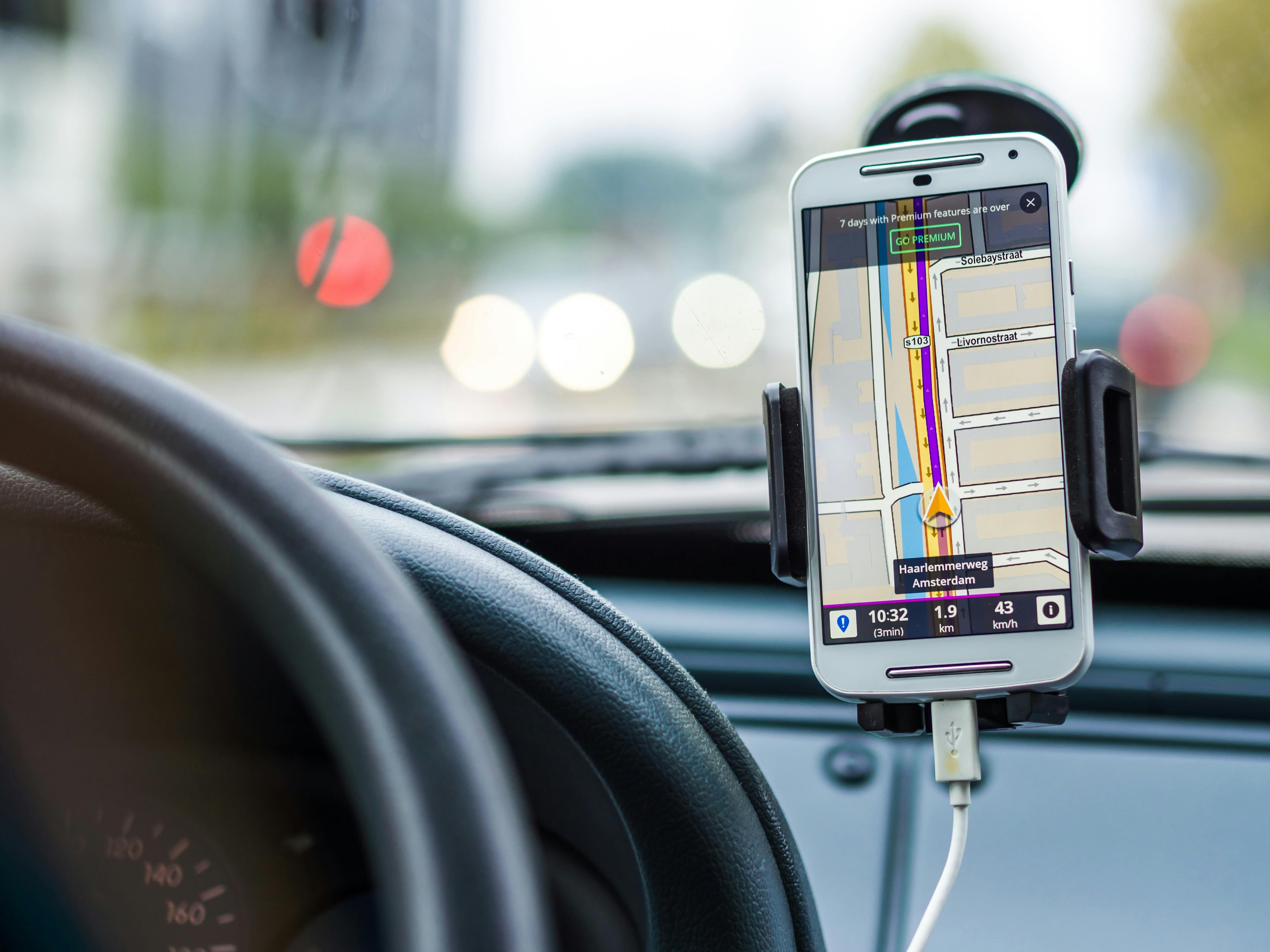
In-Car Navigation Systems
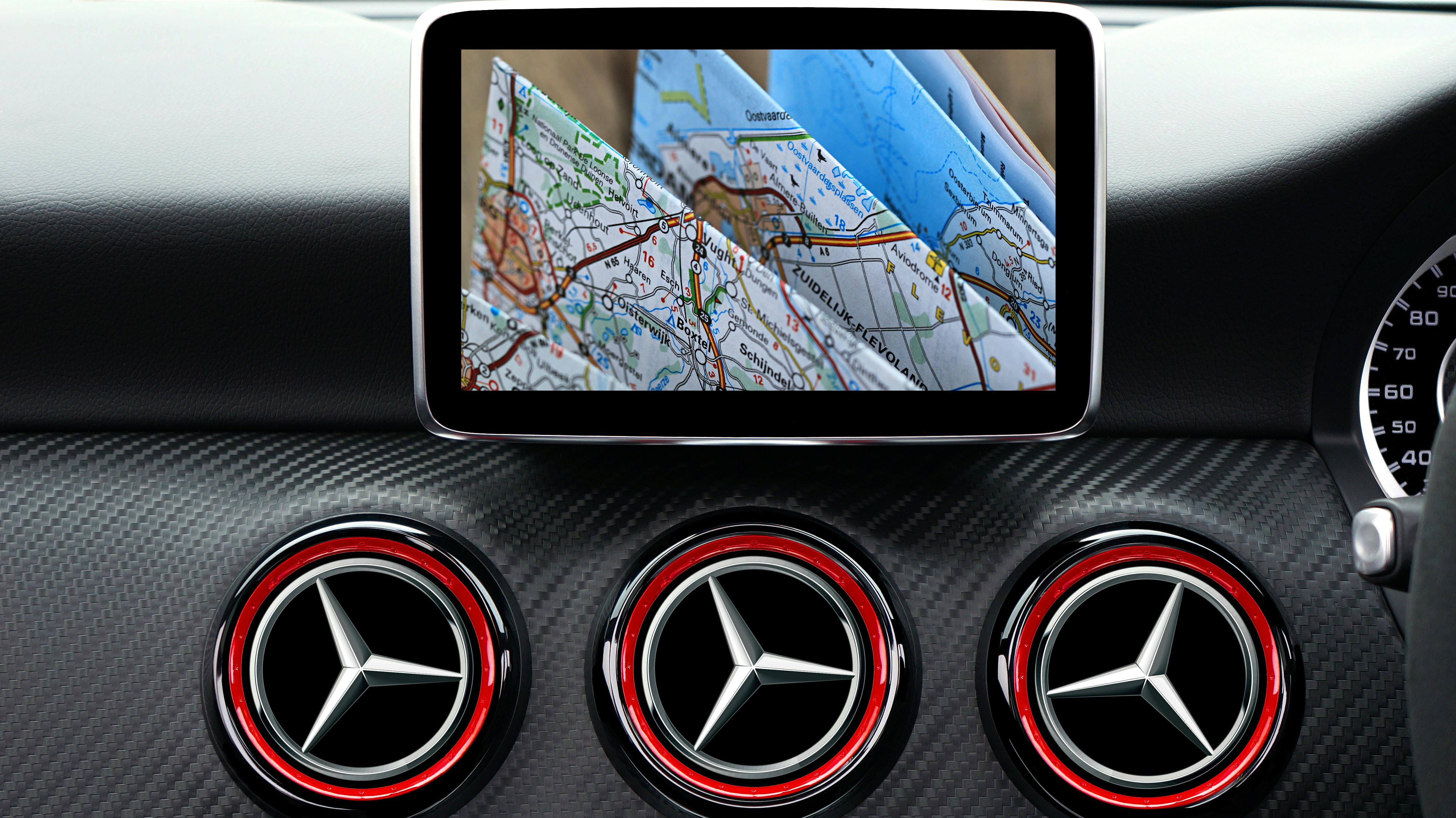
Built-in car navigation systems have transformed the driving experience from a guessing game into a guided trip. Integrated into the dashboard, these systems deliver spoken directions, lane guidance, estimated arrival times, and route recalculations without forcing drivers to unfold a paper map or interpret a compass heading.
They also work seamlessly with other vehicle features. Many can sync with traffic reports, fuel data, parking information, and even driver assistance tools. That makes them less of a simple direction finder and more of a full travel assistant. Compared with a traditional compass, an in-car navigation system feels like moving from a bicycle to a high-speed train.
Smartwatches With Navigation
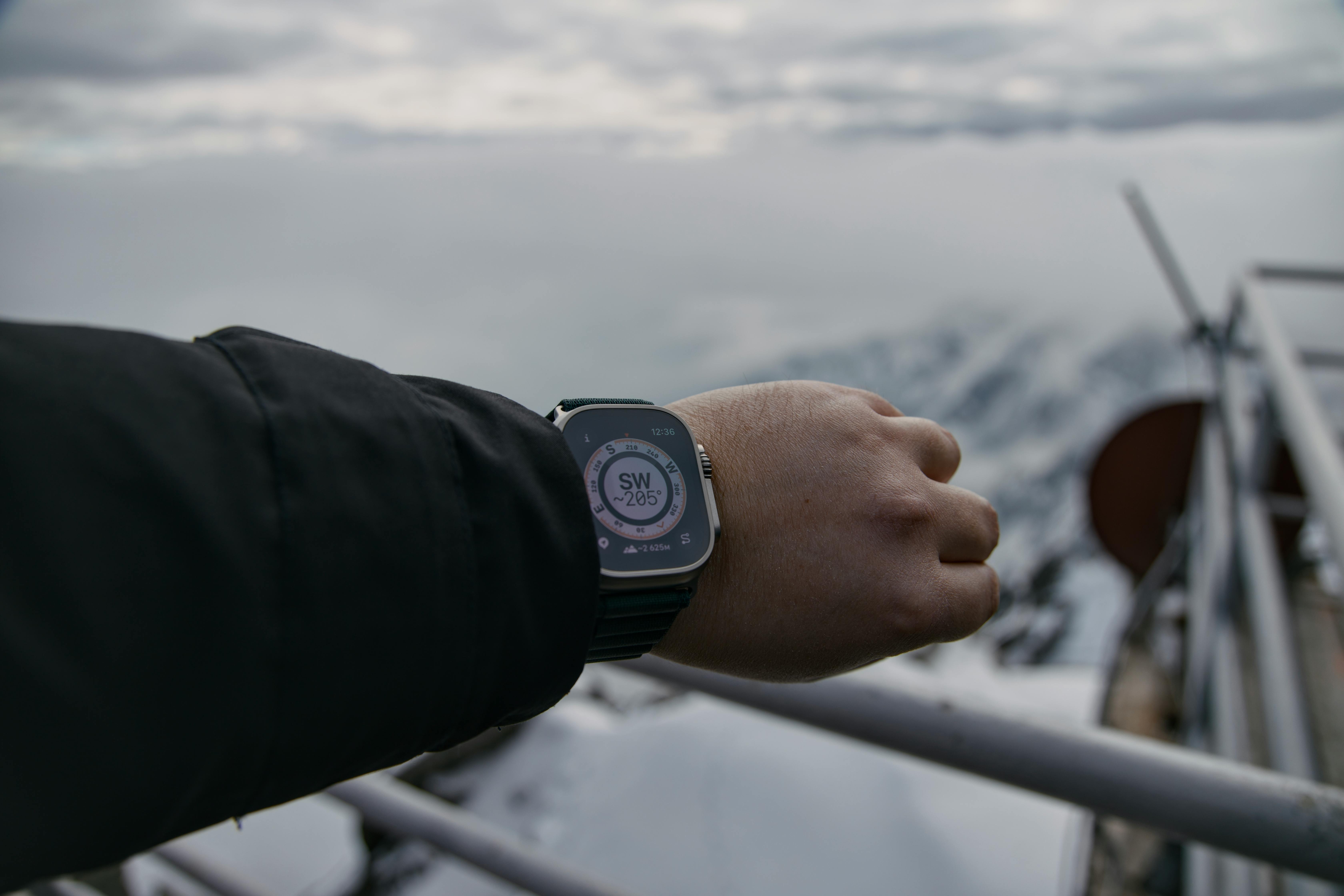
Smartwatches have made navigation even more personal by putting route guidance directly on the wrist. For runners, cyclists, walkers, and travelers in unfamiliar cities, that means a quick glance is often enough to stay on course. Many models now include GPS, offline mapping, breadcrumb trails, and vibration alerts for upcoming turns.
That hands-free convenience is a major leap beyond the old compass. Instead of stopping to orient a map and measure your direction, you can keep moving while the watch quietly guides you. In fitness and outdoor settings especially, smartwatches blend navigation with health tracking, weather updates, and emergency tools in a way no classic compass ever could.
Marine Chartplotters

On the water, marine chartplotters have dramatically changed how captains and recreational boaters navigate. These systems combine GPS positioning with detailed nautical charts, depth readings, sonar, and route planning, giving users a live picture of where they are and what hazards may be nearby.
A compass still has backup value at sea, but chartplotters handle the real work of modern navigation. They can mark fishing spots, track safe channels, and help avoid shallow areas or busy traffic lanes. In an environment where conditions shift quickly and mistakes can be costly, chartplotters offer a depth of awareness that a simple magnetic needle was never designed to provide.
Aviation Navigation Systems
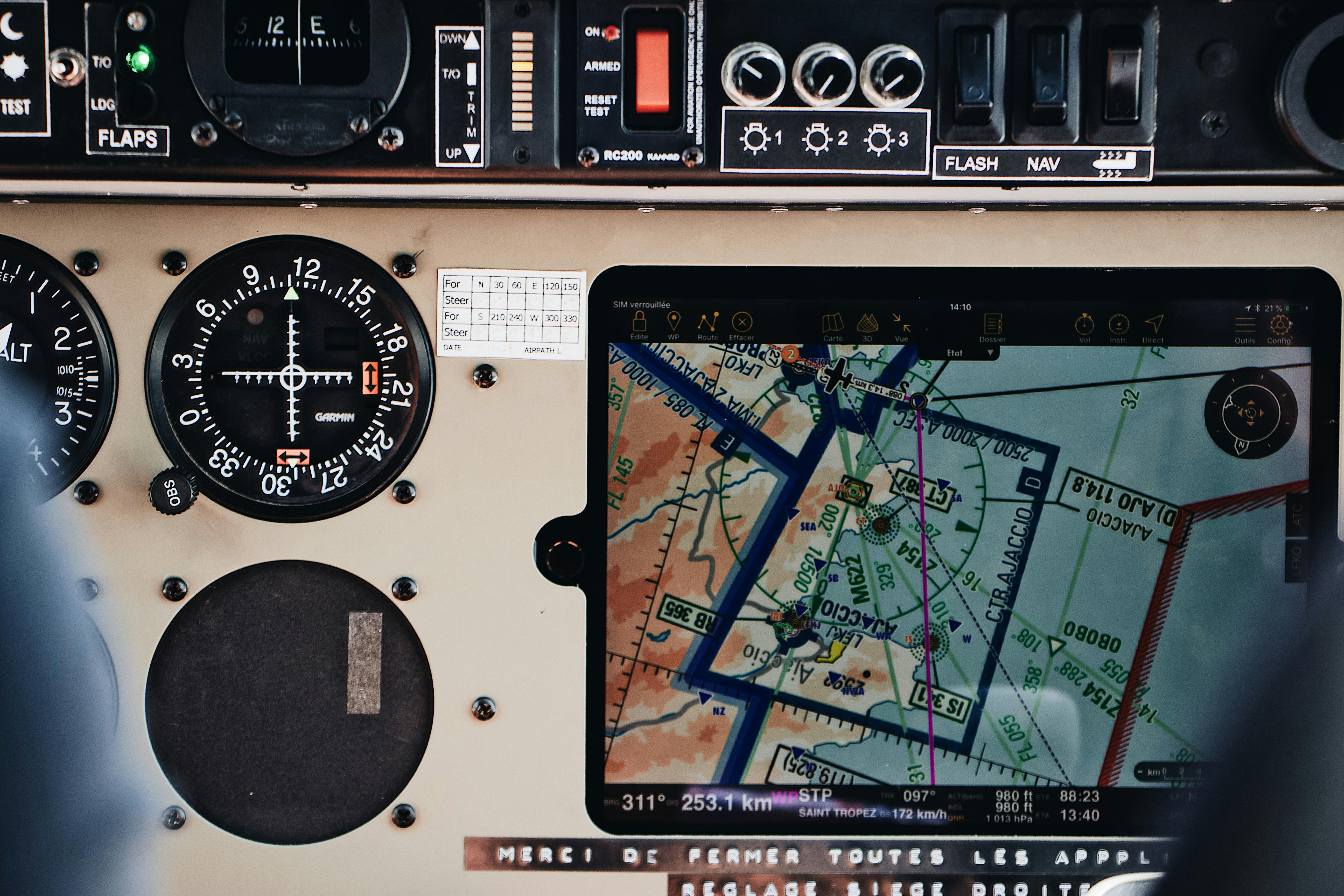
Aviation left the basic compass behind long ago. Modern aircraft use sophisticated navigation systems that combine GPS, inertial reference units, radio beacons, moving maps, and flight management computers. Pilots can track exact position, altitude, speed, route changes, and weather information with far more precision than a magnetic heading alone could ever offer.
In the air, accuracy is everything. Aircraft must follow carefully planned corridors, approach paths, and safety procedures over vast distances and changing conditions. While compasses still exist as backup instruments, real navigation depends on layered digital systems that constantly update and cross-check one another. It is a world where the old needle now plays only a supporting role.
Emergency Locator Beacons

Emergency locator beacons are not just navigation tools. They are lifelines when things go wrong. Devices such as personal locator beacons and satellite messengers can transmit your position to rescue services, allowing help to reach you far faster than if you were relying on a compass and hoping to self-rescue.
They have become especially important for solo hikers, sailors, climbers, and remote travelers. Many models also allow check-ins, tracking, and SOS messaging from areas with no cell service at all. A compass can help with direction, but it cannot call for help or share your exact coordinates. In critical moments, that difference can be life-changing.
Satellite Navigation for Agriculture

Modern farming may seem far removed from old-school exploration, but it is one of the clearest examples of navigation technology making the compass feel outdated. Tractors and harvesters now use satellite guidance to drive straight lines across fields with remarkable precision, reducing overlap, saving fuel, and improving planting accuracy.
This kind of navigation is about efficiency as much as direction. Farmers can map fields, automate passes, and apply seed or fertilizer exactly where it is needed. A traditional compass could never support that level of detail. In precision agriculture, navigation has become a powerful data tool, helping growers manage land with scientific accuracy instead of rough estimation.
Drone Navigation Systems
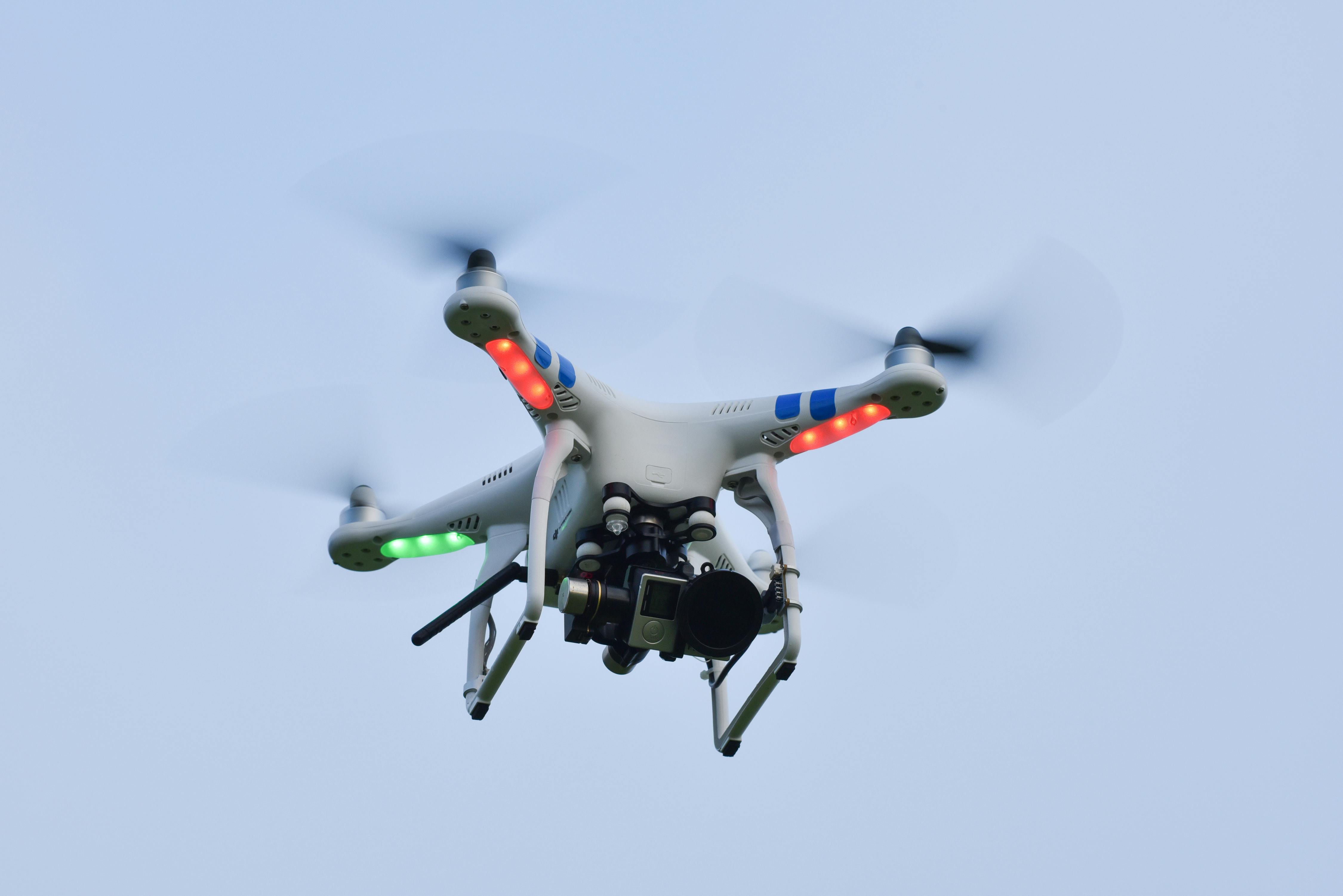
Drones have introduced a completely new style of navigation, one that depends on sensors, GPS, gyroscopes, and onboard software rather than human guesswork. Whether used for photography, inspection, farming, or search operations, drones can hold position, follow programmed routes, and return home automatically with impressive consistency.
That level of control shows just how far navigation has evolved. A compass might offer a sense of orientation, but a drone navigation system can stabilize flight, avoid drifting, and map an area from above with precise location data attached to every image. It is less about finding north and more about controlling movement in three dimensions with confidence.


