
Modern navigation has made travel easier than ever; yet, many people are surprised when their GPS or smartphone suddenly stops working in certain parts of the United States. From deep wilderness valleys to sprawling deserts and remote mountain corridors, signals can drop without warning, leaving travellers confused or stranded. Understanding the environmental and technical reasons behind these failures can help adventurers stay safer and move with more confidence.
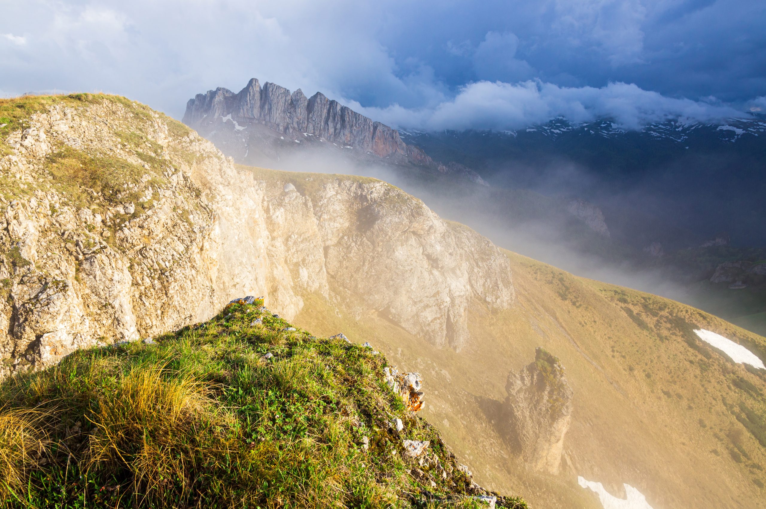
Steep Canyons Block Satellite Line-of-Sight
GPS requires a direct path to multiple satellites, but steep canyon walls interrupt those signals. In places like the Grand Canyon or narrow Western gorges, the surrounding rock forms a barrier that prevents your receiver from connecting to enough satellites to calculate your position. The deeper you go, the more severe the interference becomes, often creating total signal loss until you climb out or reach wider terrain.
Dense Forest Canopies Disrupt Signal Strength

Thick forests packed with tall evergreens or layered foliage reduce the strength of GPS transmissions before they can reach your device. Moist leaves and layered branches weaken the signal even further, especially after rain or snowfall. Dense forests in states like Washington, Oregon, and Maine often cause navigation apps to lose accuracy, bounce locations, or completely freeze until you reach a clearing or thinner canopy.
Remote Mountain Regions Have Limited Cellular Coverage
Many mountain corridors remain too rugged and sparsely populated for full cellular infrastructure. Carriers avoid building towers in remote parts of the Rockies, Appalachians, and Sierra Nevada due to cost and limited access. Without nearby cell towers, smartphones can’t refresh map data or load routing information, even if the GPS is technically working. This results in stalled navigation and delayed updates during travel.
Deep Valleys Create Natural Signal Dead Zones
Valleys trap you beneath surrounding terrain that blocks both cell and satellite signals. Narrow valleys in rural West Virginia, Montana, or Idaho often produce long stretches where no device can maintain a stable connection. Even small shifts in elevation can cause your phone to flicker between a weak signal and no service at all. This dead zone effect becomes more noticeable during stormy or overcast weather.
Heavy Cloud Cover and Storms Affect GPS Accuracy
Although GPS normally penetrates clouds, severe storms, thick cloud layers, or atmospheric disturbances can weaken transmissions. Moisture-heavy systems, especially in the Southeast or Midwest, scatter signals enough to reduce positional accuracy. During thunderstorms or blizzards, GPS performance may lag, drift, or fail when combined with other terrain challenges. This is why hikers often struggle with navigation during major weather shifts.
Desert Heat Distorts Radio Signals
Extreme desert heat affects how radio waves travel through the air. In places like Death Valley or southern Arizona, rising heat creates atmospheric layers that bend or dissipate signals. Combined with long distances between cell towers, these factors reduce accuracy and slow map loads. Even GPS units in vehicles may show delayed movements or temporary freezes when the heat distortion becomes severe enough.
Remote Regions Lack Sufficient Data Infrastructure
Some areas simply don’t have the fibre lines, repeaters, or towers needed to support modern smartphone navigation. Reservations, remote plains, and lesser-travelled highways often rely on older communication systems or none at all. Even if GPS reception is strong, map apps require periodic data downloads, meaning your device can stall when it can’t access updated maps, satellite imagery, or traffic information.
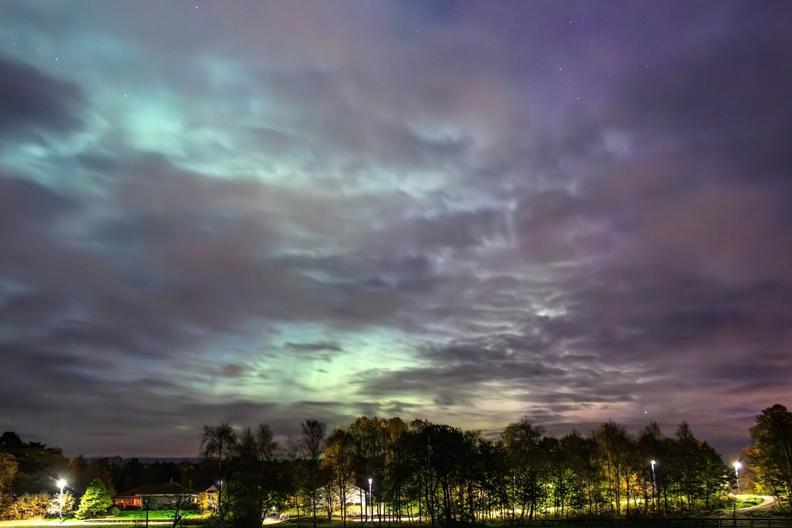
Solar Activity and Geomagnetic Storms Interrupt GPS Reliability
Solar flares and geomagnetic storms interfere with radio signals that GPS relies on. These events, although invisible, can cause widespread disruptions that hikers, drivers, and pilots may suddenly notice. During strong solar activity, your phone might show inaccurate locations, delayed tracking, or inconsistent navigation. High-altitude regions and northern states tend to feel these effects more strongly during peak solar cycles.
Old or Low-Quality Devices Struggle in Challenging Terrain
Not all GPS receivers are equal. Older phones or budget devices have weaker antennas and outdated chips that cannot lock onto multiple satellites efficiently. In rugged regions where signals are already compromised, these limitations become obvious. The device may take longer to find a location, lose accuracy faster, or completely fail whenever conditions change. Using updated hardware greatly improves reliability.
Offline Maps and Settings Aren’t Always Enabled
Even when your device can access satellites, navigation may fail if maps weren’t downloaded beforehand. Many travellers forget that apps like Google Maps or Gaia GPS require saved offline areas to function without cell service. In remote terrain, the phone may show your location but not the roads, trails, or landmarks. Preparing offline maps ensures your device can guide you regardless of connectivity.


