
Exploring America’s trail systems reveals routes that consistently rank among the most scenic and challenging. This selection is based on U.S. National Park Service visitor statistics, elevation data, and trail mileage published by the U.S. Geological Survey and AllTrails. Each of these hikes stands out for its unique terrain, natural features, and popularity among experienced hikers and outdoor enthusiasts.
Skyline Loop – Washington’s Alpine Gem
The 5.5-mile Skyline Loop Trail in Mount Rainier National Park climbs nearly 1,700 feet, topping out at 6,800 feet. It is celebrated for panoramic views of Mount Rainier, the Nisqually Glacier, and wildflower meadows that peak in July and August. The National Park Service estimates more than 1.5 million visitors pass through the Paradise area annually, making this one of Washington’s most iconic alpine treks.
Chilnualna Falls Trail – Yosemite’s Lesser-Known Climb
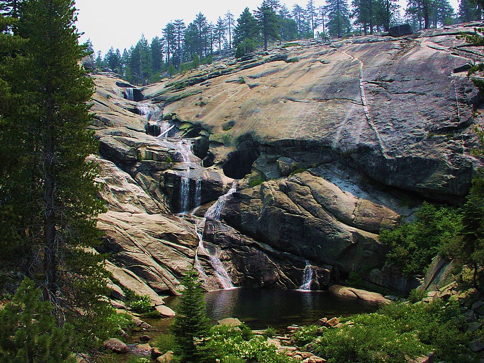
Located in Yosemite’s Wawona region, the Chilnualna Falls Trail stretches 8.2 miles round-trip with a strenuous 2,400-foot elevation gain. Hikers encounter a series of cascades culminating in the 240-foot-high Upper Chilnualna Fall. Unlike Yosemite Valley’s heavily trafficked routes, this trail sees a fraction of the park’s four million annual visitors, offering a quieter yet equally rewarding experience.
Devil’s Garden – Arches’ Longest Maintained Trail
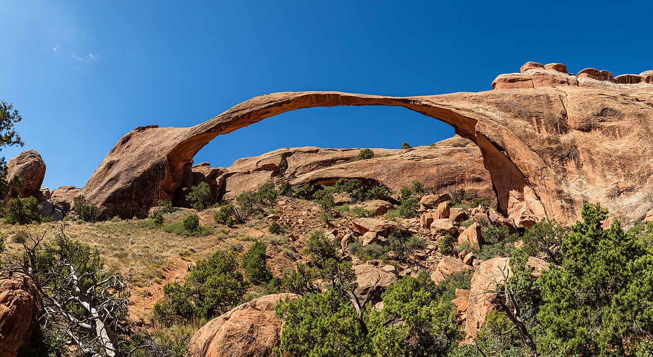
Arches National Park’s Devil’s Garden Trail spans 7.9 miles and includes access to eight major arches, including the famous Landscape Arch at 290 feet—the longest natural arch in North America. The trail combines well-marked paths with sections of rock scrambling. With Arches welcoming over 1.8 million visitors annually, Devil’s Garden remains one of its most extensive and varied hikes.
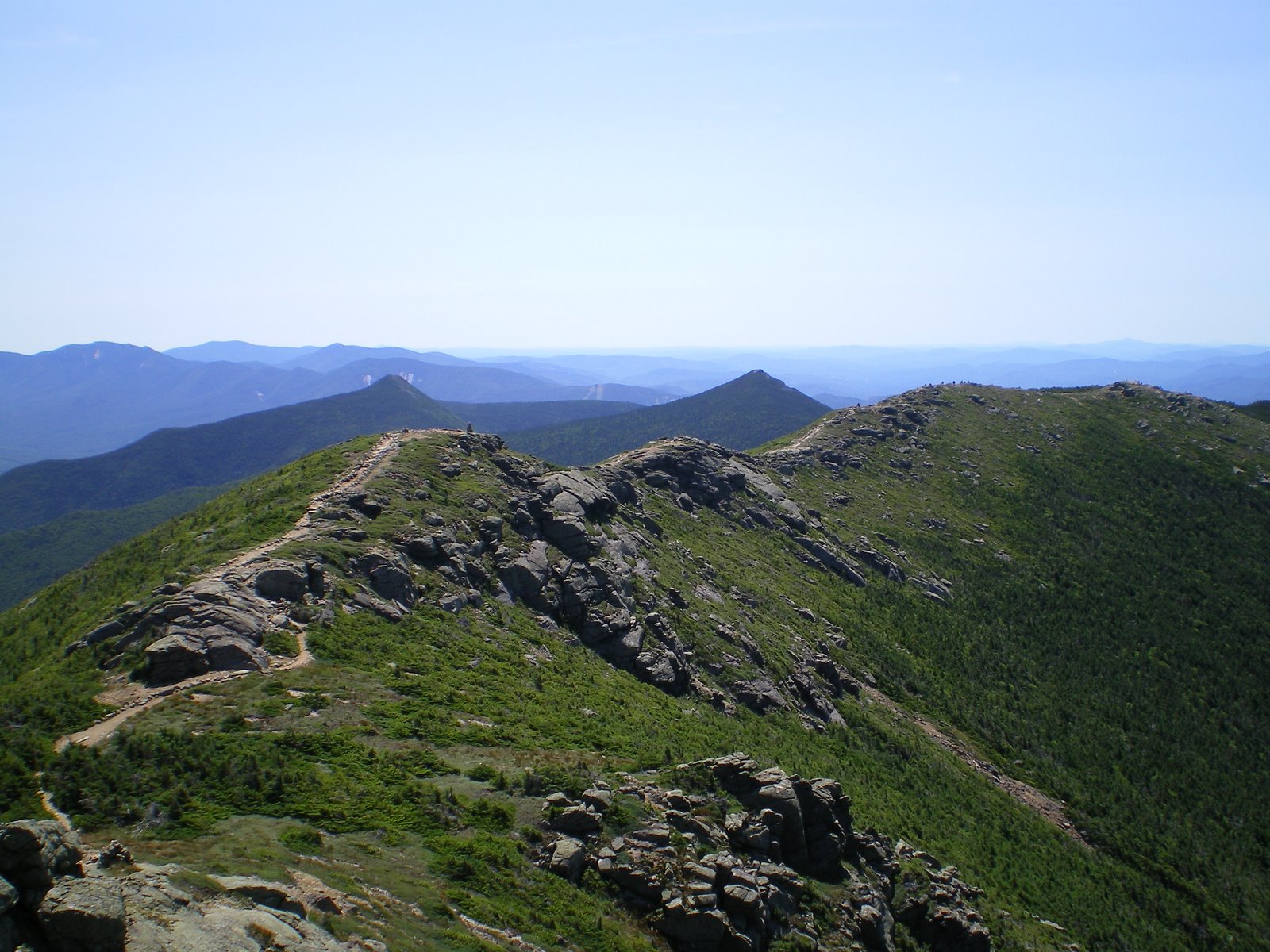
John Muir Trail – Sierra Nevada Epic
Stretching 211 miles through California’s Sierra Nevada, the John Muir Trail links Yosemite Valley to Mount Whitney, the highest peak in the contiguous U.S. at 14,505 feet. Hikers typically take three weeks to complete the route, passing through Sequoia, Kings Canyon, and Yosemite National Parks. The trail’s high-elevation segments average above 8,000 feet, providing continuous alpine scenery and some of the most photographed wilderness in the nation.
Blue Mesa Trail – Painted Desert Colors
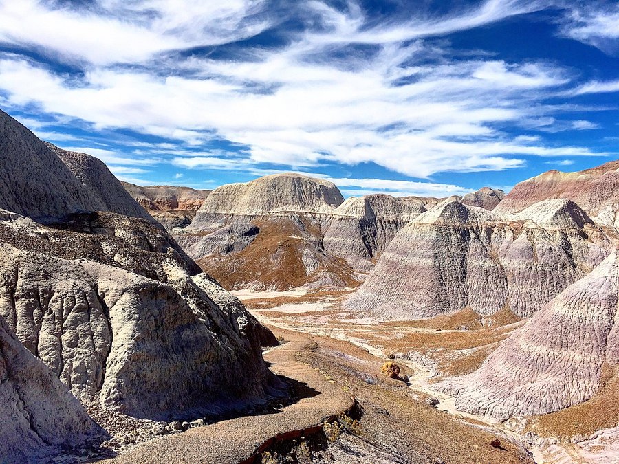
The Blue Mesa Trail in Petrified Forest National Park, Arizona, is a 1-mile loop that showcases the park’s famous badlands. Elevation is moderate at 5,400 feet, and the trail highlights blue, purple, and gray bentonite clay formations alongside petrified wood deposits dating back 200 million years. Although shorter than many desert hikes, it provides one of the most concentrated geological displays in the park.
Devil’s Bridge Trail – Sedona’s Iconic Arch
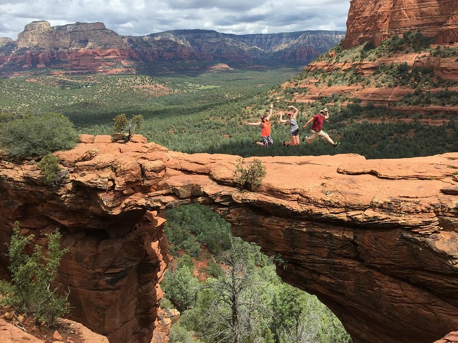
At 4.2 miles round-trip, Sedona’s Devil’s Bridge Trail is the largest natural sandstone arch in the area, spanning about 45 feet across. Rising nearly 400 feet in elevation, the trail culminates in a dramatic walk onto the arch itself. With more than three million visitors coming to Sedona annually, Devil’s Bridge is among the most photographed features in Arizona’s Red Rock Country.
The Narrows – Zion’s Famous River Hike
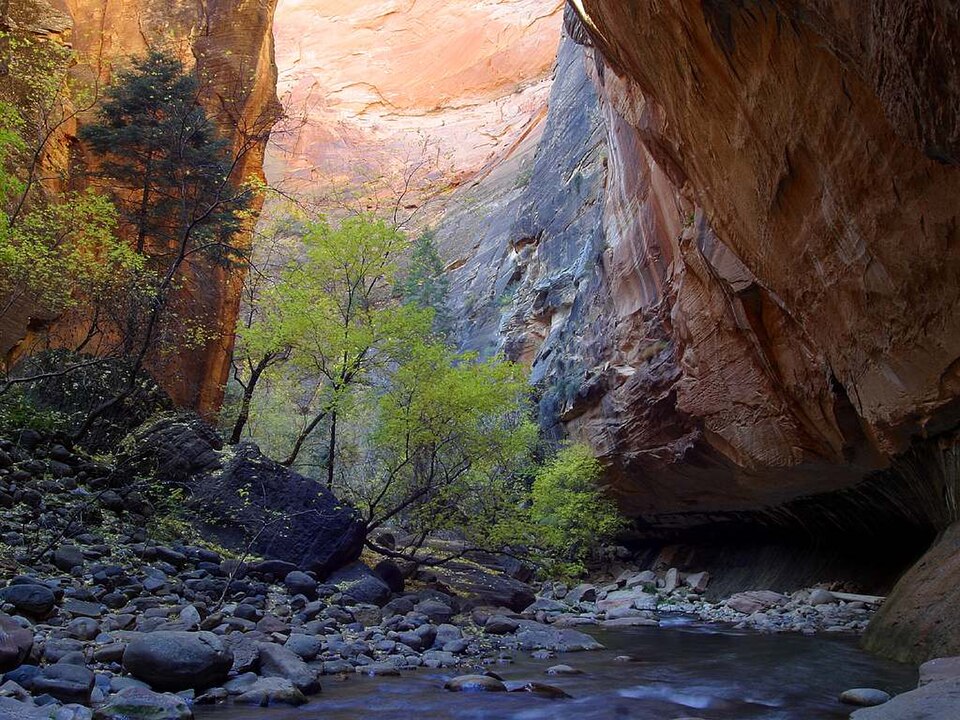
The Narrows in Zion National Park is a slot canyon trek through the Virgin River, stretching up to 16 miles if hiked top-to-bottom. Most visitors complete the 9.4-mile round-trip “bottom-up” route from the Temple of Sinawava. Water levels, monitored daily by the U.S. Geological Survey, determine accessibility. With walls rising 1,000 feet overhead and passages only 20–30 feet wide, this is Utah’s most unique hiking experience.
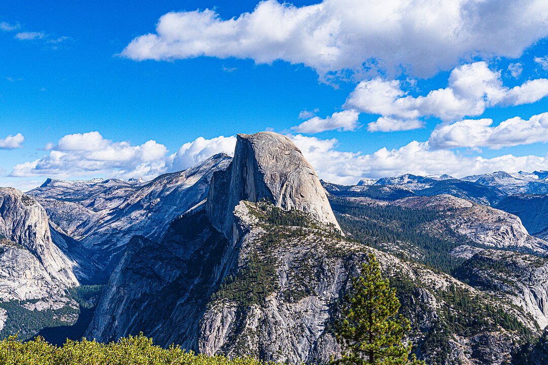
Glacier Point Trail – Yosemite’s Overlook in the Sky
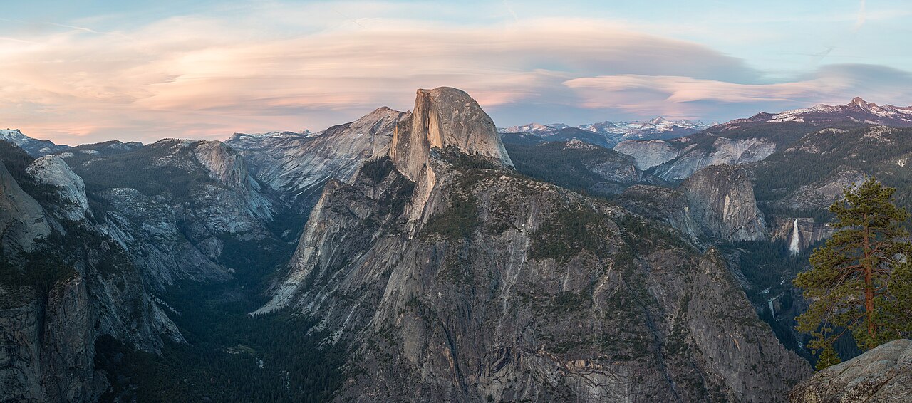
Glacier Point, accessible via a 4.8-mile trail with 3,200 feet of elevation gain from Yosemite Valley, provides one of the park’s most sweeping panoramas. From the 7,214-foot viewpoint, Half Dome, Yosemite Falls, and the High Sierra peaks are visible. Although a road also reaches the summit, the hike remains popular for those seeking a more physical ascent.
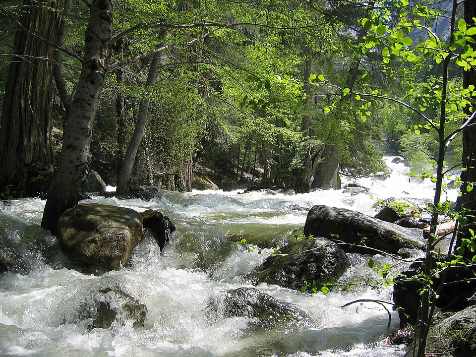
Upper Yosemite Falls Trail – California’s Tallest Cascade
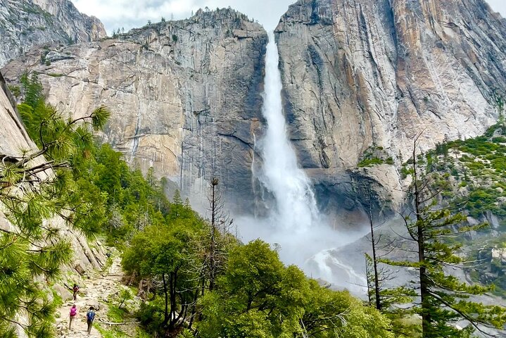
The Upper Yosemite Falls Trail climbs 3,175 feet over 7.6 miles round-trip to the top of North America’s tallest waterfall, dropping 2,425 feet. Spring snowmelt creates peak flows, with volumes reaching thousands of gallons per second. The strenuous ascent rewards hikers with direct views into Yosemite Valley, often cited as one of the park’s most challenging day hikes.
Emory Peak – Texas’ High Point in Big Bend
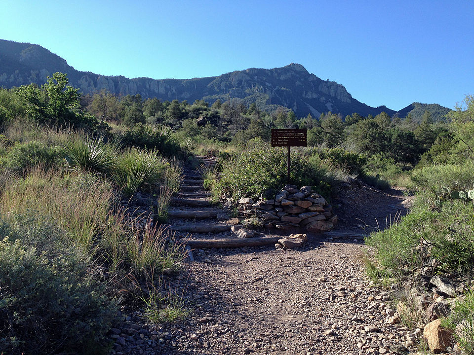
Emory Peak, the highest summit in Big Bend National Park at 7,825 feet, is reached via a 10.5-mile round-trip hike from the Chisos Basin. The final 25-foot scramble to the summit requires careful climbing but offers 360-degree views of the Chihuahuan Desert. Big Bend averages fewer than 600,000 visitors annually, making Emory Peak a remote and less crowded high-altitude adventure.
Navajo Loop and Queens Garden – Bryce Canyon’s Classic Circuit
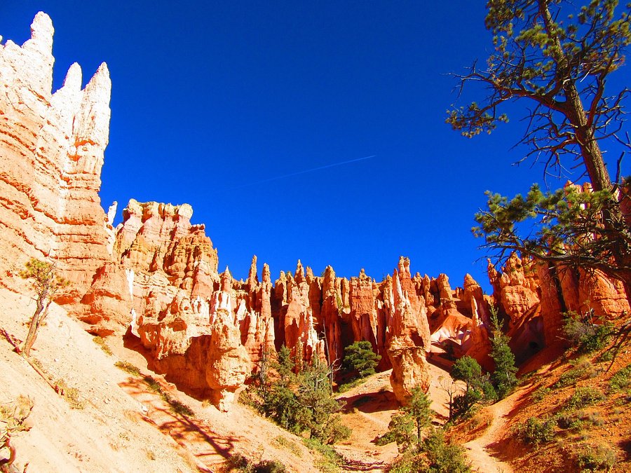
Bryce Canyon National Park’s most popular loop combines the 1.3-mile Queens Garden Trail with the 1.5-mile Navajo Loop, totaling 3 miles. Dropping 580 feet into the canyon, hikers weave among Bryce’s iconic hoodoos, including formations like Thor’s Hammer. According to park data, over 2 million people hike this route each year, making it one of Utah’s most trafficked short trails.
Half Dome – Yosemite’s Bucket-List Climb
The Half Dome Trail spans 14 to 16 miles round-trip with an elevation gain of 4,800 feet, ending with the famous cable-assisted climb up its 8,800-foot granite summit. Permits are limited to 300 hikers per day, and success requires both physical endurance and comfort with heights. It remains one of Yosemite’s most demanding but rewarding experiences, consistently ranking among America’s top bucket-list hikes.
South Kaibab Trail – Grand Canyon’s Scenic Descent
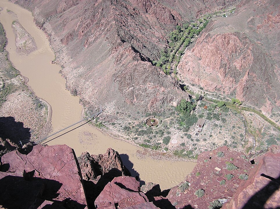
The South Kaibab Trail, beginning at 7,260 feet on the Grand Canyon’s South Rim, descends 7 miles to the Colorado River with a 4,780-foot drop. Notable viewpoints include Ooh Aah Point (0.9 miles) and Skeleton Point (3 miles). Unlike the Bright Angel Trail, this route has no water sources, making preparation essential. It is renowned for its unobstructed panoramic vistas of the canyon’s layers.
Appalachian Trail – Eastern Seaboard’s Longest Trek
The Appalachian Trail extends 2,198 miles through 14 states from Georgia to Maine, crossing 464,500 feet of cumulative elevation gain. Maintained by the Appalachian Trail Conservancy, it sees about 3 million visitors annually, with 20,000+ people having completed the entire trek since 1936. The trail’s highest point is Clingmans Dome in Tennessee at 6,643 feet, offering sweeping views of the Smokies.


