
Exploring America’s toughest trails means facing steep elevation gains, long mileage, and rugged terrain that push hikers beyond comfort. This list is based on trail length, elevation change, accident statistics, and difficulty ratings published by the National Park Service, U.S. Forest Service, and verified hiking databases such as AllTrails. Each of these 13 routes requires high endurance, preparation, and respect for the wilderness.
Angels Landing – Zion’s Vertigo Challenge
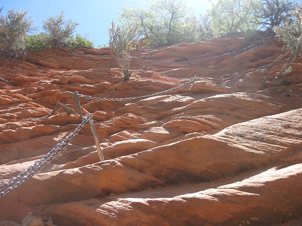
Angels Landing in Utah’s Zion National Park spans just 5.4 miles round-trip but climbs 1,488 feet in under 2.5 miles. The infamous final half-mile narrows to a ridge only a few feet wide with 1,000-foot drop-offs on both sides. Chains bolted into rock assist hikers, yet the exposure makes it one of the most dangerous U.S. hikes. Between 2000 and 2023, at least 17 fatalities were recorded on the trail.
The Maze – Canyonlands’ Most Remote Labyrinth
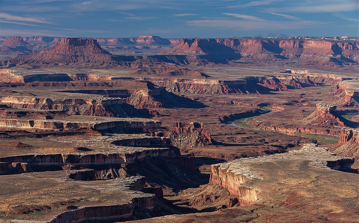
The Maze district of Canyonlands National Park in Utah covers over 173,000 acres of canyons, spires, and dead ends. It’s consistently ranked the most remote section of the U.S. National Park system, with rescue times averaging 3+ days. Trails are unmarked, water sources are scarce, and GPS reception is unreliable. Even experienced hikers can get lost, making endurance here as much about mental navigation as physical effort.
Kalalau Trail – Kauai’s Coastal Gauntlet
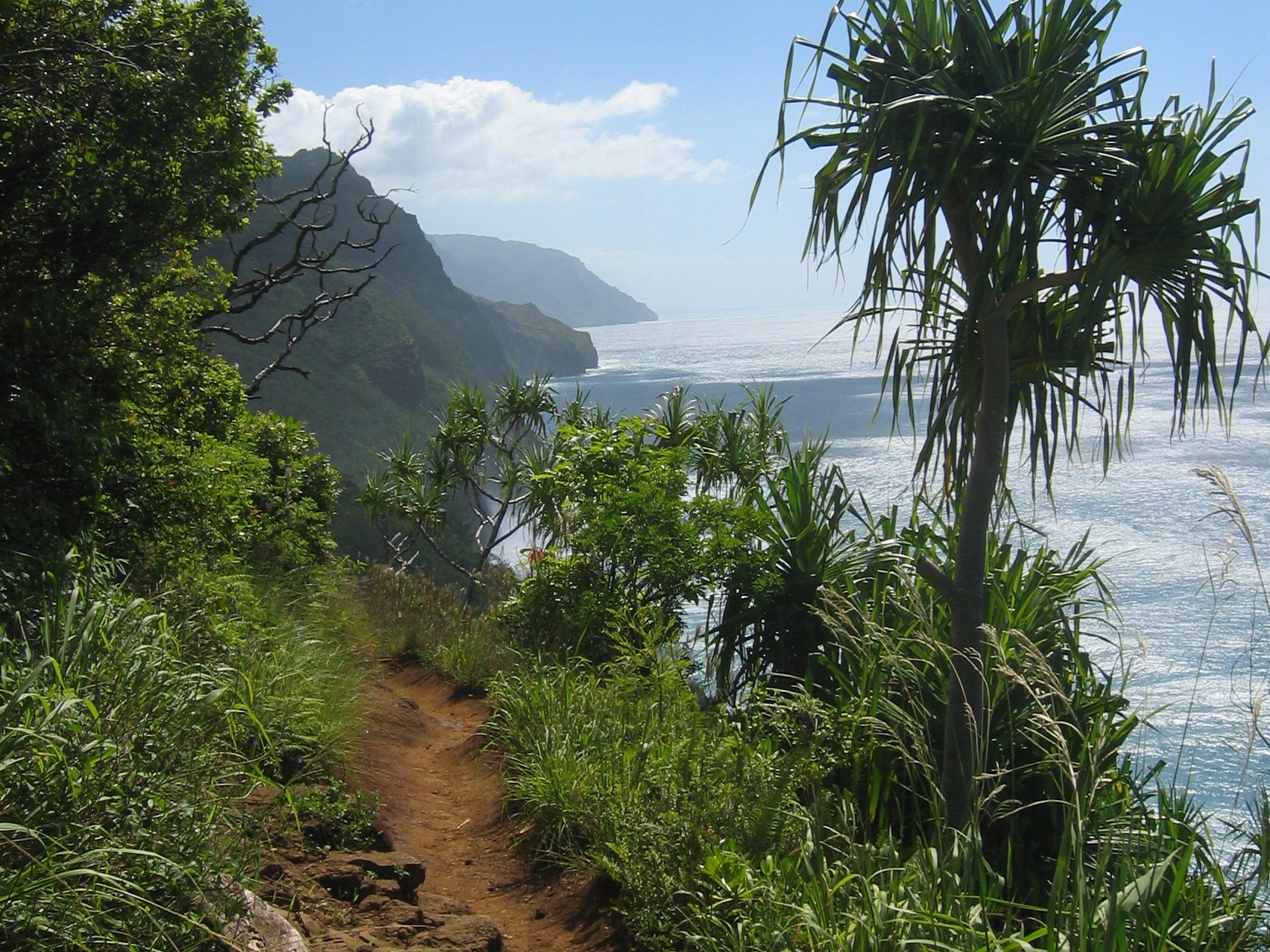
Hawaii’s Kalalau Trail is an 11-mile route along the Nā Pali Coast, totaling 22 miles round trip with nearly 6,500 feet of cumulative elevation gain. Rain makes cliffs slippery, and flash floods frequently block river crossings. The trail has been linked to dozens of rescues each year; the Hawaii Department of Land and Natural Resources regularly issues warnings due to drownings near the Hanakāpī‘ai Stream crossing.
Half Dome – Yosemite’s Iconic Grind
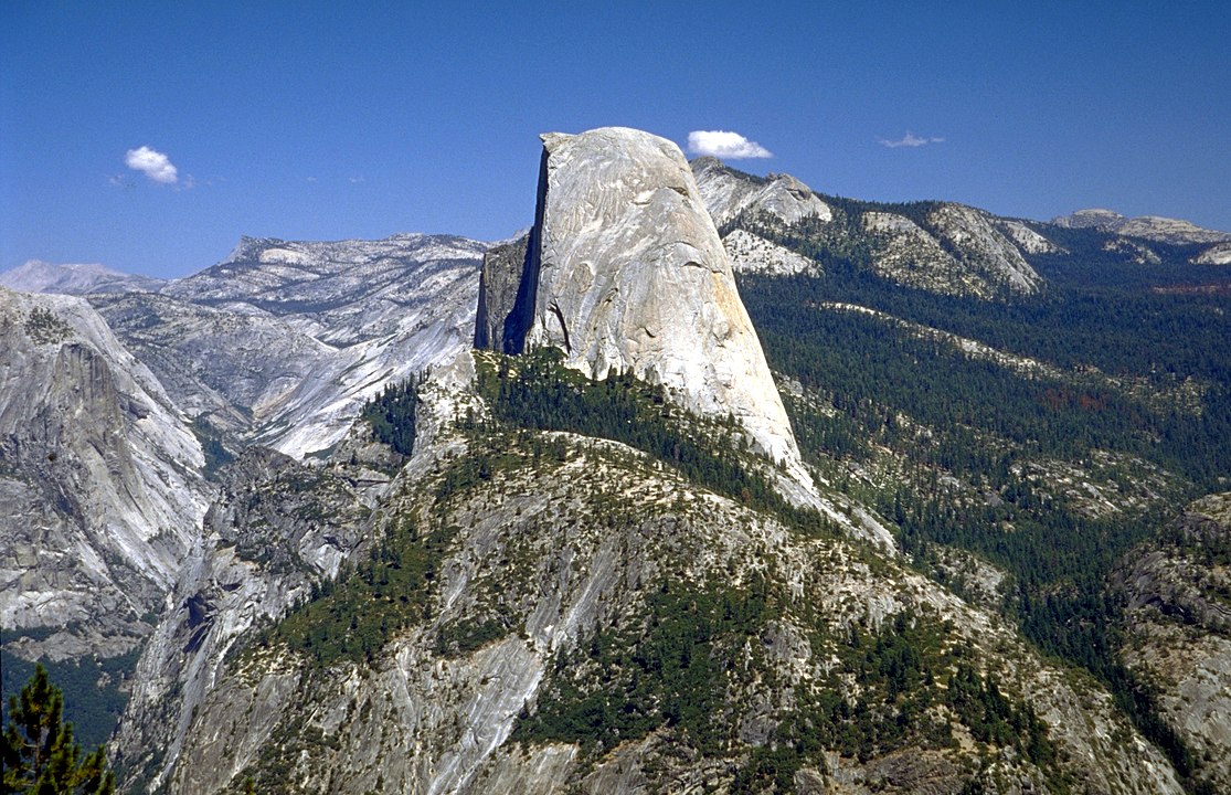
The Half Dome hike in Yosemite National Park stretches 14–16 miles round trip with about 4,800 feet of elevation gain. The final 400 feet are climbed using steel cables on near-vertical granite, requiring upper-body strength and nerves of steel. A permit system caps daily hikers at 300, yet accidents remain common. According to park records, more than 60 rescues occur annually on Half Dome, often due to exhaustion or dehydration.
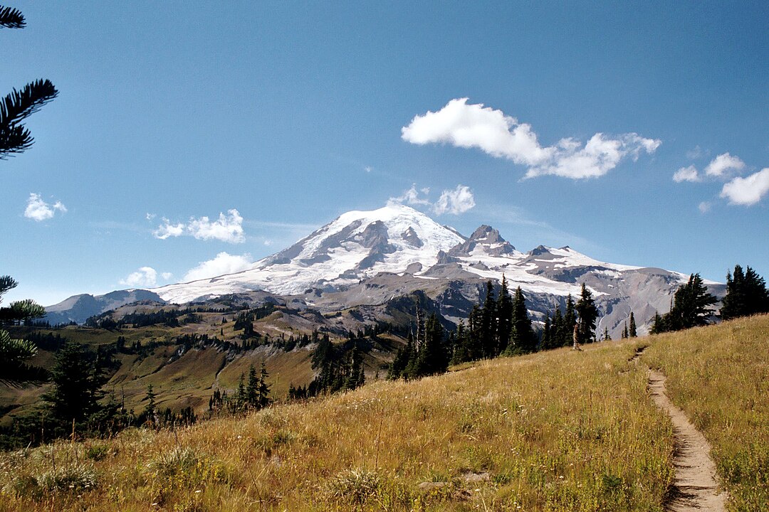
Enchantments Traverse – Washington’s Alpine Test
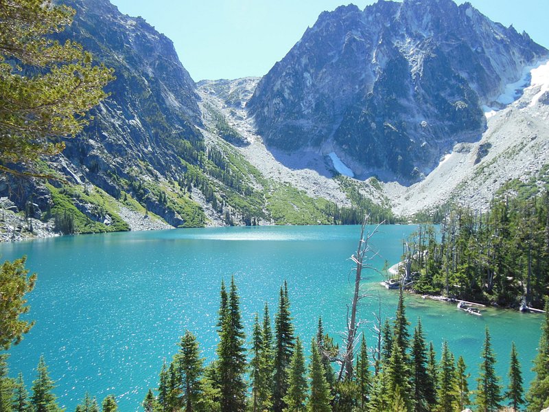
The Enchantments in Washington’s Alpine Lakes Wilderness require a 19-mile one-way traverse with over 4,500 feet of elevation gain and a high point at 7,800-foot Aasgard Pass. The pass alone climbs 2,200 feet in under a mile, one of the steepest official trails in the country. Limited permits restrict overnight stays, so many attempt the entire traverse in a single day, often taking 12–14 hours to complete.
Tonto Trail – Grand Canyon’s 95-Mile Marathon
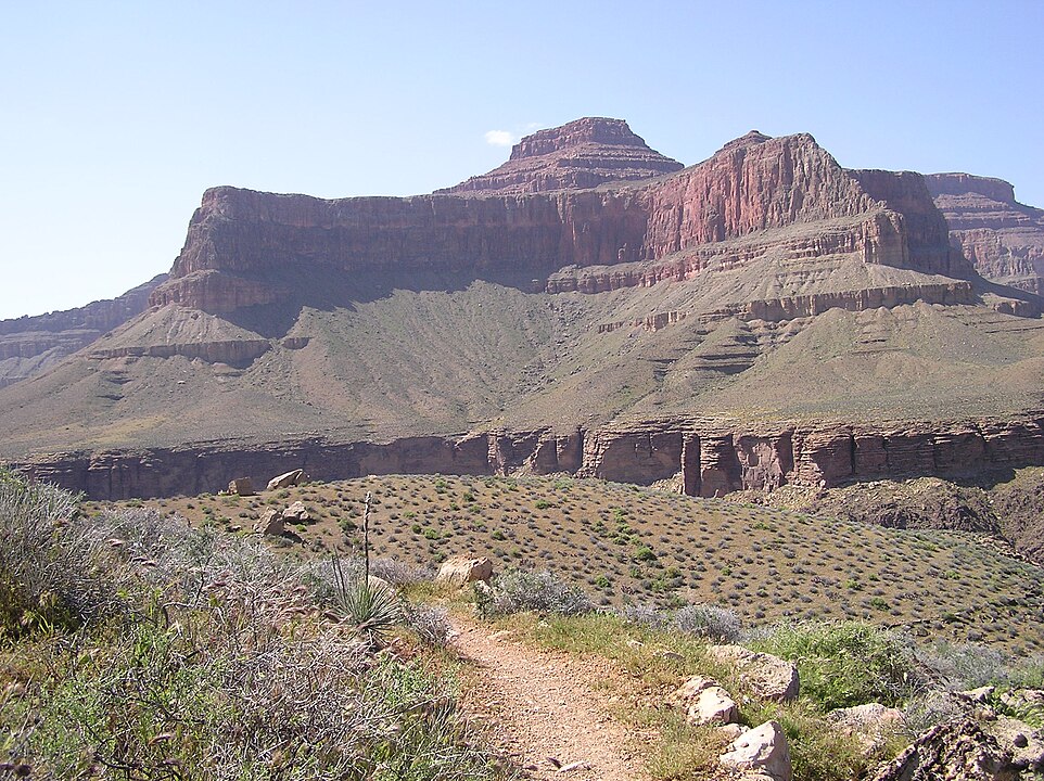
The Tonto Trail covers 95 miles along the Grand Canyon’s south side, weaving across exposed desert plateaus between 2,500–4,000 feet in elevation. With little shade and temperatures surpassing 110°F in summer, water planning is critical. Hikers must navigate 20+ major side canyons, making resupply impossible. The National Park Service cites heat-related illness as the most common medical emergency for hikers attempting long sections of the Tonto.
Highline Trail – Glacier’s Cliffside Traverse
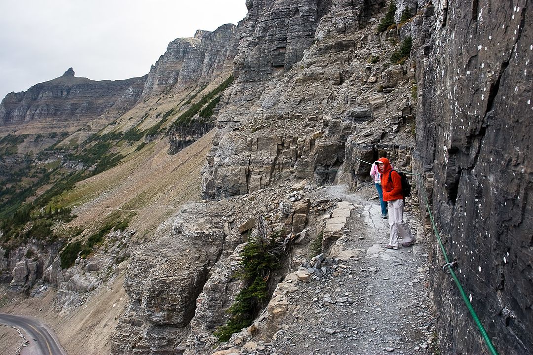
Glacier National Park’s Highline Trail runs 11.8 miles one way, tracing the Continental Divide at elevations near 7,000 feet. The narrow ledge section above Going-to-the-Sun Road drops 100 feet on one side with only a hand cable for balance. The route gains over 2,600 feet and often requires snowfield crossings well into July. Grizzly bear encounters are also more common here than on most U.S. trails, adding a unique endurance factor.
Longs Peak – Colorado’s 14er Death Zone
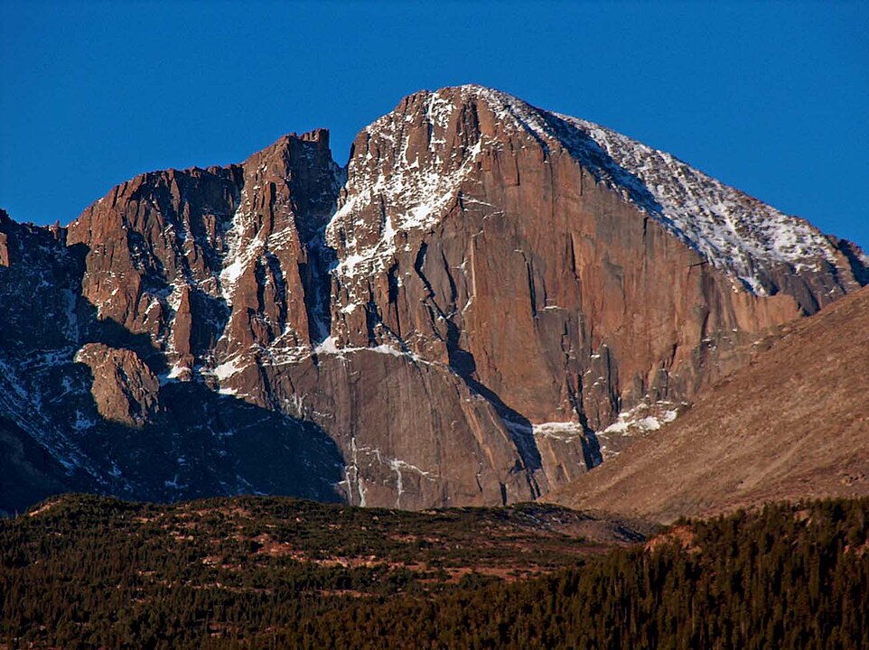
At 14,259 feet, Longs Peak in Rocky Mountain National Park is a 14–15 mile round trip with 5,100 feet of elevation gain. Its “Keyhole Route” includes exposed scrambles across ledges and the infamous “Homestretch,” a polished granite slope at extreme altitude. The thin air reduces oxygen by 40% compared to sea level. Between 1915 and 2021, more than 70 people died attempting Longs Peak, making it Colorado’s deadliest 14er.
Wonderland Trail – Rainier’s 93-Mile Circuit
Encircling Mount Rainier, the Wonderland Trail spans 93 miles with a staggering 22,000 feet of cumulative elevation gain. Its steep ups and downs cross multiple river valleys fed by glacial melt, requiring log bridge crossings that can wash out unpredictably. Weather shifts quickly at elevations ranging from 2,000 to 6,750 feet. Completing the trail takes 10–14 days on average, and backcountry permits are limited to reduce overuse.
Mount Katahdin – Maine’s Knife-Edge
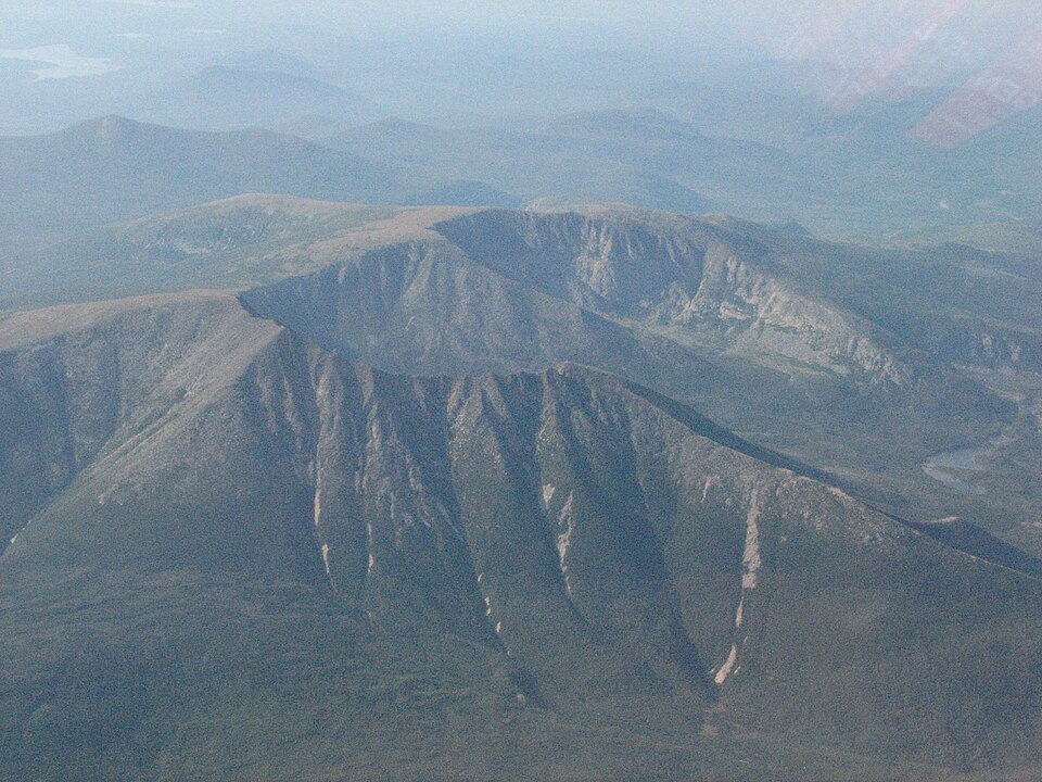
Mount Katahdin, Maine’s tallest peak at 5,269 feet, offers multiple routes, the most notorious being the Knife Edge Trail. The ridge narrows to just 3–4 feet wide for nearly 1.1 miles, with 2,000-foot drops on both sides. Weather shifts abruptly, with winds frequently topping 40 mph at the summit. Katahdin marks the northern terminus of the 2,198-mile Appalachian Trail, so many thru-hikers finish their months-long trek on this brutal climb.
Presidential Traverse – New Hampshire’s Weather Gauntlet
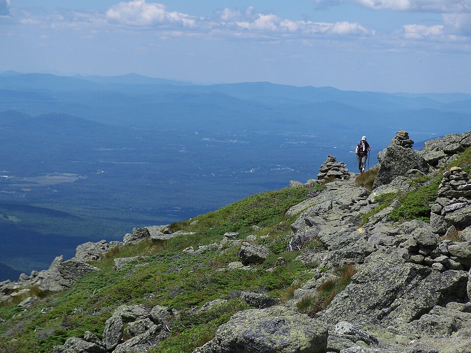
The Presidential Traverse covers 20–23 miles over the White Mountains’ highest peaks, with 9,000 feet of cumulative elevation gain. Mount Washington, the centerpiece, is infamous for record-breaking winds—231 mph in 1934—and hypothermia-inducing weather even in summer. Hikers spend 12–16 hours above treeline, fully exposed to the elements. Despite the trail’s popularity, fatalities occur almost every year, often due to exhaustion or hypothermia.
Rim-to-Rim – Grand Canyon’s Depth Defier
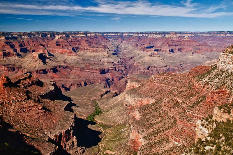
The Grand Canyon Rim-to-Rim hike runs 21–24 miles depending on the route, dropping over 6,000 feet from the North Rim to the Colorado River before climbing 4,500–5,700 feet to the South Rim. Temperatures can swing 30–40°F between the canyon floor and rim in a single day. Despite warnings, about 250 emergency rescues occur in the canyon annually, many linked to Rim-to-Rim attempts without adequate conditioning.
Four Pass Loop – Colorado’s High-Altitude Trial
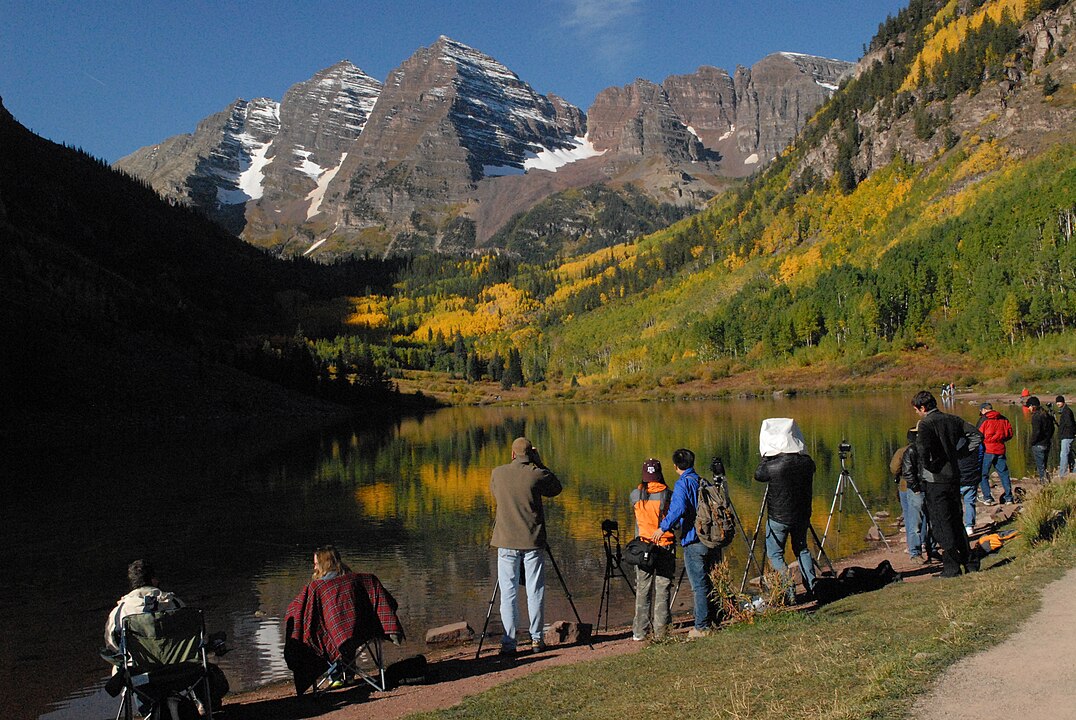
The Four Pass Loop near Aspen, Colorado, covers 26.6 miles with 7,500 feet of elevation gain, crossing four passes above 12,000 feet. Oxygen levels are 35% lower than sea level, and afternoon thunderstorms regularly bring lightning above treeline. The loop takes most hikers 3–4 days, though elite endurance athletes attempt it in a single day. Its combination of high elevation, distance, and exposure makes it one of Colorado’s toughest backpacking circuits.


