
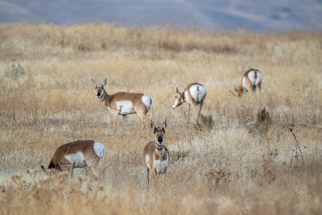
A smart deer search starts long before a stand goes up, because the best hotspots leave clear, repeatable clues. Hunters can save time by focusing on signs that confirm recent movement, then pairing it with terrain features that naturally guide travel. Food, bedding cover, and water often connect through predictable routes, but pressure and wind can alter their paths when deer use them. A careful plan combines quick observation with targeted verification, maintaining low disturbance while building confidence. The ten methods below highlight practical ways to narrow options and identify the most productive areas fast.
Read Fresh Tracks And Trail Patterns
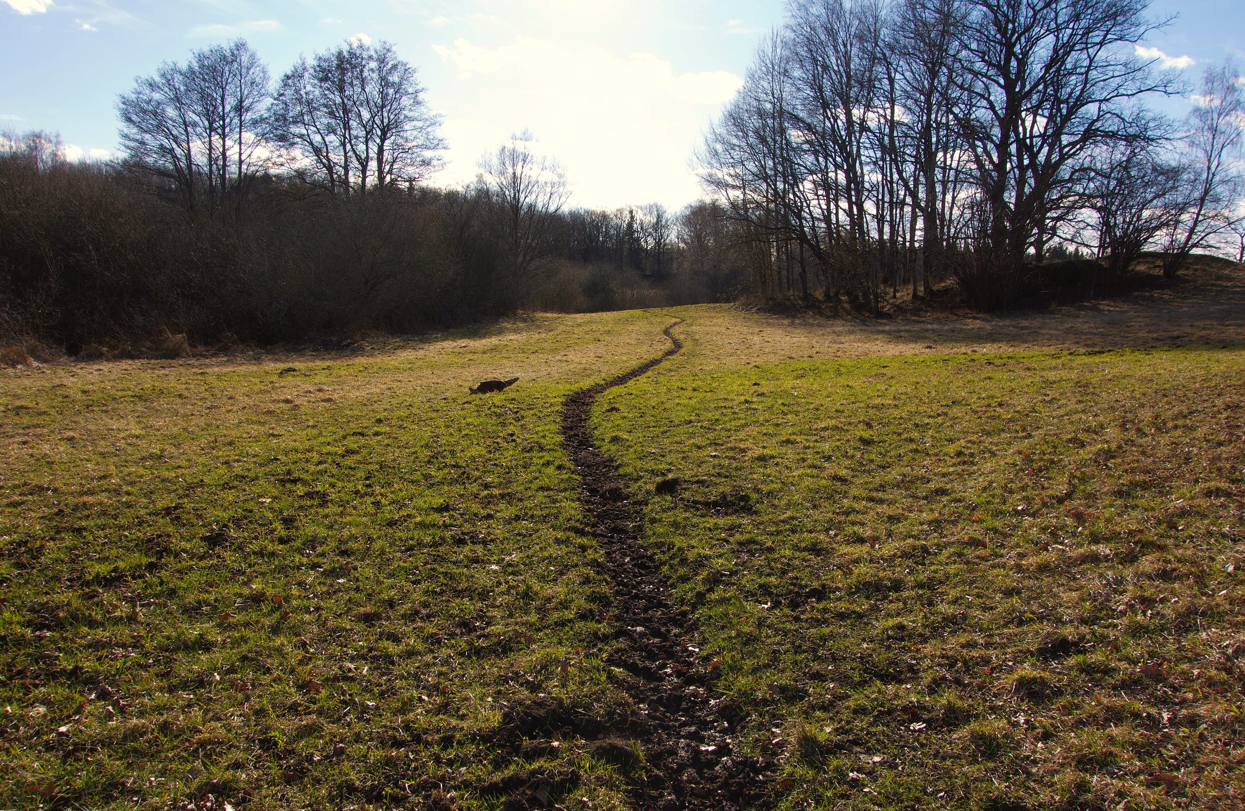
The quickest scouting starts with fresh deer sign because tracks and trails reveal routine movement without guesswork. Crisp edges, clean toe marks in mud, and undisturbed impressions in snow often indicate recent travel. Direction matters, since repeated travel lines form corridors between bedding cover, food sources, and water. Track size and stride length help separate doe groups from larger deer, improving pattern recognition. Nearby droppings, freshly disturbed leaves, and snapped stems add confirmation that the area sees steady use. Consistency across several crossings signals a hotspot, while a lone print suggests a one-time pass.
Glass Edges At First And Last Light
Optics can narrow a search fast when used at dawn and dusk, when deer often shift between cover and feeding areas. Quiet observation from concealed points keeps pressure low and improves accuracy. Field edges, logging cuts, and open timber lanes deserve attention because deer may step out briefly before slipping back into cover. Slow, repeated scanning works better than rushing, since movement often appears as small changes rather than full silhouettes. Subtle cues like ear flicks, head turns, and tail movement can reveal animals that blend into grass or shadow. Careful glassing builds a reliable picture of entry routes and timing.
Map Funnels And Natural Pinch Points
Terrain-based planning identifies likely travel routes because deer commonly choose efficient paths that provide cover and easier footing. Topographic maps and aerial imagery highlight saddles, narrow ridges, creek crossings, and timber strips squeezed between openings. These pinch points concentrate movement, turning several options into one usable line. Field verification should focus on edges, where tracks, hair, and rubbed brush often appear without walking through the core corridor. Fence crossings and low spots in hedgerows can show repeated use with minimal ambiguity. Wind direction and human activity still influence traffic, so the best funnels are those offering cover plus limited disturbance.
Find Food Sources With Seasonal Timing
Food drives movement, but preferred choices shift with crops, mast drops, and local browse availability. Early season often centers on green forage and accessible agricultural edges where legal access exists. When acorns fall, oak flats and nearby transitions can light up with fresh feeding signs. As winter approaches, remaining crops and woody browse gain importance, especially where cover sits close to nutrition. Scouting should look for clipped stems, pawed leaves, and concentrated droppings rather than relying on distant field views alone. Trails that angle from bedding cover toward food in evening lines often confirm repeatable patterns.
Identify Bedding Cover And Security Zones
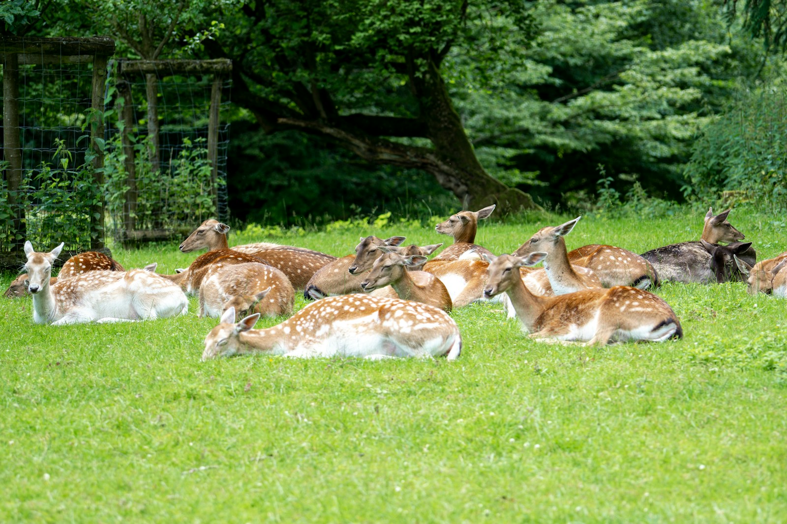
Bedding areas anchor daily patterns because deer return to secure rest sites when conditions stay favorable. Oval depressions in leaves, grass, or snow, paired with hair and droppings, can confirm repeated bedding. Thick brush, young pines, cattail marshes, and leeward slopes often provide wind protection and visual cover. Observation should stay downwind and at a respectful distance, since bumping deer from beds can disrupt movement for days. Buck bedding frequently appears more isolated and strategically placed for visibility, while doe bedding may cluster near dependable cover. Recognizing these zones helps explain nearby trail traffic and timing.
Follow Water And Terrain-Based Comfort Lines
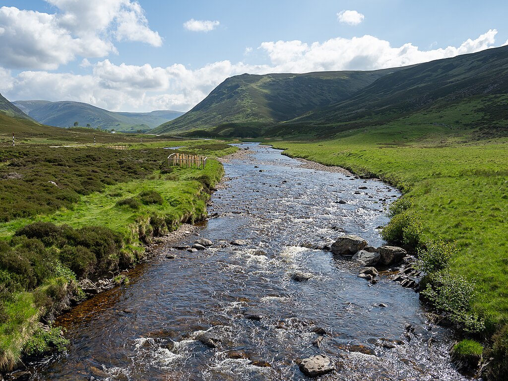
Water and comfort corridors shape travel because deer drink regularly and favor routes that feel secure and efficient. Trails that parallel creeks, skirt ponds, or run along drainage bottoms can carry steady movement, especially when cover stays consistent. During dry stretches, reliable water sources can concentrate activity in limited areas, while wet conditions may spread travel across many options. Fresh tracks on muddy banks and worn entry points provide clear confirmation. Benches on hillsides and gentle contours also matter, since deer often avoid steep climbs when easier lines exist. Linking water, cover, and terrain creates a practical map of recurring hotspots.
Use Wind To Choose The Right Side Of Sign
Wind acts as a filter because deer use scent to manage risk and select routes that protect them. Approaches should stay downwind of bedding and primary trails to reduce contamination. On ridges and points, deer often bed with wind at the back and visibility ahead, creating predictable travel choices nearby. Scouting across different wind directions can explain why one trail looks hot on some days and quiet on others. Repeated intrusion leaves a lingering scent, so low-impact routes and limited visits protect a productive area. Planning stands and observation points around the wind keep scouting accurate and improve long-term consistency.
Study Rubs And Scrapes For Current Activity
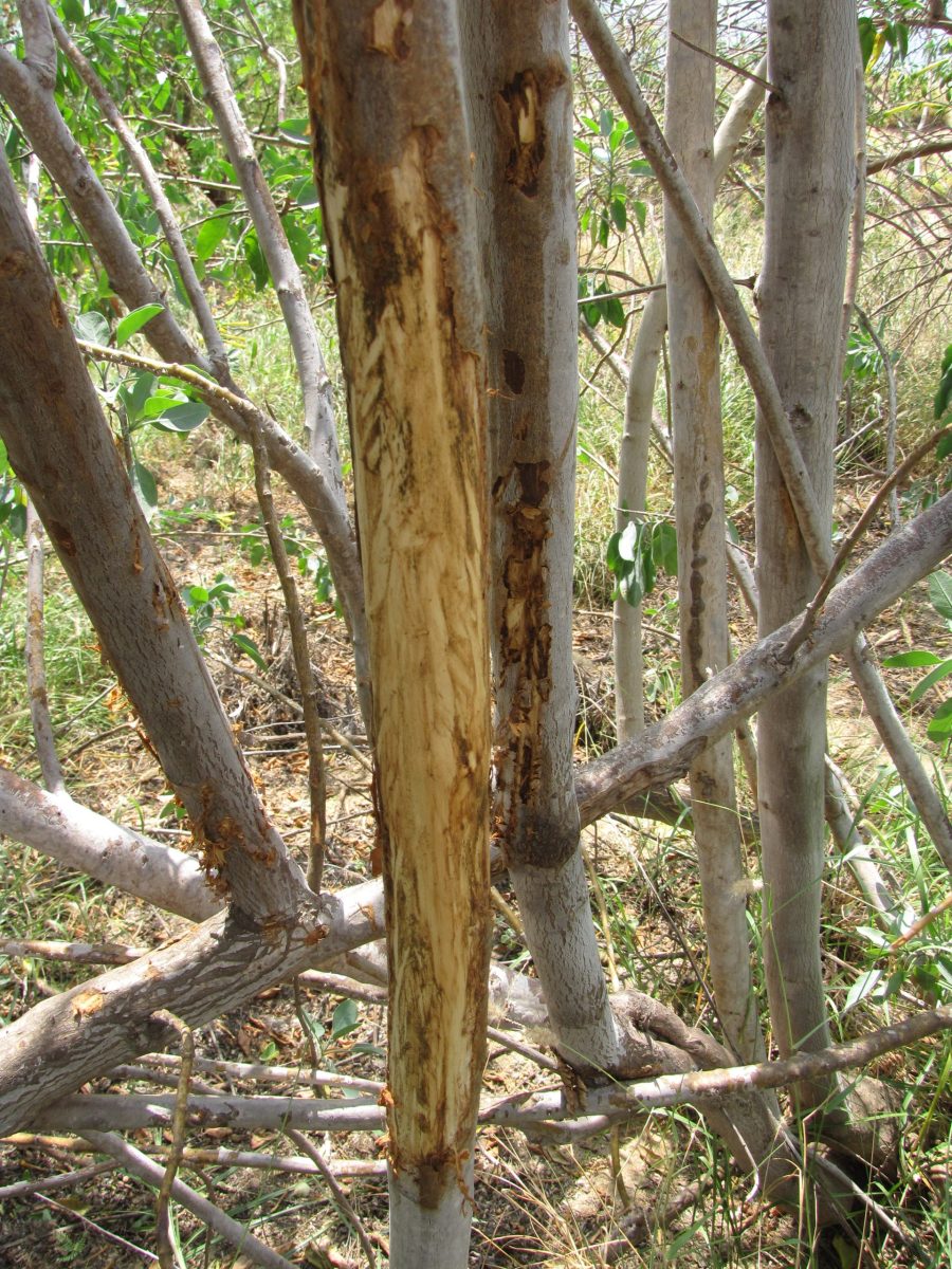
Rubs and scrapes can pinpoint buck activity when interpreted carefully, especially during the pre-rut and rut. Fresh rubs often show bright, exposed wood, while older rubs look darkened and weathered. Active scrapes feature disturbed soil beneath an overhanging licking branch, with tracks that indicate repeat visits. Connecting several rubs and scrapes into a line can reveal a travel corridor rather than a single stop. Handling signs should stay minimal, since excessive disturbance can reduce daylight movement. Pairing this evidence with nearby cover and wind behavior helps separate truly productive zones from scattered, low-value signs.
Scout Access And Pressure Like A Predator
Pressure changes deer behavior fast, so smart scouting accounts for people as carefully as it tracks animals. Common entry points, parking areas, and heavily walked trails often push deer toward thicker cover or alternative routes. Tracks that angle into dense habitat during midday can indicate avoidance patterns rather than random travel. Listening for nearby shooting, vehicles, or farm activity can explain sudden shifts in movement. Access routes should minimize noise and scent to keep a hotspot active across multiple sites. Rotating locations also helps, since repeated use of the same path can educate deer quickly. Managing pressure protects patterns and supports consistent success.
Confirm With Trail Cameras And Quick Data Checks
Trail cameras, where legal, provide time-stamped proof that refines scouting without constant intrusion. Placement works best on funnel edges, field corners, or well-used trails, aimed to capture full-body movement while limiting false triggers. Checks should stay infrequent and timed for midday lulls to reduce disturbance. Photo data becomes more useful when compared against wind shifts, temperature changes, and repeated daylight appearances. Consistency matters more than one-night spikes, so the focus should remain on repeatable movement windows. The strongest payoff comes from using results to improve stand placement and access routes, not from chasing every new image in a different spot.


