
The United States is home to over 193,000 miles of hiking trails managed by the National Park Service, U.S. Forest Service, and state park systems. Among them, certain trails stand out for their dramatic scenery, unique ecosystems, and challenging terrains. Based on trail length, elevation profiles, visitor statistics, and recognition in outdoor recreation studies, here are nine of the most breathtaking hikes across the country.
The Highline Trail – Montana’s Glacier Crown Jewel
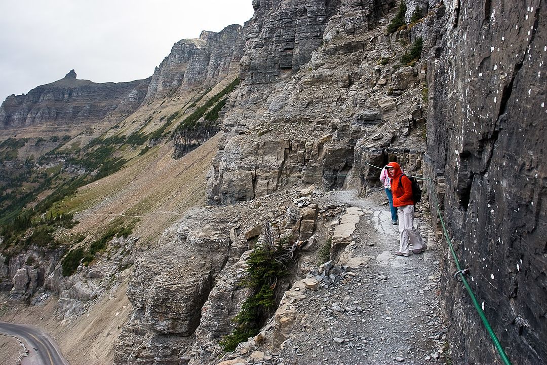
Stretching 11.8 miles one way, the Highline Trail in Glacier National Park runs along the Continental Divide, offering constant exposure to alpine scenery. Hikers gain about 800 feet in elevation but are treated to panoramic views of the Lewis Range and encounters with wildlife like mountain goats. According to NPS visitation reports, Glacier welcomed over 2.9 million visitors in 2023, with this trail consistently ranked as one of the park’s top hikes.
Kalalau Trail – Hawaii’s Rugged Coastal Wonder
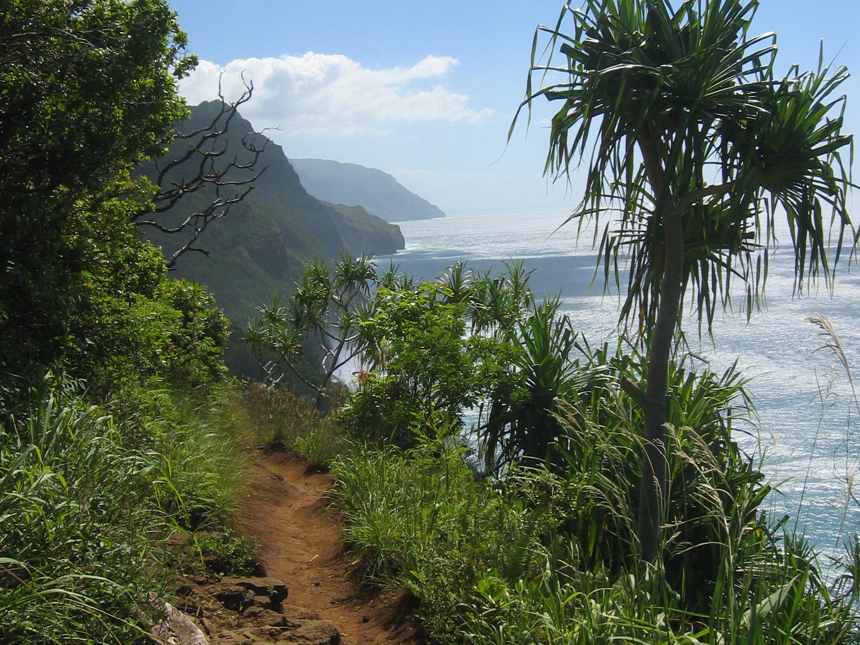
The Kalalau Trail traces the 11-mile Na Pali Coast of Kauai, with a total round trip distance of 22 miles. Known for its steep cliffs rising over 4,000 feet above the Pacific, it is the only land access to Kalalau Beach. Hawaii’s Division of State Parks limits overnight permits to 60 per day, keeping the area protected and pristine. Heavy rainfall—averaging 70–80 inches annually—makes sections of the trail slippery and treacherous.
Angels Landing – Utah’s Iconic Cliffside Ascent
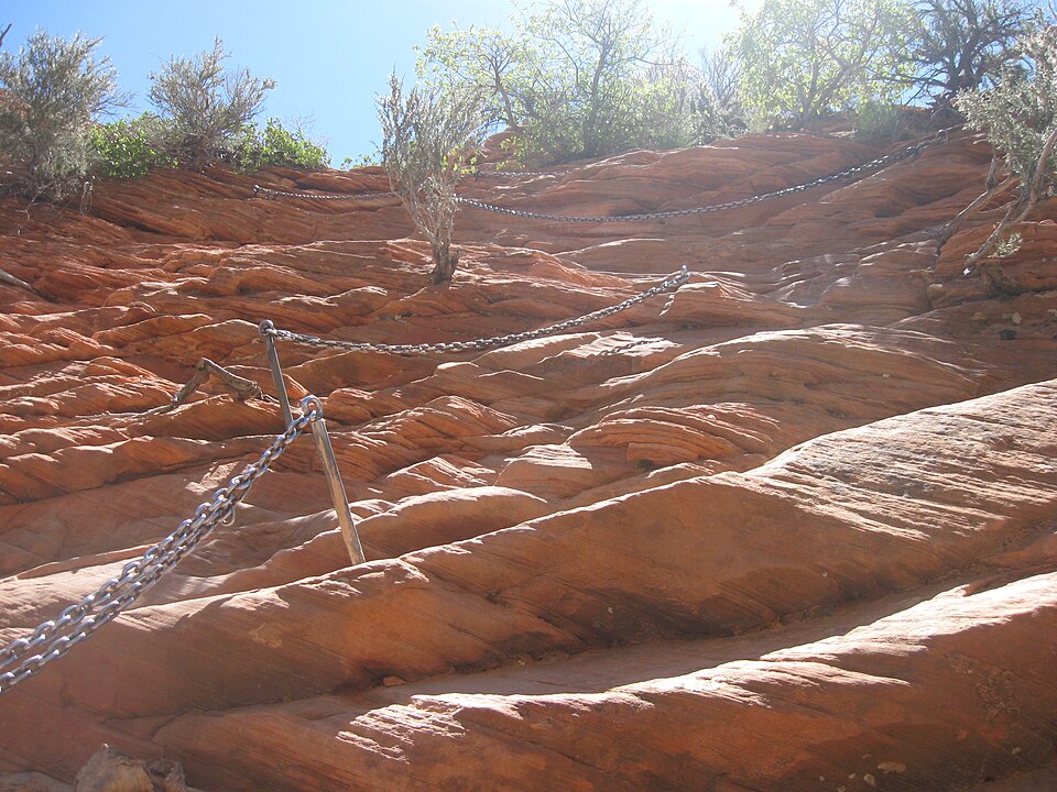
Located in Zion National Park, Angels Landing is a 5.4-mile round trip hike with an elevation gain of 1,488 feet. The final half-mile involves chains bolted into sandstone, with sheer 1,000-foot drop-offs on either side. Due to its popularity, the NPS instituted a permit lottery system in 2022, with more than 200,000 applicants annually competing for access. Despite the danger, its sweeping views of Zion Canyon make it one of the park’s most iconic experiences.
Teton Crest Trail – Wyoming’s Alpine Traverse
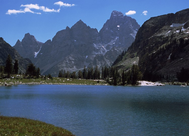
The Teton Crest Trail spans 40 miles, traversing the spine of the Teton Range. Elevations range from 6,800 feet at Jackson Hole Valley to over 10,700 feet at Paintbrush Divide. Backpackers typically complete it in 3–5 days, encountering alpine lakes, wildflower meadows, and glacier-carved valleys. Grand Teton National Park reported nearly 3.4 million visitors in 2023, but only a small fraction attempt this high-altitude multi-day trek, making it both challenging and less crowded.
Franconia Ridge Loop – New Hampshire’s Alpine Highway
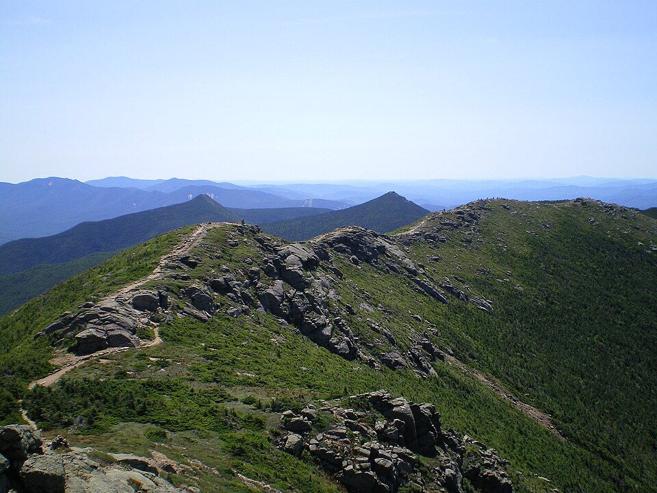
Part of the White Mountains’ Presidential Range, the Franconia Ridge Loop covers 8.6 miles with about 3,900 feet of elevation gain. It connects three major 4,000-foot peaks: Little Haystack, Lincoln, and Lafayette. The exposed ridgeline, above treeline for nearly 1.5 miles, offers uninterrupted views of New England’s wilderness. According to the Appalachian Mountain Club, this section of the White Mountains receives some of the highest hiker traffic in the Northeast.
Grinnell Glacier Trail – Montana’s Icy Alpine Route
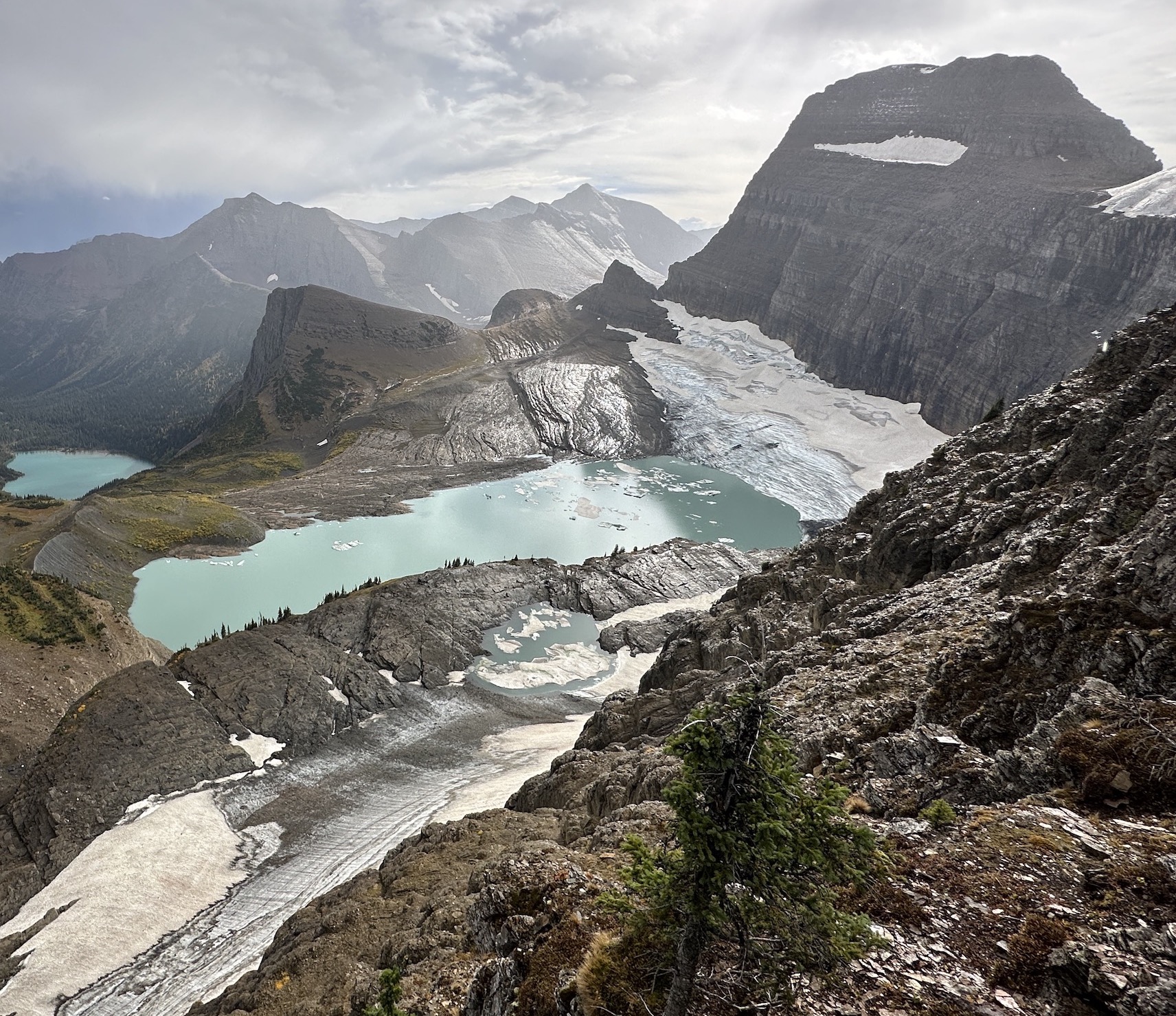
This 10.6-mile round trip trail climbs 1,600 feet to Grinnell Glacier, one of Glacier National Park’s most studied ice masses. USGS data shows that Grinnell has lost over 40% of its area since 1966, making it a vital climate change observation point. Along the hike, visitors pass turquoise glacial lakes and high meadows, with frequent sightings of bighorn sheep. Its combination of natural beauty and scientific significance makes it one of Glacier’s most remarkable hikes.
Enchantment Lakes – Washington’s Alpine Paradise
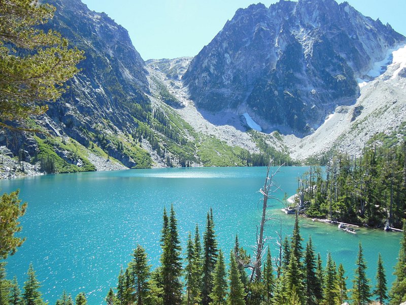
The Enchantments in the Alpine Lakes Wilderness require a strenuous 18-mile point-to-point hike with 4,500 feet of elevation gain. The U.S. Forest Service issues only 24 overnight permits per day during the peak season to preserve the fragile ecosystem. The basin features over 700 alpine lakes and ponds scattered among granite peaks and larch forests. During October, the golden larches against snow-dusted ridges create one of the most photographed alpine landscapes in the U.S.
Lost Coast Trail – California’s Remote Shoreline Trek
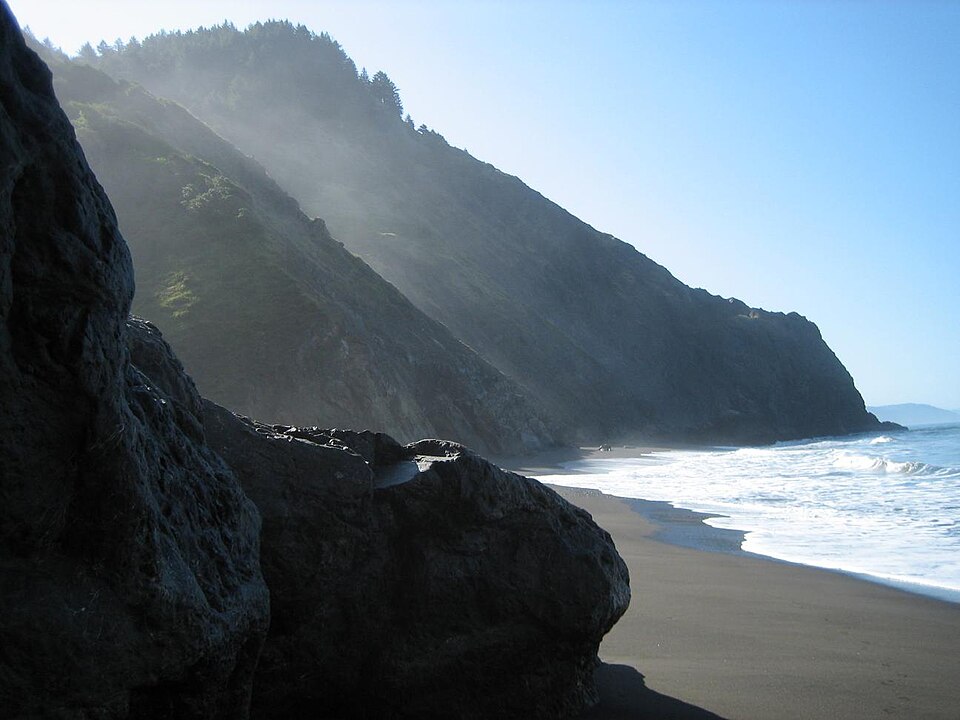
Northern California’s Lost Coast Trail follows 25 miles of undeveloped Pacific coastline within King Range National Conservation Area. This is one of the few stretches of California coast too rugged for Highway 1. Hikers must plan around tides, as over 9 miles of trail become impassable during high tide. With its combination of black sand beaches, sea lion colonies, and isolation, it is considered one of the country’s premier wilderness beach hikes.
The Narrows – Utah’s Slot Canyon Adventure
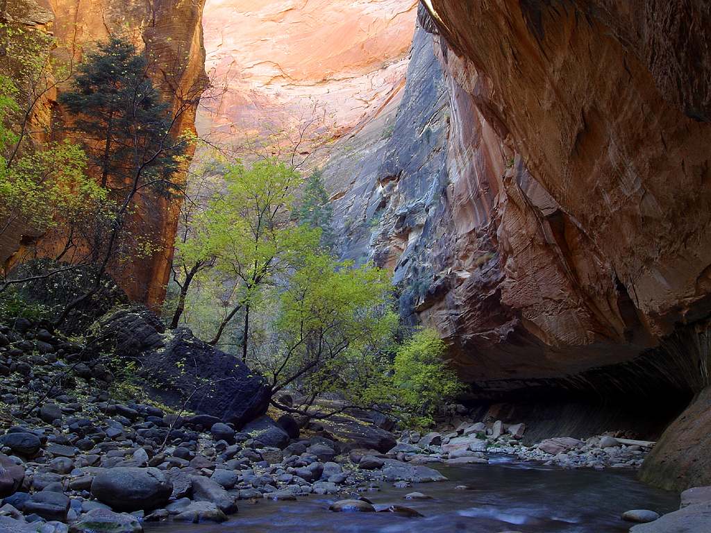
In Zion National Park, The Narrows follows the Virgin River through a slot canyon with walls towering up to 1,500 feet high. About 60% of the hike is spent wading or swimming, making it highly dependent on water flow rates. The round-trip from the bottom-up section is about 9.4 miles, while the full top-down through-hike covers 16 miles. NPS records show flash floods are the primary risk, and permits are required for the through-route.


