
Many of America’s most scenic hiking areas sit within landscapes shaped by shifting geology, steep slopes, and seasonal rainfall that can transform a peaceful trail into a hazardous environment. Heavy rain loosens soil, destabilizes rock faces, and increases runoff that can overwhelm natural drainage systems, raising the likelihood of landslides in regions already vulnerable due to topography. Hikers often seek out these locations for their dramatic views, lush forests, and rugged terrain, yet the natural beauty that draws visitors also contributes to instability during intense storms. Understanding how weather affects these environments helps travelers appreciate the complex forces that shape wilderness areas. These locations remain stunning destinations, though they require extra awareness during seasons when rainfall creates unpredictable conditions that reshape trails, slopes, and surrounding ecosystems.
Pacific Northwest Cascades, Washington and Oregon
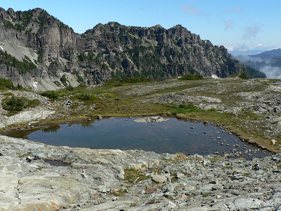
The Pacific Northwest Cascades stretch across Washington and Oregon, offering stunning alpine trails, dense forests, and volcanic landscapes that attract hikers throughout the year, yet the region’s steep slopes and heavy rainfall make it highly susceptible to landslides. Winter and spring storms saturate the soil, increasing runoff that weakens hillsides and destabilizes root systems. Trails near riverbanks and steep valleys often experience washouts or sudden slippage after prolonged rain. The region’s volcanic soil absorbs water quickly, which can accelerate erosion during back-to-back storms. Hikers visiting the Cascades often witness the effects of these conditions, as park crews frequently repair damaged paths and monitor areas prone to shifting terrain. These geological realities contribute to the region’s beauty while presenting challenges during wet seasons.
Great Smoky Mountains, Tennessee, and North Carolina
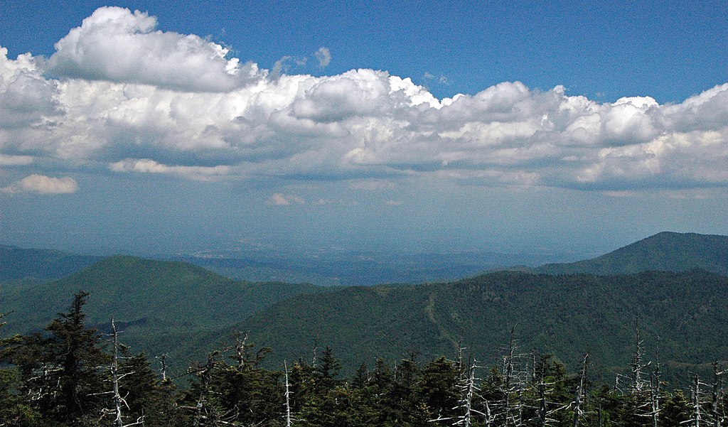
The Great Smoky Mountains, spanning Tennessee and North Carolina, remain one of the most visited national parks in the country, yet their misty slopes and abundant rainfall make them prone to landslides during heavy weather. The park’s layered sedimentary rock and dense vegetation create conditions where saturated soil becomes unstable, especially along steep ridges and winding mountain roads. Extended storms often lead to trail closures as crews address erosion or fallen debris. The region’s humid climate contributes to frequent downpours that saturate the ground quickly. Visitors encountering these landscapes often notice the deep ravines and sloping valleys that reflect centuries of natural movement. While the park’s lush terrain offers breathtaking scenery, its geology demands caution during seasons when rainfall intensifies.
Santa Monica Mountains, Southern California
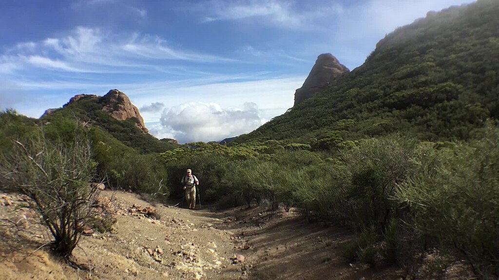
The Santa Monica Mountains in Southern California provide miles of coastal hiking trails with sweeping views of the Pacific Ocean, yet the region’s combination of steep slopes, loose soil, and irregular rainfall patterns makes it particularly vulnerable to landslides. Heavy winter storms often follow long dry periods, creating sudden soil instability as water rapidly absorbs into parched ground. Burn scars from frequent wildfires further weaken hillsides by removing vegetation that normally anchors soil. Trails along canyon edges or narrow ridgelines can shift unexpectedly after heavy rain. Park crews regularly monitor erosion-prone areas, especially during atmospheric river events that bring heavy moisture. Despite the mountains’ scenic appeal, their geology and climate create conditions where slides occur without warning during severe weather.
Blue Ridge Mountains, Virginia and North Carolina
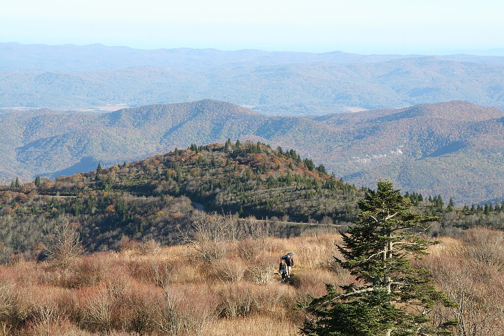
The Blue Ridge Mountains offer some of the East Coast’s most scenic hiking opportunities, but the region’s rugged slopes and seasonal storms create a landscape that is no stranger to landslides. Heavy rainfall often overwhelms clay-rich soil, causing it to loosen and move downslope, particularly along steep sections of trail. Rockfalls also occur when repeated wetting and drying weaken underlying layers. Roads along the Blue Ridge Parkway sometimes close during major storms as crews remove debris and assess structural stability. Visitors exploring this terrain frequently encounter areas shaped by past slides, where deposits of rock and soil offer a visible reminder of natural processes at work. The mountains’ dramatic elevation changes contribute to both their beauty and their vulnerability during heavy rain.
Columbia River Gorge, Oregon
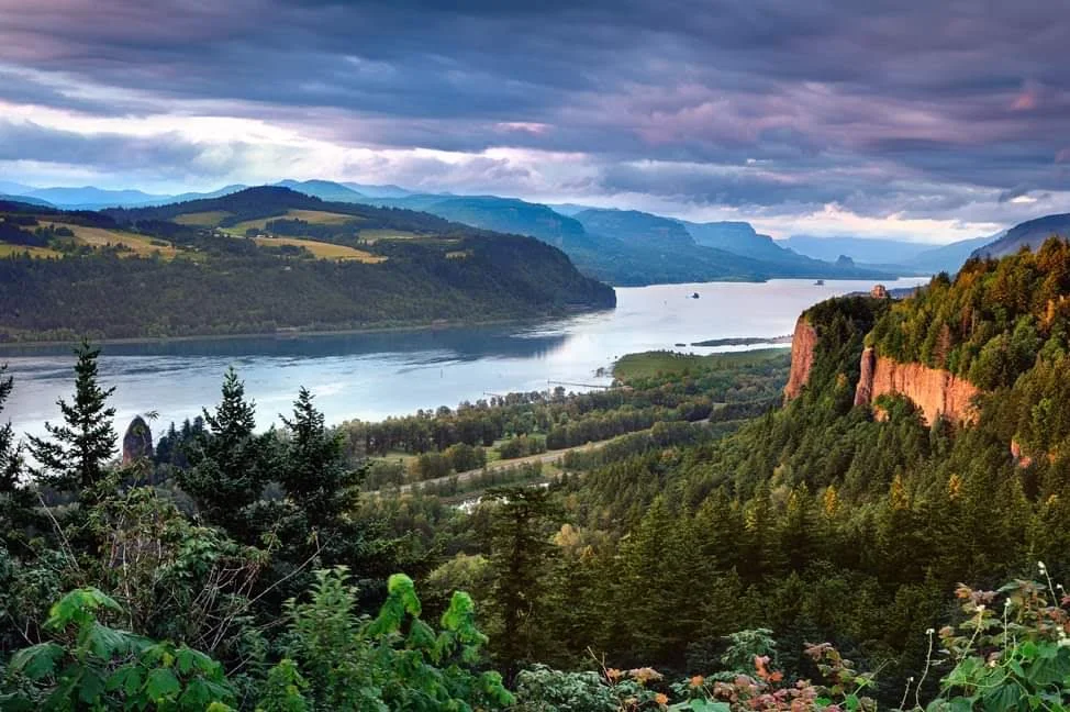
The Columbia River Gorge in Oregon is renowned for its dramatic cliffs, cascading waterfalls, and lush green trails, yet its geology makes it particularly prone to landslides during heavy rainfall. Basalt cliffs tower above river-level paths, and water seeping into existing cracks weakens rock layers over time. Winter storms regularly saturate the steep slopes, triggering debris flows that can block trails or damage infrastructure. Historic slides have reshaped portions of the gorge, leaving behind scarred terrain that reveals the region’s dynamic geological history. Park and forest crews frequently assess unstable areas while managing erosion caused by seasonal downpours. The gorge’s dramatic beauty comes with inherent risks that intensify during stormy months when rainfall reaches its peak.
Appalachian Trail Sections in Vermont
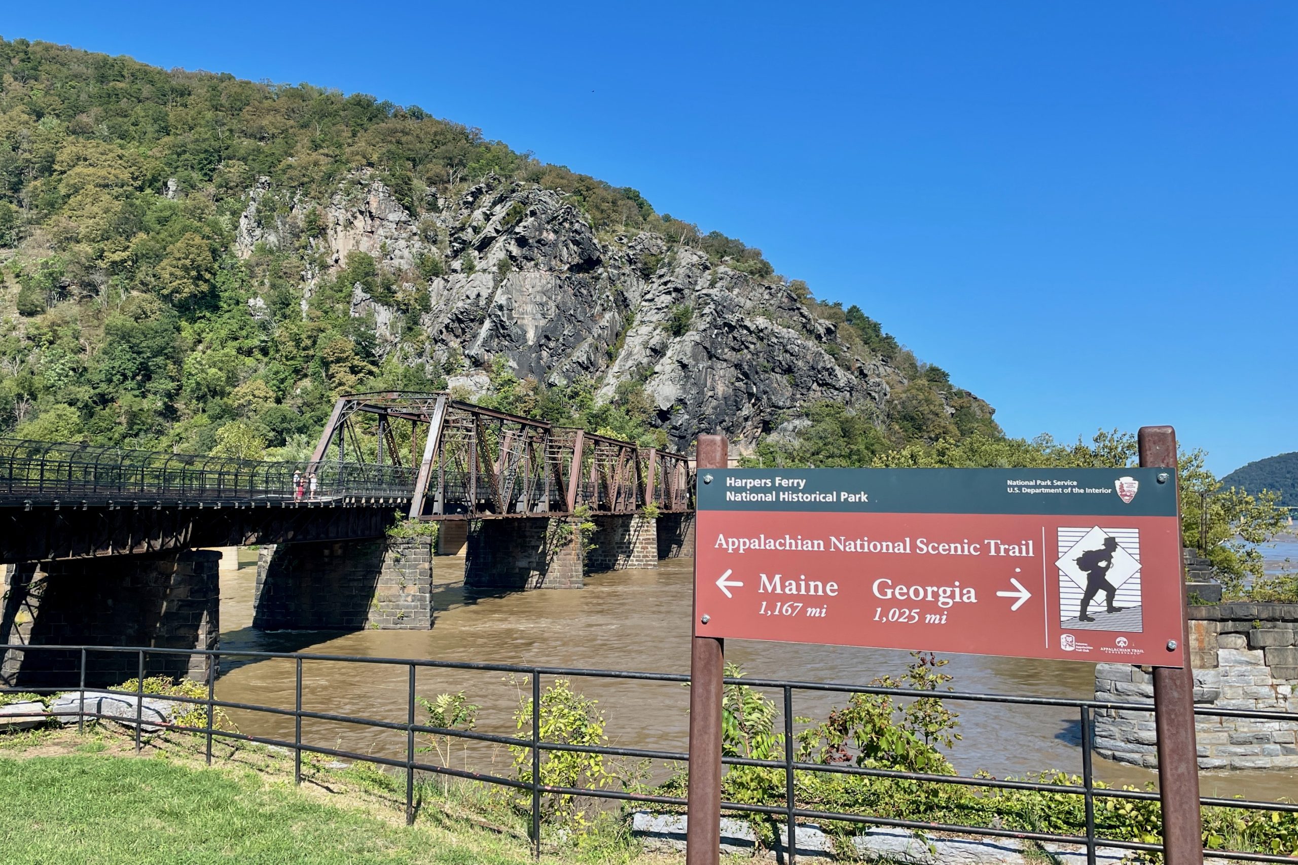
Sections of the Appalachian Trail in Vermont traverse steep ridges, muddy slopes, and forested mountainsides that become increasingly unstable after prolonged rain. The region receives significant precipitation throughout spring and summer, saturating soil that already contains a high concentration of organic material and clay. This combination weakens the ground, especially on narrow switchbacks and exposed hillside paths. Hikers often encounter deep mud, washouts, or rerouted segments following heavy storms. Vermont’s freeze-thaw cycle adds another layer of complexity by loosening rocks and roots before seasonal rain arrives. These factors make the state’s Appalachian Trail sections particularly susceptible to landslides, reflecting the powerful relationship between weather and mountainous terrain throughout New England.
Big Sur Coast, California
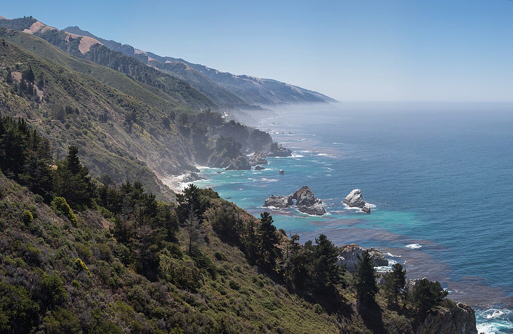
California’s Big Sur coast features rugged cliffs, winding trails, and dramatic seaside views, yet the region is one of the most landslide-prone hiking areas in the United States due to its steep coastal bluffs and periods of intense rainfall. Winter storms often saturate the soil along the cliffs, causing large sections to slip toward the ocean. Highway and trail closures are common during wet months as crews assess safety and repair damaged areas. Wildfire burn scars further destabilize slopes by eliminating vegetation that normally holds ground in place. Hikers exploring Big Sur often witness evidence of past slides carved into the landscape. The region’s beauty is tied closely to its geological instability during heavy rain.
Olympic National Park, Washington
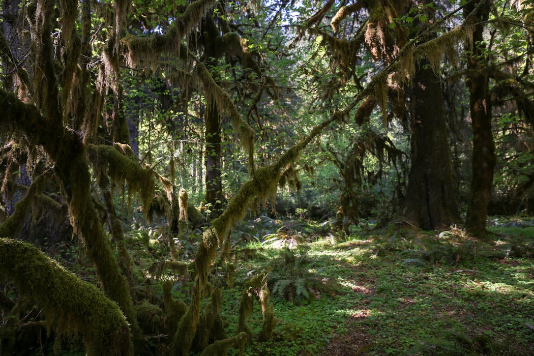
Olympic National Park in Washington encompasses rainforests, mountains, and coastal cliffs, making it one of the most diverse ecosystems in the country and also one of the most susceptible to landslides when heavy rain arrives. The park receives substantial annual precipitation, especially in the Hoh and Quinault regions, where saturated soil weakens tree roots and increases the likelihood of slope failure. Trails near riverbanks and steep ravines often require frequent maintenance due to erosion. Storms can trigger debris flows that reshape sections of forest or temporarily block access routes. The dramatic interplay between moisture, vegetation, and steep terrain creates a dynamic environment where landslides become a natural part of the park’s evolving landscape during rainy seasons.


