
Coastal hiking in the United States offers a mix of rugged cliffs, sandy shores, and panoramic ocean views. According to data from the National Park Service and state tourism boards, millions of visitors trek these routes annually, with trails ranging from short seaside walks to multi-day backcountry adventures. The following seven hikes stand out for their scenic beauty, biodiversity, and unique geological features.
Trekking the Kalalau Trail – Kauai, Hawaii
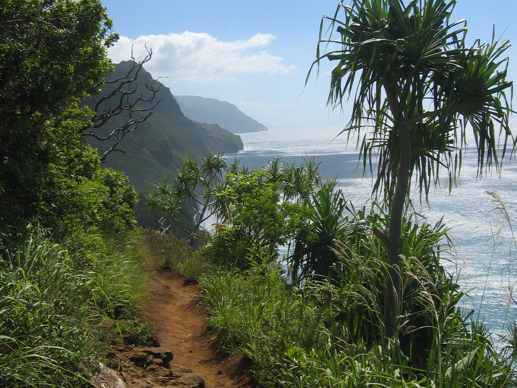
Stretching 11 miles along Kauai’s Nā Pali Coast, the Kalalau Trail is one of Hawaii’s most challenging hikes, climbing nearly 5,000 feet in elevation gain. Limited permits about 60 issued per day help preserve its fragile ecosystems. The trail passes through five lush valleys and ends at Kalalau Beach, a secluded spot accessible only by foot or boat. Heavy rainfall, averaging 85 inches annually, makes the trail both lush and slippery, demanding careful preparation.
Acadia’s Ocean Path – Maine’s Granite Shoreline
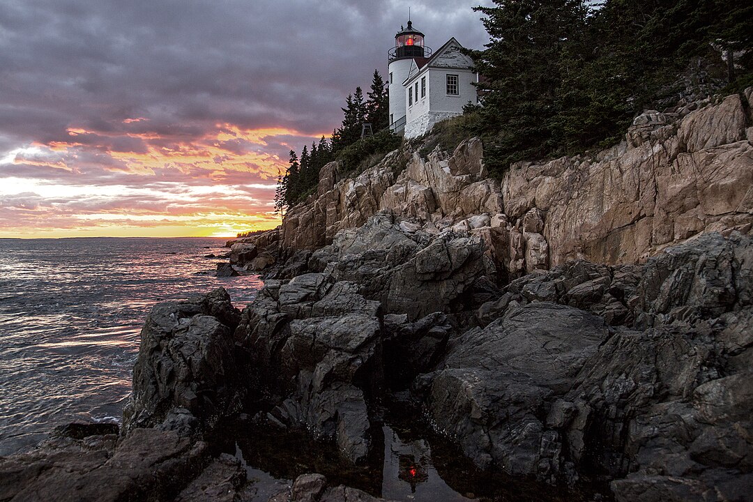
Ocean Path in Acadia National Park runs 4.5 miles round trip along Maine’s rugged Atlantic coast. The route connects key landmarks such as Sand Beach, Thunder Hole, and Otter Cliffs one of the tallest sea cliffs on the U.S. Atlantic seaboard, rising 110 feet. The trail offers unobstructed views of Frenchman Bay and is among the park’s most visited, with Acadia drawing more than 4 million visitors in 2023, ranking it in the top 10 most visited U.S. national parks.
Point Reyes Coastal Hike – California’s Foggy Peninsula
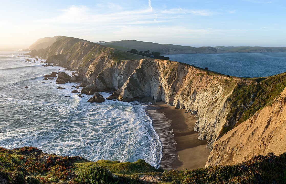
Point Reyes National Seashore offers 150 miles of trails, with the 9.4-mile Coast Trail from Palomarin to Alamere Falls being the most iconic. Alamere Falls is one of only two tidefalls in the continental U.S., where fresh water cascades directly onto the beach. The area is also part of the Pacific Flyway, hosting over 490 bird species, making it a hotspot for wildlife enthusiasts. Seasonal fog and strong coastal winds shape the landscape and hiking experience.
Exploring Cape Hatteras National Seashore – North Carolina’s Shifting Sands
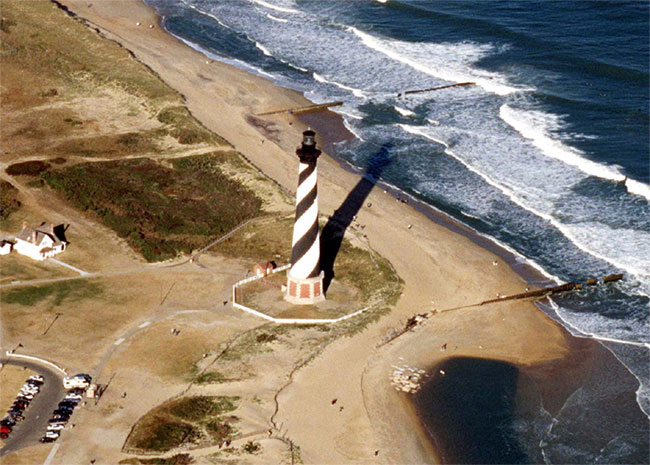
Cape Hatteras, stretching 70 miles across the Outer Banks, offers hikes through maritime forests, dunes, and long sandy beaches. The Buxton Woods Trail and Hatteras Village Nature Trail provide accessible routes with diverse habitats. The seashore is notable for its dynamic barrier island system, which shifts significantly due to storms and ocean currents. Cape Hatteras is also home to the tallest brick lighthouse in the U.S., standing at 198 feet, guiding mariners since 1870.
Rialto Beach to Hole-in-the-Wall – Washington’s Wild Pacific Edge
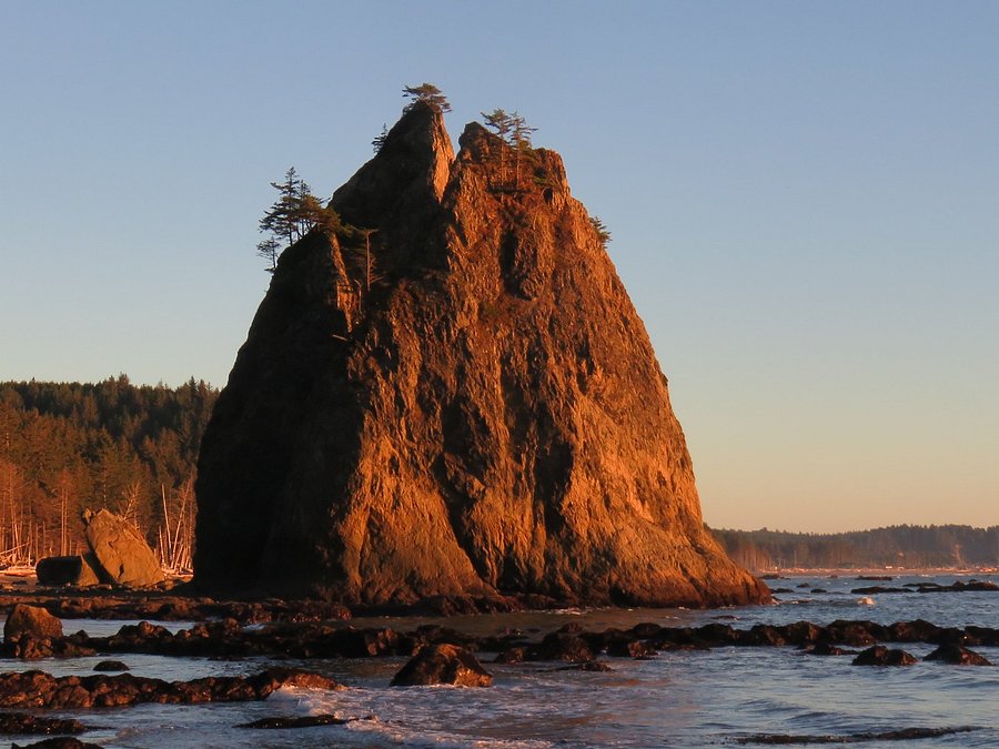
In Olympic National Park, the 3.4-mile round-trip hike from Rialto Beach to Hole-in-the-Wall features dramatic sea stacks, tide pools, and offshore islands. The coastline here is part of a federally protected wilderness, where bald eagles, seals, and sea otters are common sightings. Tides are a critical factor low tide exposes extensive tide pools filled with starfish and anemones. Olympic’s coastline receives over 100 inches of rain annually, fueling its lush temperate rainforest backdrop.
Hiking Cumberland Island National Seashore – Georgia’s Untamed Coast
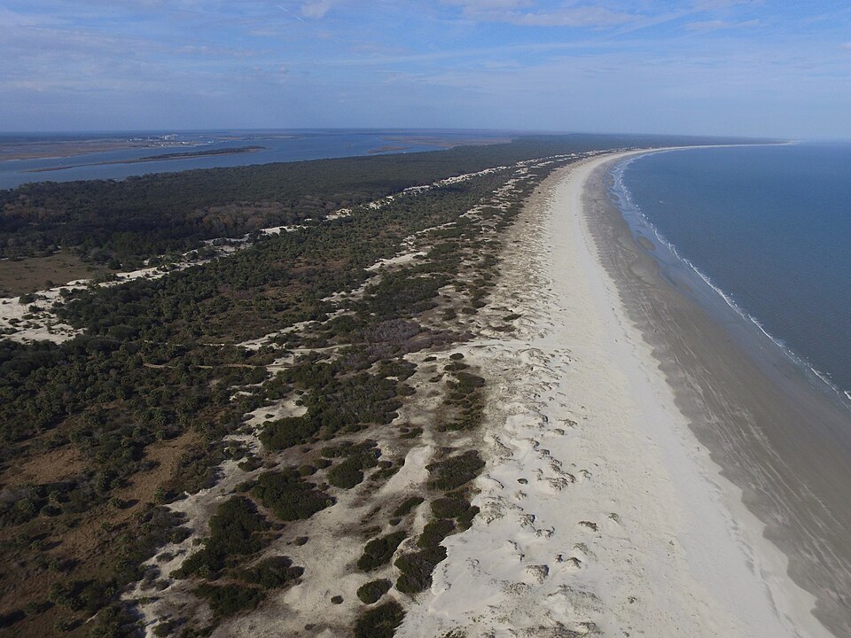
Cumberland Island, Georgia’s largest barrier island at 17.5 miles long, is accessible only by ferry and allows just 300 daily visitors to preserve its ecosystem. The island features 50 miles of hiking trails, with routes passing through live oak forests, marshes, and undeveloped beaches. Wild horses, first introduced in the 1700s, still roam freely. The island also preserves historic sites like the ruins of the 19th-century Carnegie family estate, adding cultural depth to its natural beauty.
Big Sur Coastal Trails – California’s Cliffside Views
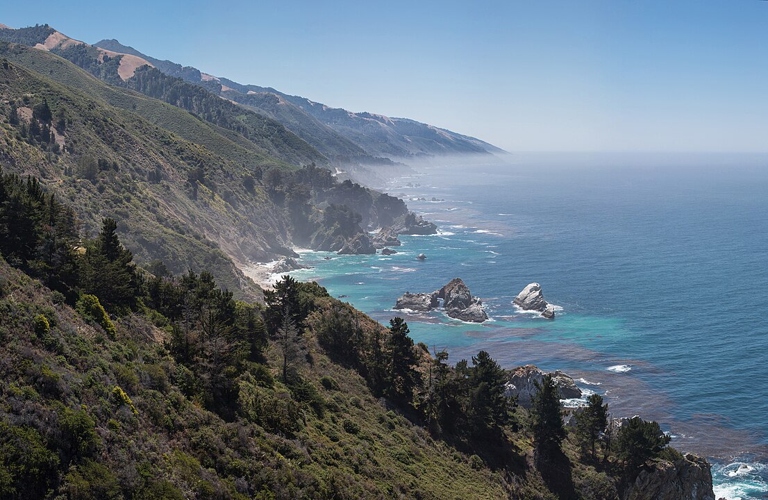
Big Sur’s coastline along California’s Highway 1 offers numerous hikes, with the 8.8-mile Ewoldsen Trail and 1.5-mile McWay Falls Overlook among the most popular. McWay Falls is one of only two major tidefalls in California, dropping 80 feet directly into the Pacific Ocean. The region’s steep cliffs rise up to 5,000 feet from the ocean, creating dramatic views. Big Sur is also part of the protected California Condor Recovery Zone, where the endangered bird has been successfully reintroduced.


