
Glacier National Park, covering 1,583 square miles in Montana, offers more than 700 miles of hiking trails, according to the National Park Service. These routes range from short, family-friendly walks to strenuous alpine treks, giving hikers access to glaciers, lakes, and wildlife habitats. Visitor surveys show that hiking is the park’s most popular activity, with over 80% of its 3 million annual visitors exploring at least one trail. Here are 17 of the park’s most remarkable hikes backed by data and historical significance.
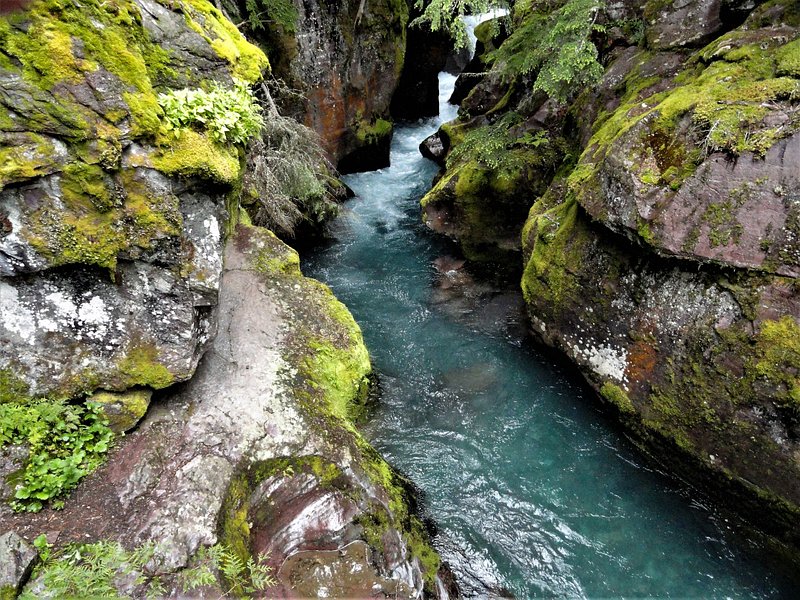
Avalanche Lake: A Scenic Basin Reward

Avalanche Lake Trail stretches 4.5 miles round trip, gaining about 730 feet in elevation. It ends at a glacial cirque framed by Bearhat and Little Matterhorn mountains, with multiple waterfalls plunging into the lake. Park ranger data shows this is among the top five most trafficked trails, drawing over 100,000 hikers annually because of its accessibility and dramatic scenery.
Trail of the Cedars: Glacier’s Accessible Gem
This 1-mile loop is fully boardwalk and wheelchair-accessible, making it one of Glacier’s most inclusive hikes. It passes through old-growth western red cedar and black cottonwood trees, some reaching 80 feet tall and over 500 years old. According to NPS records, it is one of only two wheelchair-friendly hikes in the park, making it vital for universal access.
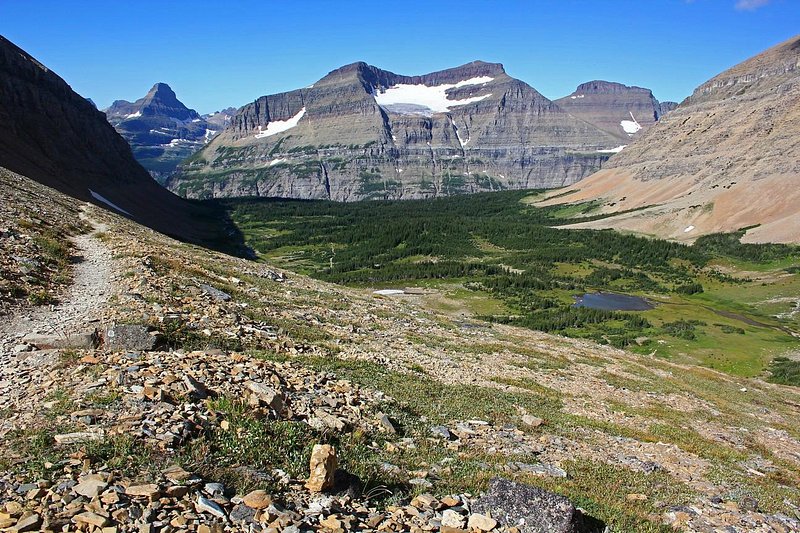
Grinnell Glacier: Witnessing Ice in Retreat
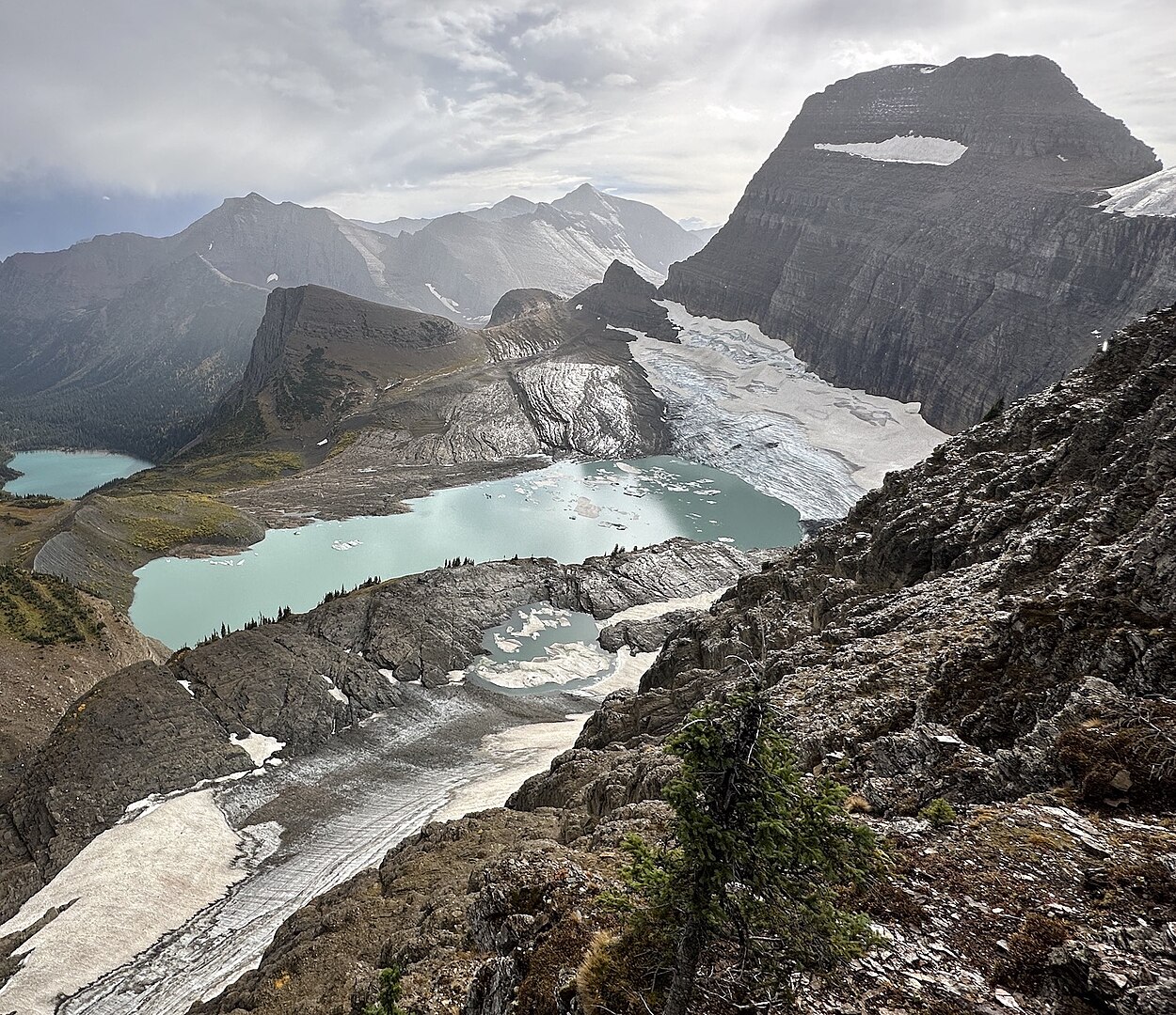
The Grinnell Glacier Trail is 10.6 miles round trip with 1,600 feet of elevation gain, offering direct views of one of the park’s remaining active glaciers. U.S. Geological Survey (USGS) data indicates Grinnell Glacier has shrunk by over 40% since 1966, making this hike a powerful window into climate change. Mountain goats are frequently observed along the route, adding wildlife interest.
Iceberg Lake: Where Ice Floats Year-Round

The Iceberg Lake Trail spans 9.7 miles round trip with 1,200 feet of elevation gain. The alpine lake, often dotted with floating ice even in August, sits beneath 3,000-foot cliffs of Mount Wilbur. According to NPS trail counters, Iceberg Lake is one of the top ten most popular day hikes, averaging 1,000 hikers per day in peak season.
Highline Trail: The Park’s Crown Jewel

Stretching 11.8 miles one-way along the Continental Divide, the Highline Trail offers unparalleled panoramic views. At Logan Pass, the trailhead sits at 6,646 feet elevation, and hikers often encounter bighorn sheep and mountain goats. A 2015 visitor survey by the University of Montana found the Highline was rated the park’s most scenic hike, with over 90% of respondents calling it a highlight.
Apgar Lookout: A Lake McDonald Panorama

The Apgar Lookout Trail is 7 miles round trip, climbing 1,800 feet through dense forest before opening to sweeping views of Lake McDonald and the Livingston Range. Historically used as a fire lookout, the summit structure is part of a system of over 700 fire lookouts once active in the U.S. The trail is noted for its spring wildflower blooms.
Swiftcurrent Pass: Gateway to the Continental Divide
Swiftcurrent Pass is a strenuous 14.2-mile round trip with 2,300 feet of elevation gain, connecting Many Glacier Valley to the Continental Divide. The trail passes three major lakes—Redrock, Fishercap, and Bullhead—before climbing into alpine terrain. According to park wildlife surveys, grizzly bear sightings are most frequent in this corridor, making it both thrilling and challenging.
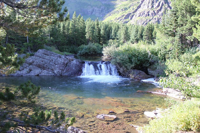
Running Eagle Falls: The Two-in-One Waterfall
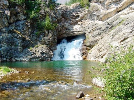
Also known as “Trick Falls,” Running Eagle Falls near Two Medicine offers a 0.6-mile round trip hike, making it highly accessible. During spring runoff, water spills over the top, while in drier seasons, the flow emerges from a cave halfway up the cliff. Geological studies by Montana State University highlight it as a rare karst spring system within Glacier.
Bowman Lake: Remote and Rugged
Reaching Bowman Lake requires a 6.7-mile round trip hike from the Bowman campground area, with modest elevation gain. The lake stretches 7 miles long, making it the park’s third largest. Its remoteness means far fewer crowds compared to Lake McDonald. According to NPS visitor use data, Bowman receives less than 10% of the traffic of more central park locations.
Ptarmigan Tunnel: Hiking Through History
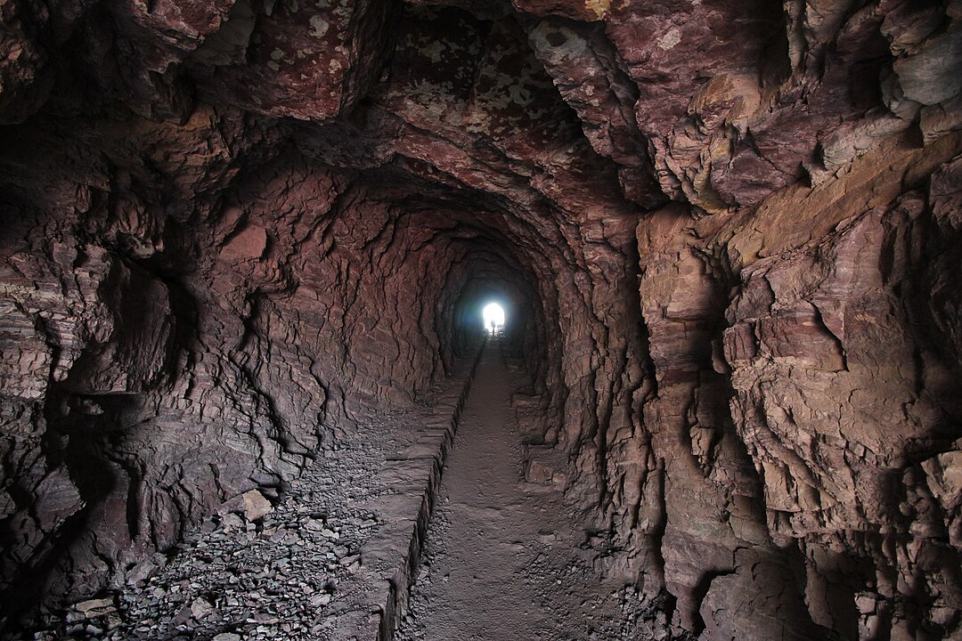
Built in 1930 by the Civilian Conservation Corps, the Ptarmigan Tunnel is a 240-foot passage blasted through solid rock to connect the Many Glacier Valley to Belly River country. The trail is 10.7 miles round trip with 2,300 feet of gain, and the steel doors to the tunnel remain closed until mid-July due to lingering snow. Historic CCC records describe the construction as one of the most ambitious park projects of its era.
Lake McDonald: Glacier’s Largest Lake Hike
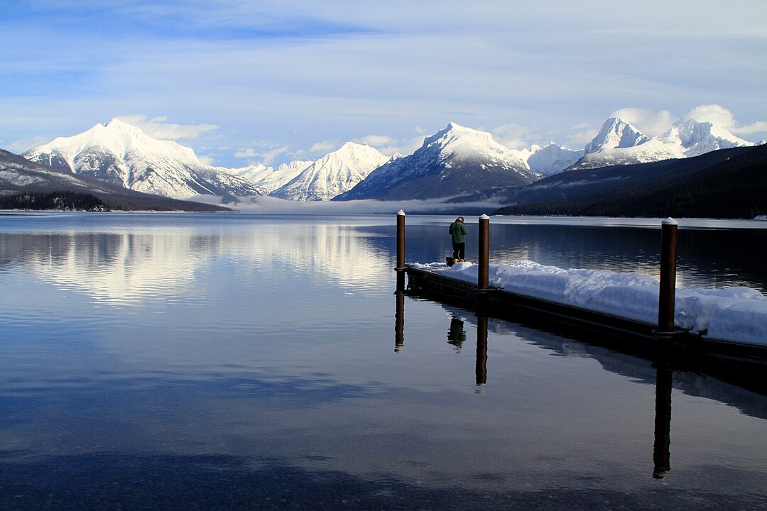
At 10 miles long and 472 feet deep, Lake McDonald is Glacier’s largest body of water. The surrounding trails, such as Johns Lake Loop, provide accessible ways to explore its shoreline. Geological surveys show the lake was carved by Ice Age glaciers over 10,000 years ago. Its location near West Glacier also makes it a hub for ranger-led hikes and educational programs.
Granite Park Chalet: A Historic Mountain Lodge Trek

The Granite Park Chalet, a National Historic Landmark built in 1914, is accessible via a 7.6-mile hike along the Highline Trail. Originally part of the Great Northern Railway’s tourist infrastructure, the chalet is one of only two remaining backcountry lodges in the park. Overnight stays require reservations, and park records show it accommodates only about 12,000 hikers per summer season.
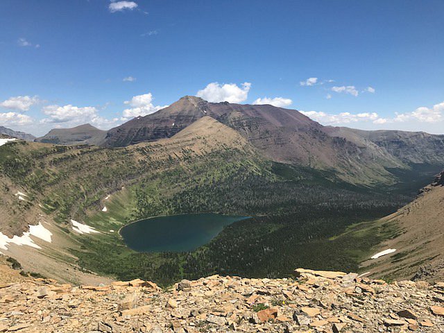
Cracker Lake: A Turquoise Surprise

The Cracker Lake Trail runs 12.6 miles round trip with 1,400 feet of elevation gain. The lake’s striking turquoise color comes from suspended glacial silt. According to USGS glaciology studies, the basin still contains remnants of glacial ice feeding the lake. The trail also passes the ruins of the Cracker Mine, a short-lived silver operation from the late 1800s.
Sperry Glacier: A Challenging Alpine Route
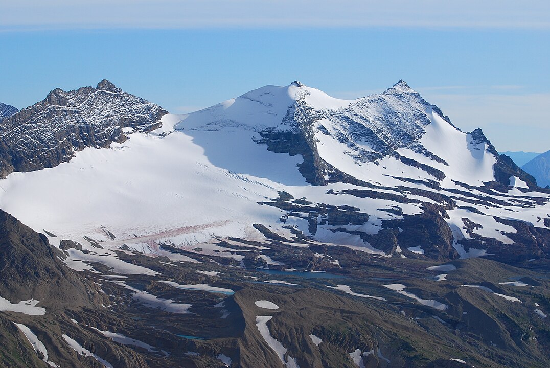
The Sperry Glacier hike requires a 16-mile round trip with nearly 5,000 feet of elevation gain, making it one of the park’s most demanding. The glacier itself has lost over 75% of its area since 1901, based on USGS measurements. Despite the loss, it remains one of the most studied glaciers in the park due to its accessibility from Sperry Chalet.
Dawson Pass: A High-Elevation Challenge
Dawson Pass, accessed from the Two Medicine area, is an 18-mile loop via the Dawson–Pitamakan Trail with 3,000 feet of elevation gain. At elevations above 7,600 feet, the pass offers sweeping views of Glacier’s southern expanse. According to NPS trail logs, this loop is completed by fewer than 5% of park hikers, making it one of the least crowded high-country routes.
Siyeh Pass: Crossing the Continental Divide
The Siyeh Pass Trail is 10.3 miles point-to-point, with a starting elevation of 5,850 feet at Sunrift Gorge and topping out at 8,100 feet. This 2,200-foot climb makes it one of the highest maintained trails in Glacier. Researchers from the University of Montana note that alpine wildflowers here are among the most diverse in the park due to microclimate variations along the pass.
Belly River: Remote Wilderness Access
The Belly River trail system in the park’s northeast corner leads deep into one of Glacier’s least visited regions. Trips vary from 6 miles to over 30 miles, often requiring multi-day backpacking. NPS backcountry permit data shows that fewer than 3% of annual visitors enter this area, making it a stronghold for solitude. The valley also supports a high density of moose and black bears


