
Rescues in U.S. national parks are far from rare. According to National Park Service (NPS) data, more than 3,000 search and rescue (SAR) operations occur annually, with hiking-related incidents accounting for nearly 50% of all rescues. Trails with steep terrain, heat exposure, or river crossings tend to see the highest numbers. Below are 13 trails repeatedly linked with frequent rescue calls, based on NPS and state park rescue statistics.
Grand Canyon’s Rescue Hotspot: Bright Angel Trail
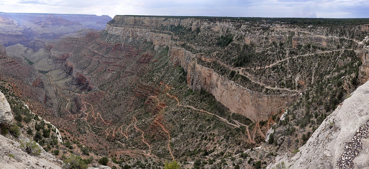
Bright Angel Trail accounts for the highest number of rescues in Grand Canyon National Park, largely due to extreme heat and its steep 4,380-foot elevation change. A 2019 NPS report showed that hundreds of heat-related emergencies occur here annually, especially when temperatures on the inner canyon floor soar above 110°F. Many hikers underestimate the energy required for the return climb, prompting frequent helicopter evacuations.
Yosemite’s Iconic Half Dome with Hidden Risks
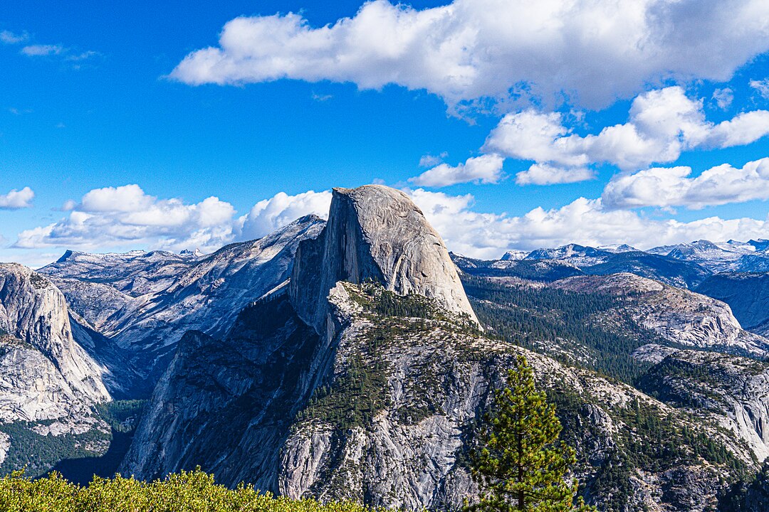
Half Dome sees 50,000 hikers annually, but rescues are common due to exhaustion, dehydration, and cable accidents. Yosemite SAR records show that about 15–20% of all rescues in the park involve Half Dome. The final 400-foot cable ascent is particularly dangerous in wet weather, with slips resulting in severe injuries. The strenuous 14–16-mile round trip also contributes to frequent overexertion cases.
Angel’s Landing: Zion’s Most Treacherous Climb
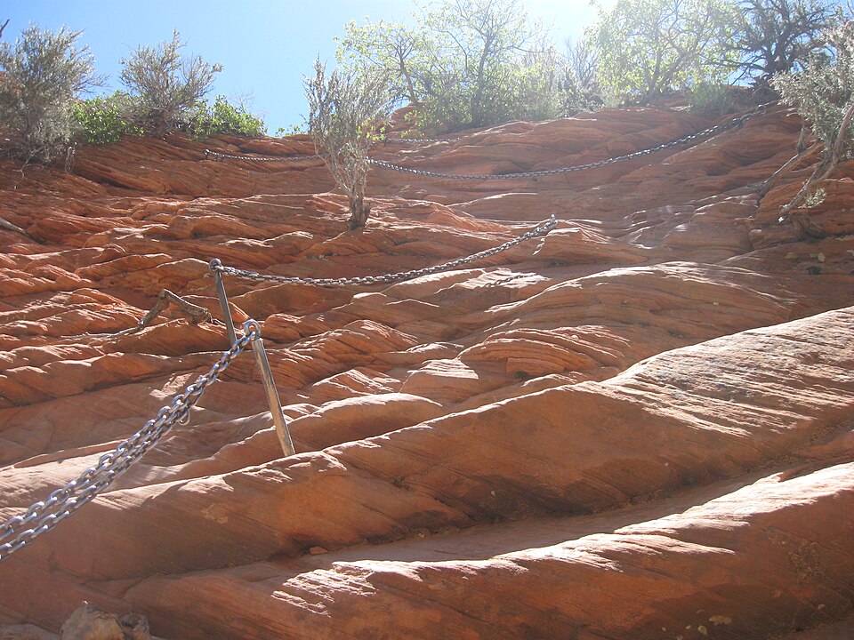
Angel’s Landing, with its 1,500-foot drop-offs and narrow sandstone ridge, is infamous for rescues and fatalities. Zion National Park SAR teams respond to over 60 incidents per year, many linked to falls or panic attacks in exposed sections. Since 2000, at least 17 deaths have been recorded on this trail, making it one of the most hazardous hikes in the U.S.
Yosemite’s Mist Trail and Slippery Dangers
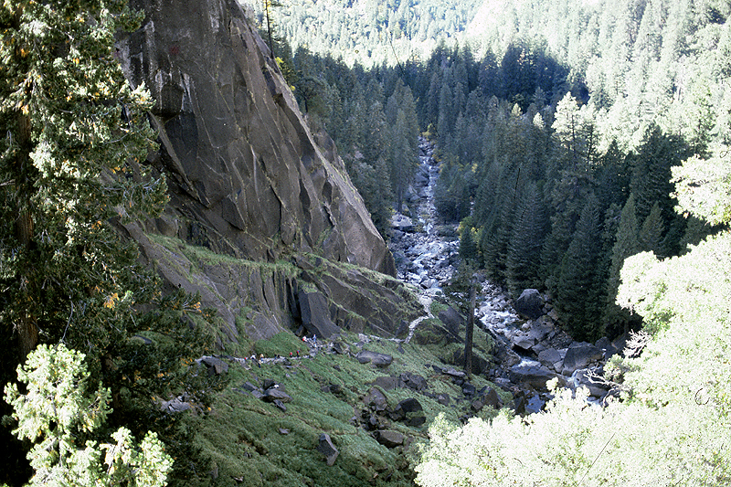
The Mist Trail, leading to Vernal and Nevada Falls, is short but perilous. NPS data notes that more than 30% of Yosemite’s water-related rescues occur here, often from slips on wet granite or attempts to swim in swift currents. Between 2005 and 2011, at least 13 fatalities were linked to hikers being swept over waterfalls, highlighting the risks near fast-flowing rivers.
Zion’s The Narrows and Flash Flood Threats
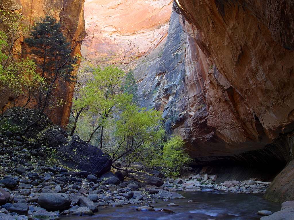
The Narrows, a slot canyon hike through the Virgin River, is highly rescue-prone due to flash floods and cold-water immersion. According to Zion SAR data, about 150 rescues annually occur in The Narrows. In 2015 alone, a sudden flood killed seven hikers. Hypothermia is also frequent in colder months, even when air temperatures feel mild.
Mount Whitney Trail: Altitude Meets Fatigue
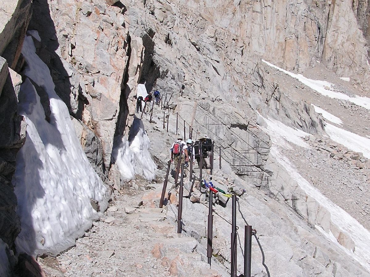
As the highest peak in the continental U.S. at 14,505 feet, Mount Whitney’s 22-mile round trip challenges hikers with altitude sickness and exhaustion. Inyo County SAR reports an average of 50 to 80 rescues per year on the Whitney Trail. Altitude-related illness accounts for nearly half, with many hikers requiring airlift from high camps or the summit area.
Kalalau Trail: Kauai’s Most Dangerous Path
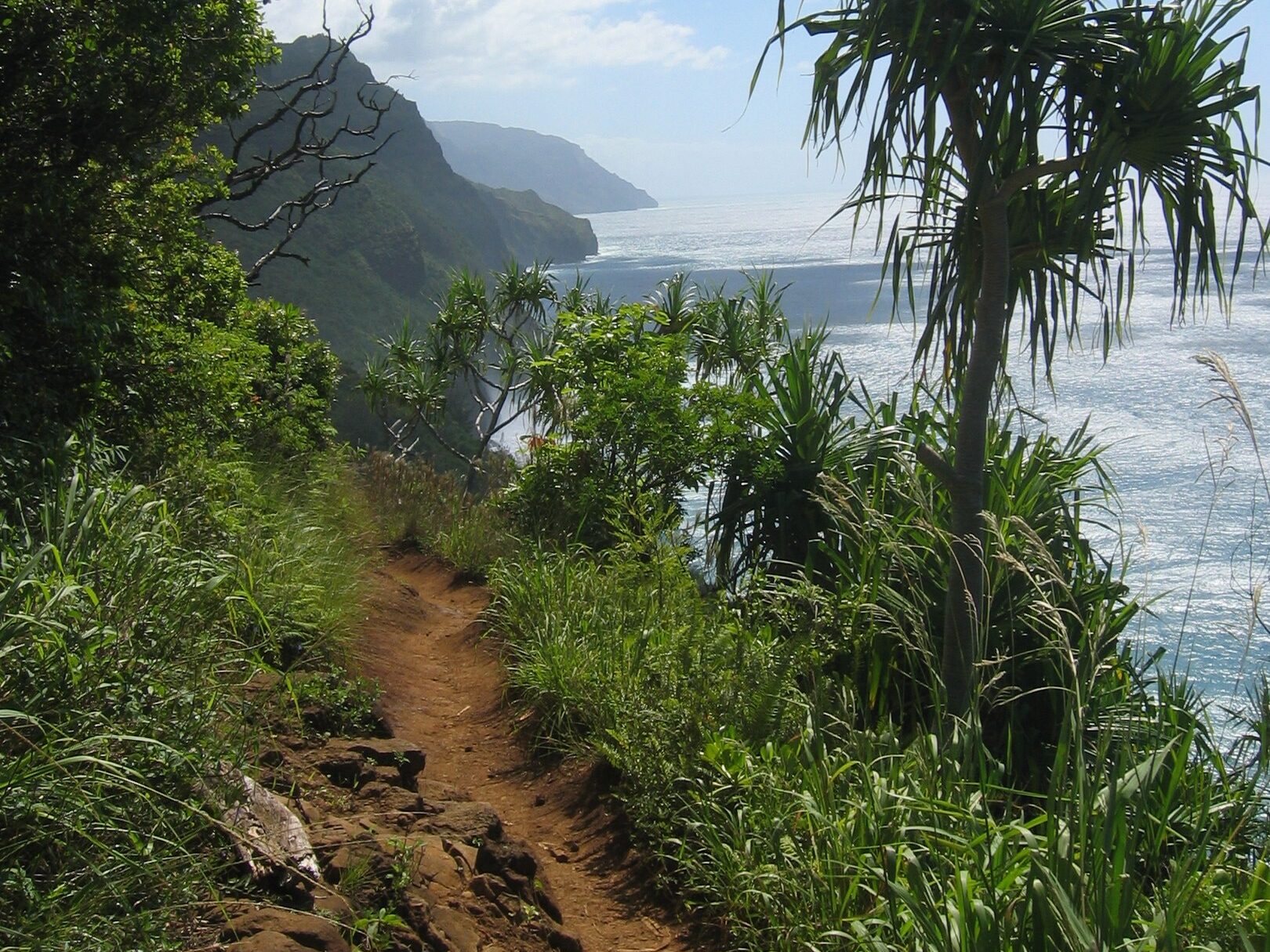
The 11-mile Kalalau Trail along Kauai’s Nā Pali Coast is notorious for rescues due to flash floods, steep cliffs, and remote terrain. Hawaii DLNR rescue data shows that hundreds of hikers are airlifted out annually, particularly at the Hanakapiai Stream crossing. Between 1992 and 2017, at least 30 drowning deaths were reported in this area, underscoring the danger of river crossings during rain.
Teton Crest Trail: Beauty at High Cost
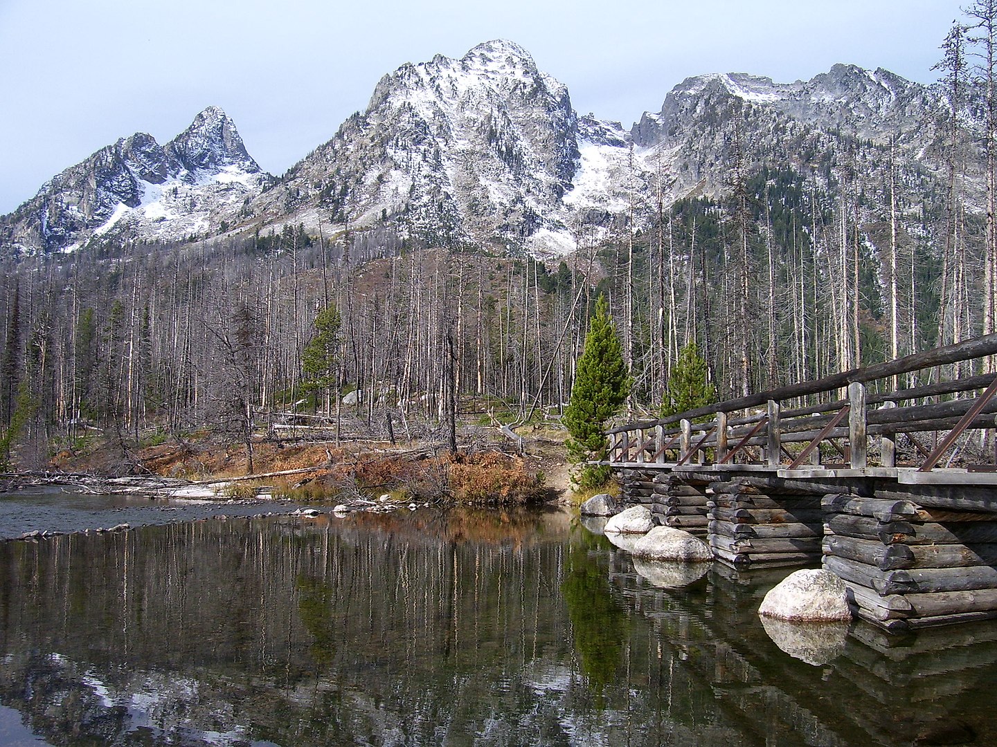
Stretching nearly 40 miles across the Tetons, this trail exposes hikers to altitude sickness, sudden snowstorms, and wildlife encounters. Grand Teton National Park SAR teams average 80–100 rescues per year, with the Teton Crest among the most common sites. Lightning strikes at high passes and grizzly bear encounters further elevate risk, especially for backpackers caught unprepared.
Longs Peak: Rocky Mountains’ Deadly Ascent
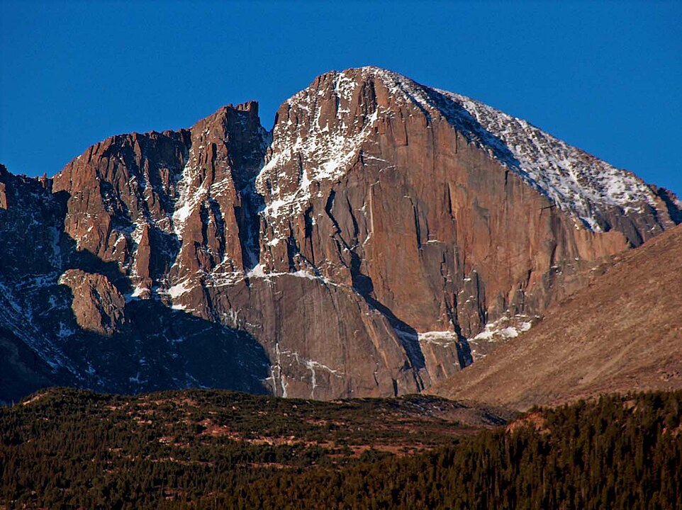
Longs Peak, at 14,259 feet, is one of Colorado’s most climbed “14ers” but also one of the deadliest. Rocky Mountain NP records over 70 deaths since the 1910s, with many more rescues each year. The “Keyhole Route” involves exposed scrambling, where falls are the leading cause of fatalities. Altitude and rapidly changing weather also trigger numerous SAR responses annually.
Mount Rainier’s Glacier-Covered Peril
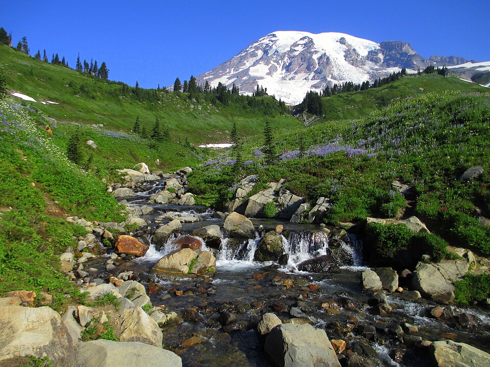
Mount Rainier, rising 14,411 feet, sees frequent rescues due to crevasse falls and altitude-related issues. NPS data reveal that about 50% of all Rainier SAR missions involve climbers on glacier routes. In 2017 alone, more than 300 rescues were logged. Severe weather often traps climbers, requiring helicopter or high-angle rope evacuations.
South Kaibab Trail: Downhill Trap of the Grand Canyon
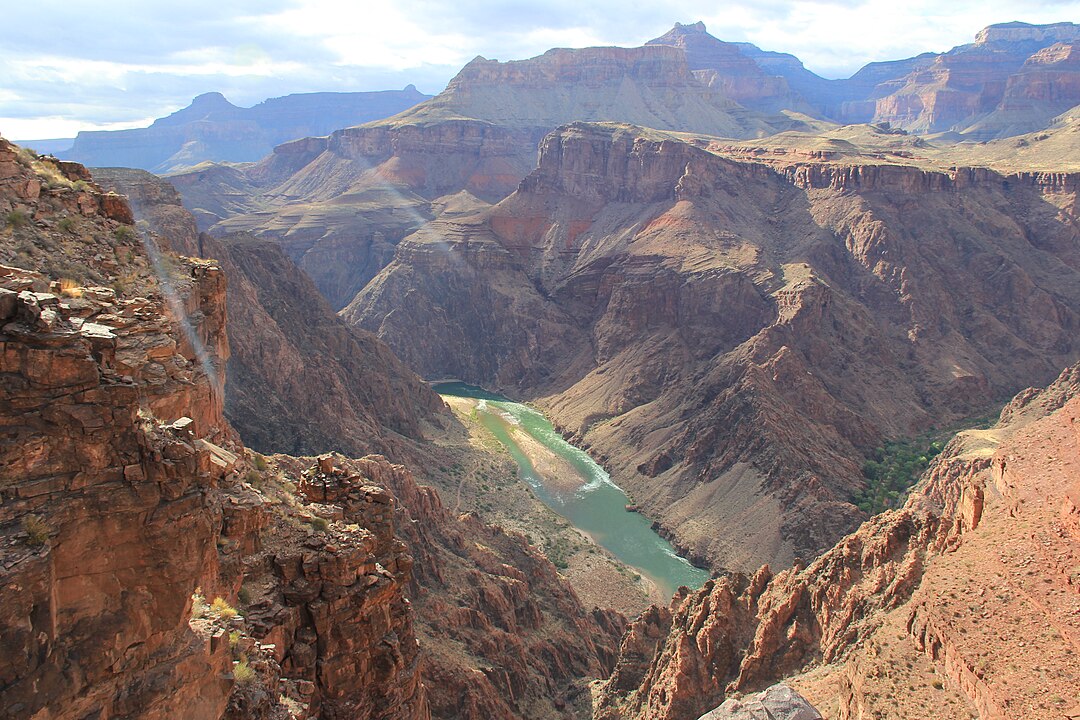
The South Kaibab Trail descends 7 miles into the canyon with no water sources, making it a hotspot for heat-related rescues. According to the Grand Canyon’s Preventive SAR program, about 250 rescues annually are linked to this trail. Its steep descent lures hikers downhill quickly, but the exhausting return ascent in extreme heat leads to frequent emergencies.
Franconia Ridge: White Mountains’ Alpine Hazard
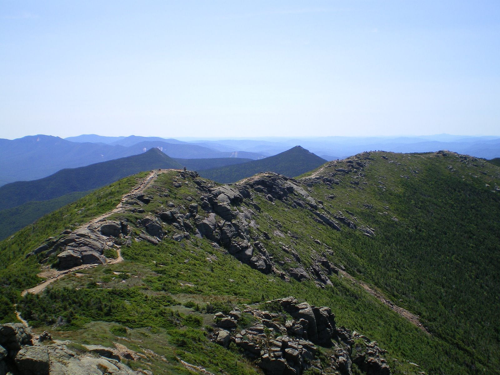
Franconia Ridge in New Hampshire’s White Mountains is one of the most rescue-intensive trails in the Northeast. The New Hampshire Fish and Game Department responds to over 180 SAR missions annually statewide, with Franconia Ridge among the top locations. Exposed alpine conditions, sudden storms, and unprepared hikers contribute to frequent calls for assistance.
Cascade Pass: North Cascades’ Avalanche Zone
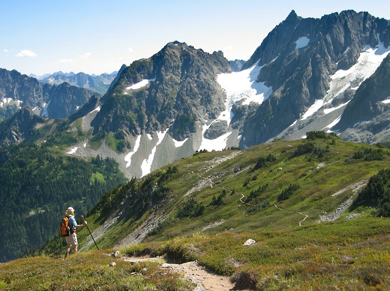
Cascade Pass, though scenic, lies in avalanche-prone terrain. The North Cascades National Park reports frequent rescues, particularly in winter and spring, when avalanches and cornice collapses occur. A 2018 NPS safety report noted that avalanche-related SAR missions in this region doubled over the past decade, with Cascade Pass a recurrent hotspot due to its popularity among backcountry skiers and hikers.


