
Utah’s dramatic landscapes attract hikers with red rock canyons, alpine plateaus, and open desert vistas. Beneath the beauty, geological forces quietly shape risks that surprise even experienced outdoors enthusiasts. Rock layers shift, water behaves unpredictably, and terrain changes rapidly with weather. Many dangers stem from ancient processes still active today. Understanding these hazards supports safer exploration and deeper appreciation of Utah’s geology. From slot canyons to high plateaus, hikers encounter conditions unlike those elsewhere. Awareness encourages preparation, patience, and respect for environments shaped by erosion, uplift, and time across the American Southwest landscapes today statewide.
Flash Flooding In Slot Canyons
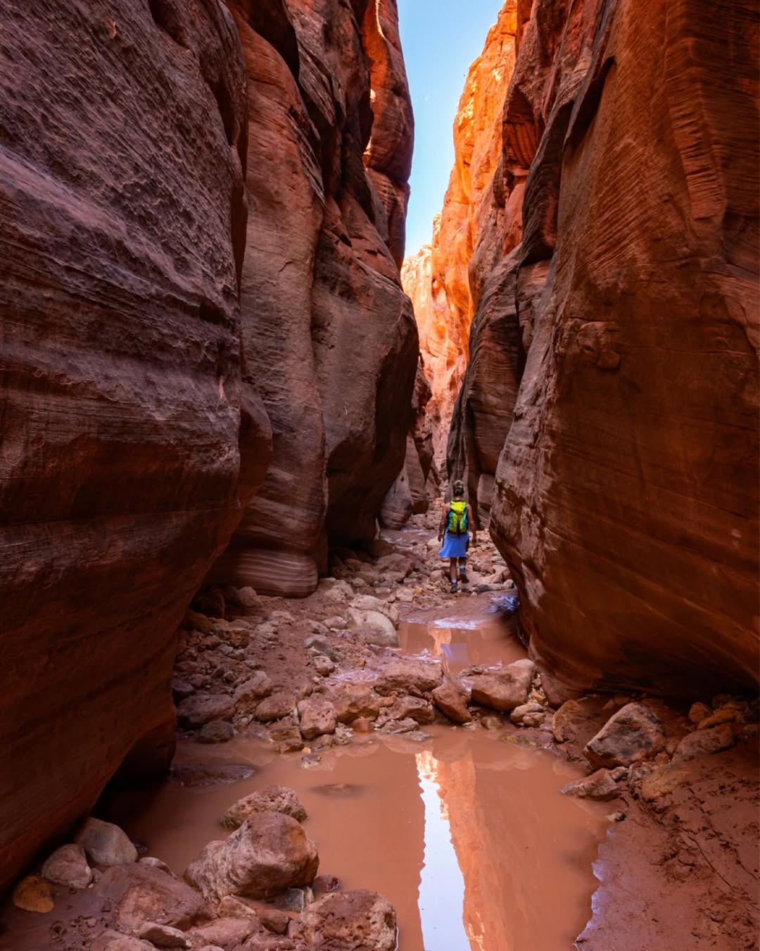
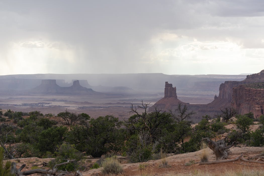
Slot canyons across southern Utah pose serious flash flooding risks. Narrow sandstone corridors funnel water rapidly during storms, even when rain falls miles away. Dry washes can transform into torrents within minutes. Hikers often underestimate danger because skies appear clear overhead. Smooth canyon walls prevent escape once water rises. Zion National Park and Grand Staircase Escalante contain many vulnerable areas. Weather changes upstream drive sudden surges. Flash flooding remains one of Utah’s deadliest hiking hazards. Understanding drainage systems, monitoring forecasts, and avoiding narrow canyons during unstable conditions remain essential for safety in these visually stunning yet unforgiving geological formations.
Rockfall In Sandstone Cliffs
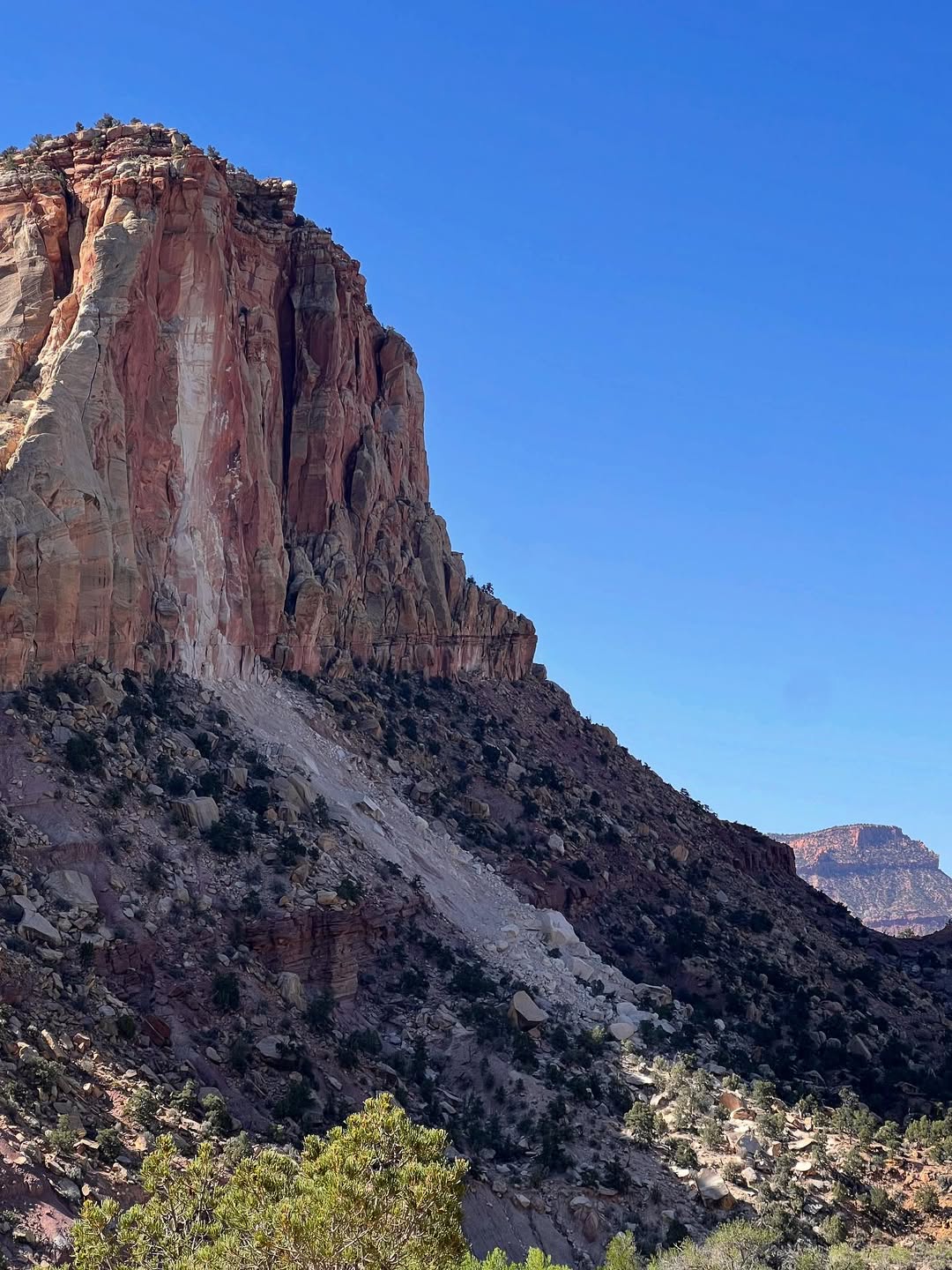
Utah’s sandstone cliffs frequently shed rock without warning. Freeze thaw cycles, erosion, and gravity loosen blocks along canyon walls. Hikers traveling beneath cliffs face danger from falling debris. Popular areas like Bryce Canyon and Arches National Park record regular rockfall events. Even stable looking formations can fail suddenly. Soundless movement often precedes impact by seconds. Trails near cliff bases carry elevated risk. Rockfall activity increases after storms or temperature swings. Awareness of surroundings and avoiding lingering below steep faces reduces exposure. Utah’s evolving geology means cliffs constantly change, reminding hikers that solid stone can still behave unpredictably.
Unstable Slickrock Slopes
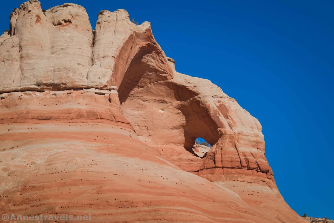
Slickrock surfaces appear smooth and inviting but hide serious slipping hazards. When dry, sandstone provides traction, yet moisture transforms it into a slick surface. Rain, snow, or frost dramatically reduce grip. Slopes common in Moab and Canyonlands challenge balance. Hikers misjudge angles and slide unexpectedly. Injuries occur when falls send people into ledges or steep drop offs. Temperature changes worsen conditions. Slickrock erosion shapes domes and fins but offers little forgiveness. Proper footwear, cautious movement, and weather awareness help manage risk. Utah’s iconic rock textures demand respect, especially during transitional seasons and shaded conditions.
Sinkholes In Karst Areas
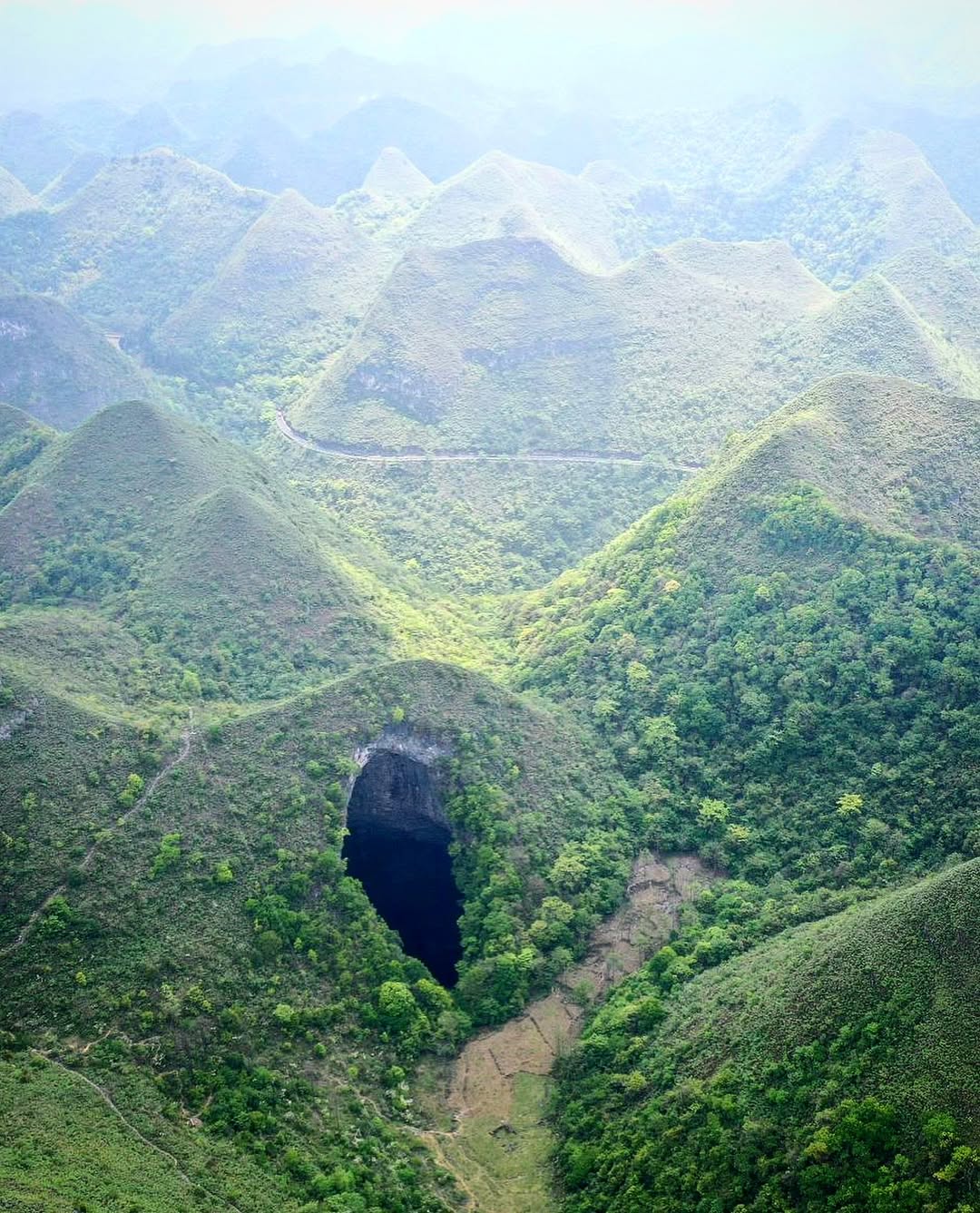
Northern Utah contains karst landscapes formed by dissolving limestone. Sinkholes develop when underground cavities collapse. These depressions appear suddenly, sometimes beneath trails or open ground. While less common than desert hazards, sinkholes pose serious risk in mountainous regions. Snowmelt and heavy rain accelerate formation. Hikers may encounter unstable ground near springs or meadows. The Wasatch Range includes vulnerable zones. Sinkholes vary in size and depth. Recognizing subtle warning signs like sagging soil helps avoidance. Karst geology evolves quietly over time, reminding hikers that hazards exist even in seemingly gentle terrain shaped by water dissolving stone beneath the surface.
Landslides After Heavy Rain
Utah’s steep slopes experience landslides following intense rainfall. Saturated soil loses cohesion, causing sudden slope failure. Clay rich layers common in central Utah amplify risk. Landslides block trails, damage roads, and threaten hikers below. Burn scars from wildfires further destabilize hillsides. Events often occur hours after storms end. Regions near Capitol Reef and the Wasatch Front face recurring slides. Warning signs include cracking soil and leaning trees. Avoiding steep slopes during wet conditions reduces danger. Landslides demonstrate how water reshapes terrain rapidly, turning familiar paths hazardous through gravity driven movement of earth and rock.
Quicksand In Desert Washes
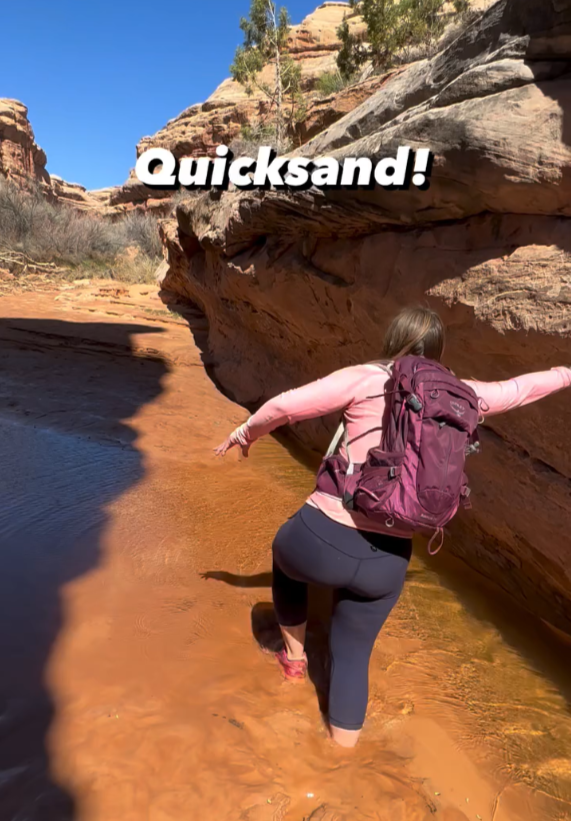
Quicksand forms where water saturates fine sediment in desert washes. Utah’s riverbanks and slot canyon exits sometimes conceal these patches. Appearing solid, the surface collapses under weight. Hikers become stuck, expending energy to escape. Though rarely fatal, quicksand causes exhaustion and injury. Areas near the Escalante River and Dirty Devil River present known risks. Slow, deliberate movement and trekking poles help test ground stability. Understanding sediment behavior reduces panic. Quicksand illustrates how water transforms desert geology, creating hazards that defy expectations in landscapes assumed dry and stable throughout most seasons.
Extreme Heat Amplified By Rock
Utah’s rock formations intensify heat exposure. Dark sandstone absorbs sunlight, radiating heat toward hikers. Slot canyons and basins trap warm air, limiting airflow. Summer temperatures soar beyond forecasted highs. Dehydration and heat exhaustion occur quickly. Regions like Goblin Valley and Canyonlands magnify thermal stress. Even shoulder seasons produce dangerous heat spikes. The geology creates natural ovens that challenge endurance. Adequate water, timing hikes early, and recognizing heat illness symptoms remain critical. Utah’s striking formations not only shape scenery but also microclimates that significantly affect human physiology during outdoor activity in exposed desert environments.
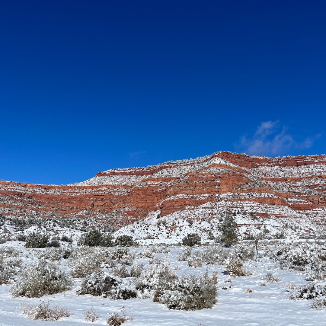
Sudden Snow In High Elevations
Utah’s high plateaus experience sudden snowfall even outside winter. Elevation changes drive rapid weather shifts. Areas like the Uinta Mountains and Bryce Canyon receive snowstorms during spring and fall. Trails become icy, obscuring footing. Hypothermia risk increases when temperatures drop unexpectedly. Geological uplift created these elevated regions, amplifying exposure. Hikers misjudge conditions based on lower elevations. Snowmelt also swells streams. Preparation with layers and traction devices improves safety. Utah’s varied topography compresses seasons into short distances, reminding hikers that altitude driven geology creates winterlike hazards far from desert floors and red rock imagery.
Volcanic Rock Instability
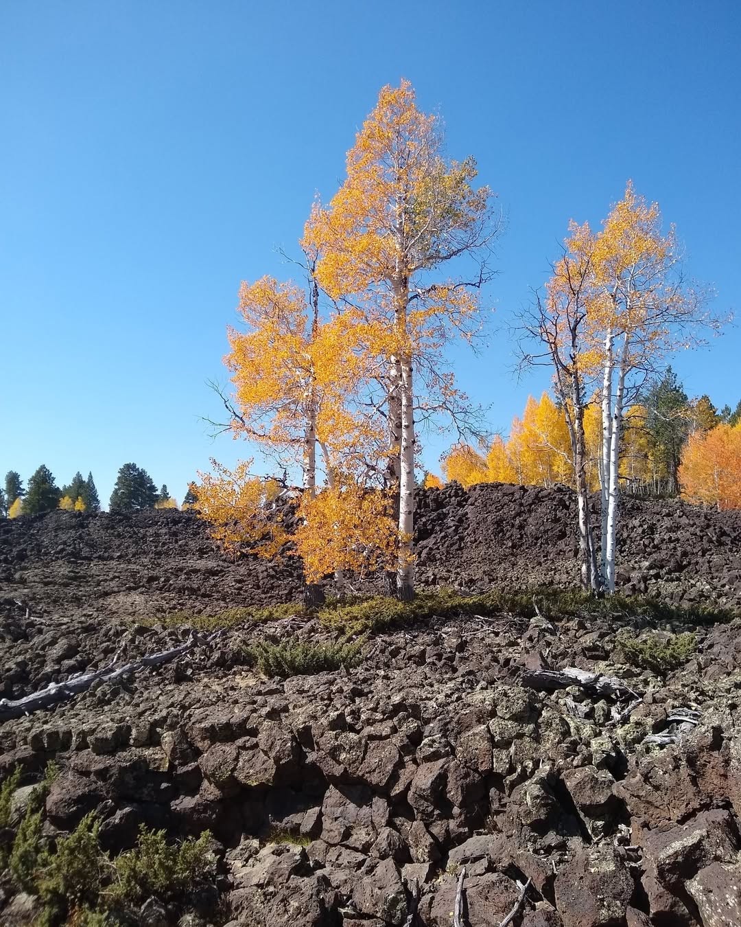
Utah contains ancient volcanic fields with unstable basalt formations. Lava flows cooled unevenly, creating fractured surfaces. Hikers encounter loose blocks and sharp edges. Areas near Fillmore and the Black Rock Desert show volcanic remnants. Trails crossing lava fields challenge footing. Fractured rock shifts under weight, increasing fall risk. Basalt absorbs heat, worsening fatigue. These landscapes differ from sandstone but carry equal danger. Awareness of rock type improves caution. Utah’s volcanic history remains visible and hazardous, offering reminders that varied geological origins create unique challenges beyond iconic red cliffs and canyons often highlighted in travel imagery.
Hidden Drop Offs In Snowfields
Lingering snowfields conceal steep drop offs beneath thin crusts. Late season snow bridges form over ravines. When weight breaks through, hikers fall unexpectedly. This hazard appears in alpine areas like the Wasatch and Uintas. Geological erosion carved deep channels now hidden by snow. Spring hiking increases risk. Sun weakens snow surfaces rapidly. Probing with poles and avoiding snow crossings reduce danger. Hidden voids demonstrate how seasonal snow interacts with underlying terrain. Utah’s mountainous geology creates deceptive conditions where solid appearing surfaces mask significant exposure and vertical relief shaped over millennia by ice and water.
Earthquake Fault Zones
Utah lies within the Intermountain Seismic Belt, containing active fault lines. Earthquakes remain infrequent but possible. The Wasatch Fault poses the greatest risk. Ground shaking can trigger rockfall, landslides, and surface rupture. Hikers near steep slopes face secondary hazards during seismic events. Fault scarps remain visible reminders of tectonic forces. Awareness of surroundings improves reaction time. While rare, earthquakes illustrate ongoing crustal movement shaping Utah’s landscapes. These deep geological processes continue influencing surface conditions. Understanding seismic context reinforces respect for terrain formed by uplift and stress, where stability cannot always be assumed even during calm conditions.
Collapsing Desert Crust
Biological soil crust covers much of Utah’s desert floor. This fragile layer stabilizes sediment. When crushed, erosion accelerates, undermining footing near ledges and slopes. Hikers stepping off trail may trigger small collapses. Areas like Canyonlands rely on intact crust for stability. Loss increases dust and runoff. While not dramatic, gradual collapse creates uneven surfaces. Awareness supports both safety and conservation. Desert geology depends on living crust as structural support. Respecting designated paths reduces risk and preserves terrain integrity. This subtle hazard shows how living and geological systems intersect, influencing stability beneath every step across arid landscapes.


