
Washington State has over 3,600 miles of trails maintained by the U.S. Forest Service and National Park Service, but only a fraction of these see heavy visitor traffic. Data from the Washington Trails Association (WTA) shows that most hikers cluster around the same 20–30 popular routes, leaving hundreds of scenic trails relatively undiscovered. For those seeking quieter paths, these 10 lesser-known trails offer unique views, geological features, and historical landmarks.
Serenity at Packwood Lake
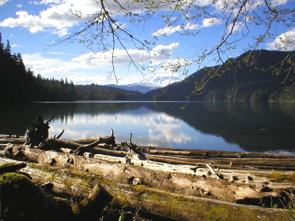
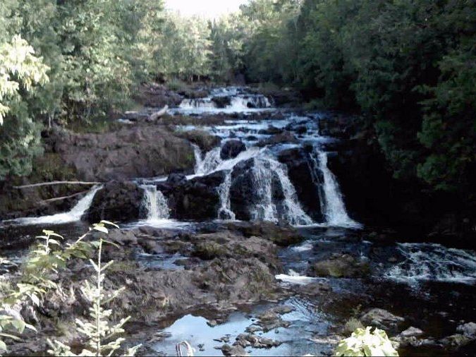
Packwood Lake Trail stretches 8.5 miles round trip with about 600 feet of elevation gain, making it a moderate hike. Originally built in 1889 for a dam project, the wide trail follows old wagon paths. Its highlight is the alpine lake covering about 450 acres, ringed by the Goat Rocks peaks. Unlike other nearby lakes, Packwood allows camping along its shores, making it a valuable overnight option away from the Mount Rainier crowds.
Views from Goat Peak Lookout
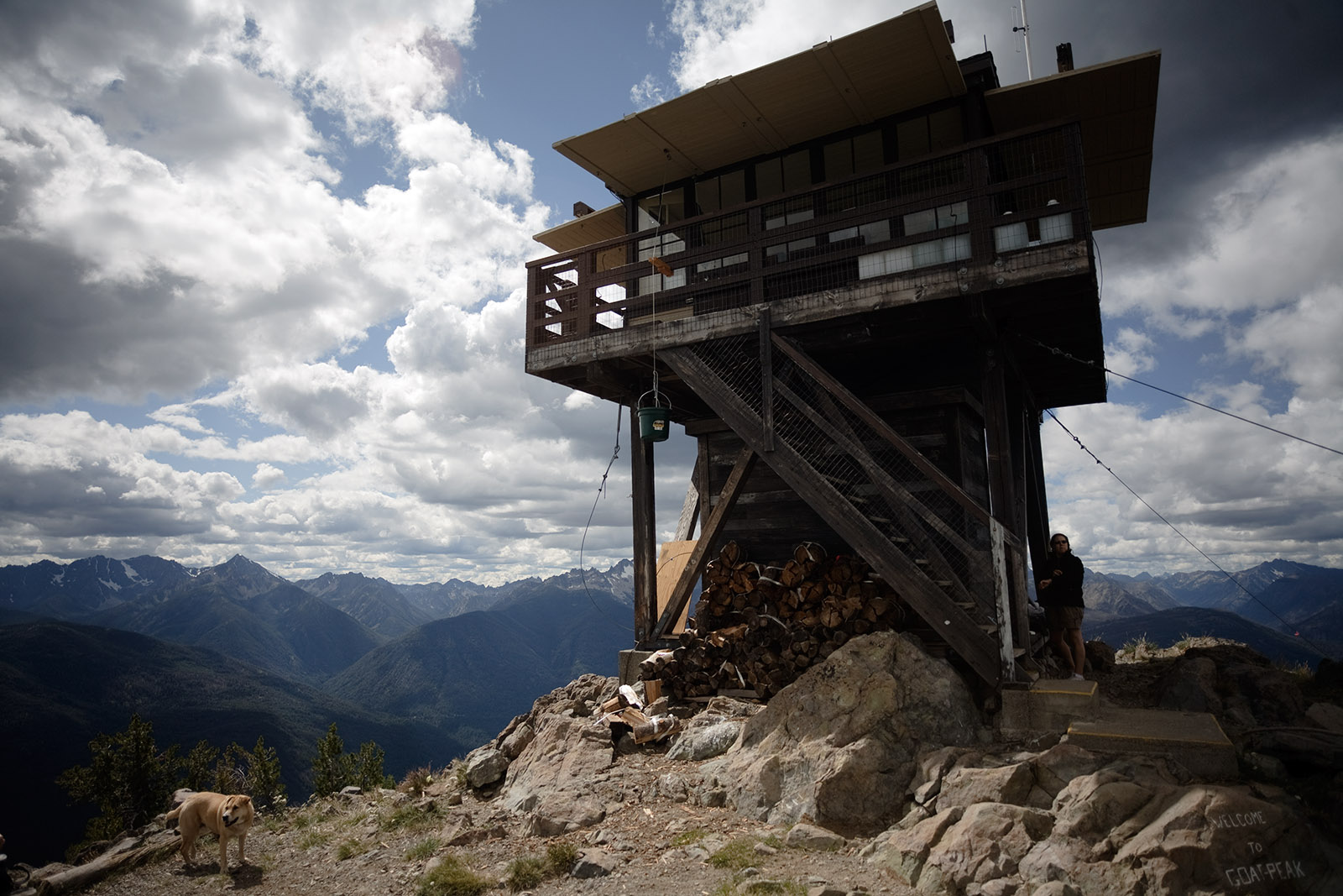
Standing at 7,001 feet, Goat Peak Lookout is one of the few remaining historic fire lookouts in Washington. The 3.5-mile trail climbs nearly 1,400 feet, rewarding hikers with panoramic views of the Methow Valley and the North Cascades. Built in 1949, the lookout is still staffed during fire season. According to the U.S. Forest Service, fewer than 93 of Washington’s original 750 lookouts remain, giving this trail rare historic significance.
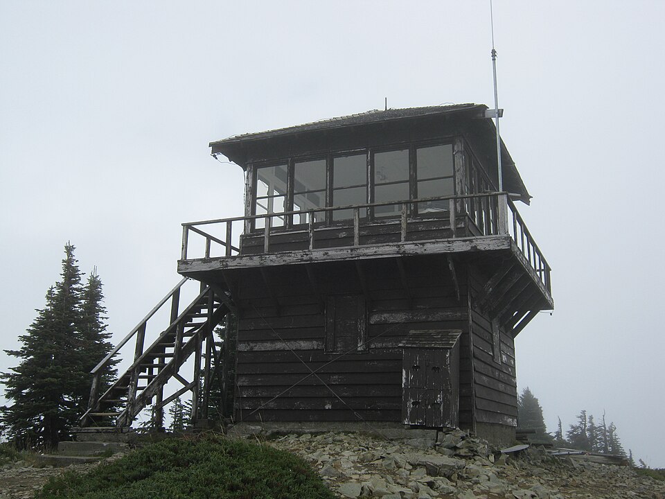
Hidden Lake’s Alpine Gem

The Hidden Lake Trail, located in the North Cascades, is an 8-mile round-trip gaining 3,300 feet in elevation. It leads to Hidden Lake Lookout, perched above a turquoise basin. The structure, dating back to 1932, is open for overnight stays on a first-come basis. A 2018 WTA trail report noted that this route sees only a fraction of the hikers compared to Cascade Pass, despite offering similar glacier and peak vistas.
Tolmie Peak’s Historic Lookout
Tolmie Peak Fire Lookout, built in 1933 by the Civilian Conservation Corps, sits above Eunice Lake in Mount Rainier National Park. The hike is 7.5 miles round trip with 1,100 feet of gain. On clear days, hikers can see Mount Rainier reflecting in Eunice Lake from the summit. According to NPS visitation records, Tolmie receives significantly fewer hikers than Paradise and Sunrise trails, making it a quieter way to experience Rainier’s alpine scenery.
Green Mountain’s Panoramic Ridge

Green Mountain Trail near Darrington is an 8.5-mile round trip with 3,000 feet of gain. It leads to a restored 1933 fire lookout and expansive views of Glacier Peak. Historical records show this lookout was slated for removal but was saved in the 1990s due to public advocacy. Because the access road is often rough, visitor numbers are far lower compared to nearby Mount Pilchuck, preserving its sense of remoteness.
Blanca Lake’s Turquoise Treasure
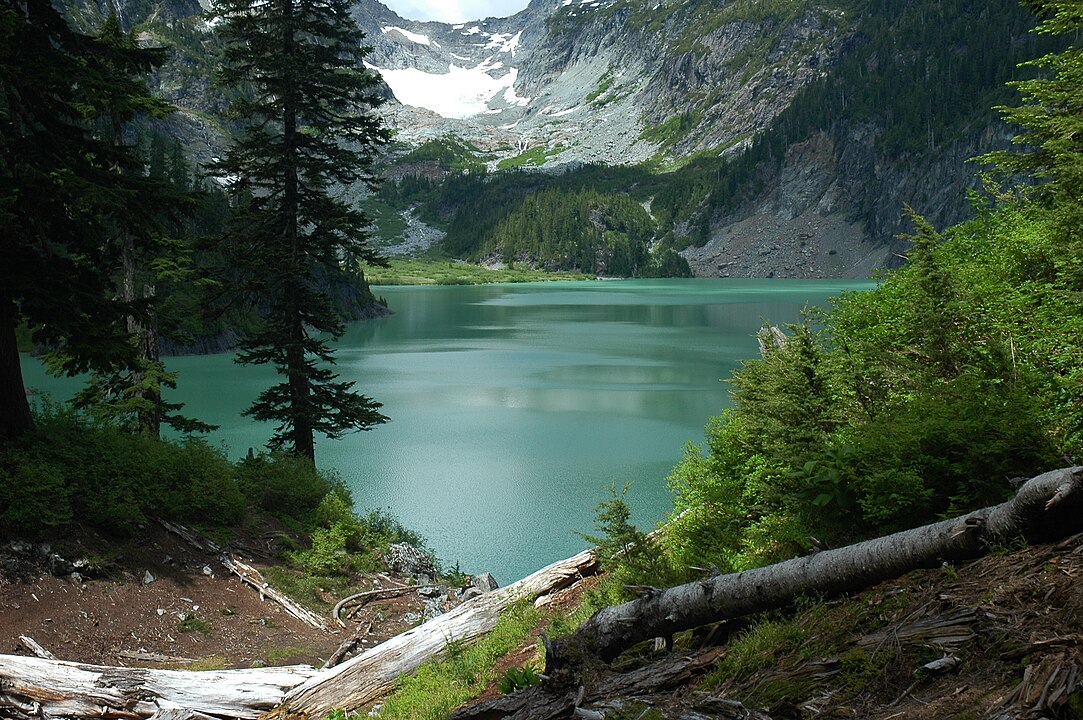
Known for its surreal turquoise color caused by glacial silt, Blanca Lake sits at 3,976 feet in the Henry M. Jackson Wilderness. The hike is 7.5 miles round trip with nearly 3,000 feet of elevation gain. Despite its strenuous climb, visitation records from WTA show a steady increase since 2015, yet it still draws fewer than a third of the hikers compared to Rattlesnake Ledge, keeping it relatively peaceful.
Thunder Creek’s Glacier Valleys

Thunder Creek Trail in North Cascades National Park extends for over 12 miles one way, offering one of the longest low-elevation hikes in the region. The route follows the Thunder Creek valley, tracing meltwater from the Neve Glacier, one of the largest in the park. Unlike most glacier-fed routes, it remains snow-free earlier in the season, which explains why the NPS classifies it as a rare long-distance spring hike option.
Remote Beauty at Copper Glance Lake
Copper Glance Lake Trail in the Pasayten Wilderness is an 8.6-mile round trip with 2,400 feet of gain. The lake sits below jagged ridgelines at nearly 6,000 feet. The trail passes through remnants of historic mining camps, with reports noting copper prospecting activity here as early as 1890. Because access requires navigating forest service roads, Copper Glance receives significantly fewer visitors than nearby popular sites like Hart’s Pass.
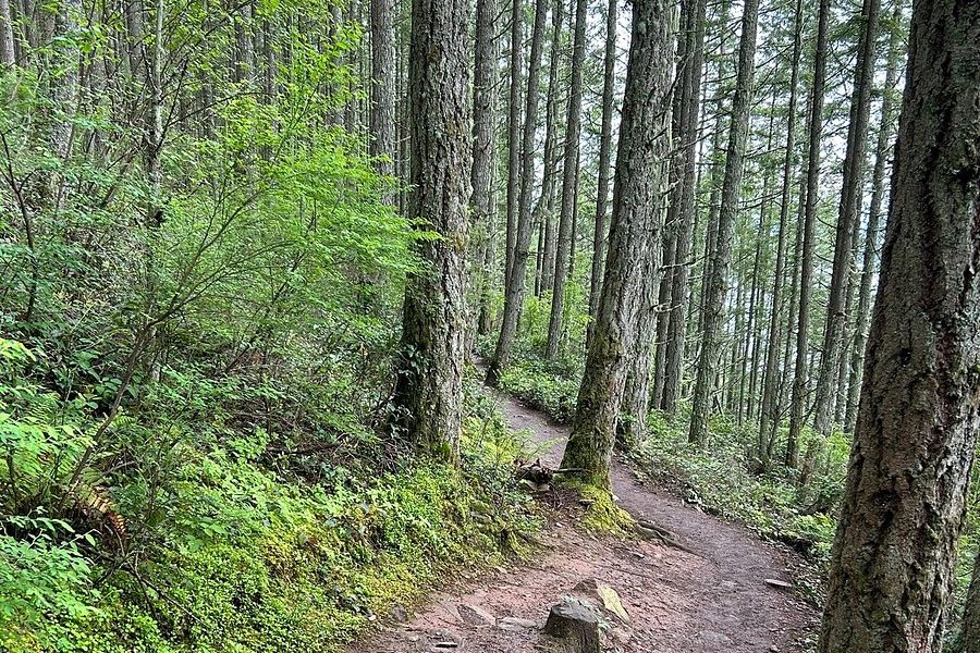
Wildflowers on West Cady Ridge

West Cady Ridge Trail stretches 14 miles round trip with 3,400 feet of elevation gain, offering sweeping meadow views. It’s renowned for its wildflower blooms, with WTA documenting over 100 species of flowers along the ridge during peak summer. The ridge also provides access to the Pacific Crest Trail, making it a strategic connector for backpackers. Despite its length, it remains lightly trafficked compared to the more accessible Heather Lake and Lake 22.
Oyster Dome via Lily Lake Route
The Oyster Dome hike via Lily Lake offers a quieter alternative to the heavily used Samish Overlook route. This 6.5-mile round-trip trail gains about 1,200 feet and passes Lily and Lizard Lakes before reaching the Dome. According to Skagit Land Trust records, Oyster Dome provides habitat for the threatened peregrine falcon, making it not only a scenic viewpoint over Puget Sound but also a critical conservation area.


