
The most visited national parks in the United States collectively receive over 300 million visits annually, a figure that translates directly into crowded trailheads, reserved campsite waitlists measured in months, and the specific disappointment of traveling hundreds of miles to experience wilderness only to find yourself in a queue. Serious campers already know this reality intimately, which is why the most rewarding outdoor experiences in this country increasingly belong to those willing to look past the famous names and do the research that most visitors never bother with. The United States contains over 640 million acres of public land managed across multiple federal and state agencies, the vast majority of which receives a fraction of the attention that a handful of iconic destinations absorb. Hidden within that enormous inventory are landscapes every bit as dramatic, diverse, and genuinely wild as anything on the standard itinerary, accessible to anyone with the preparation and the willingness to navigate without the infrastructure that popular destinations provide. The ten destinations collected here were selected specifically for their combination of genuine wilderness quality, relative obscurity among the general camping public, and the specific experiential details that make each one worth the additional planning effort that lesser-known destinations always require from the people who find them most rewarding.
1. Owyhee Canyonlands, Oregon and Idaho
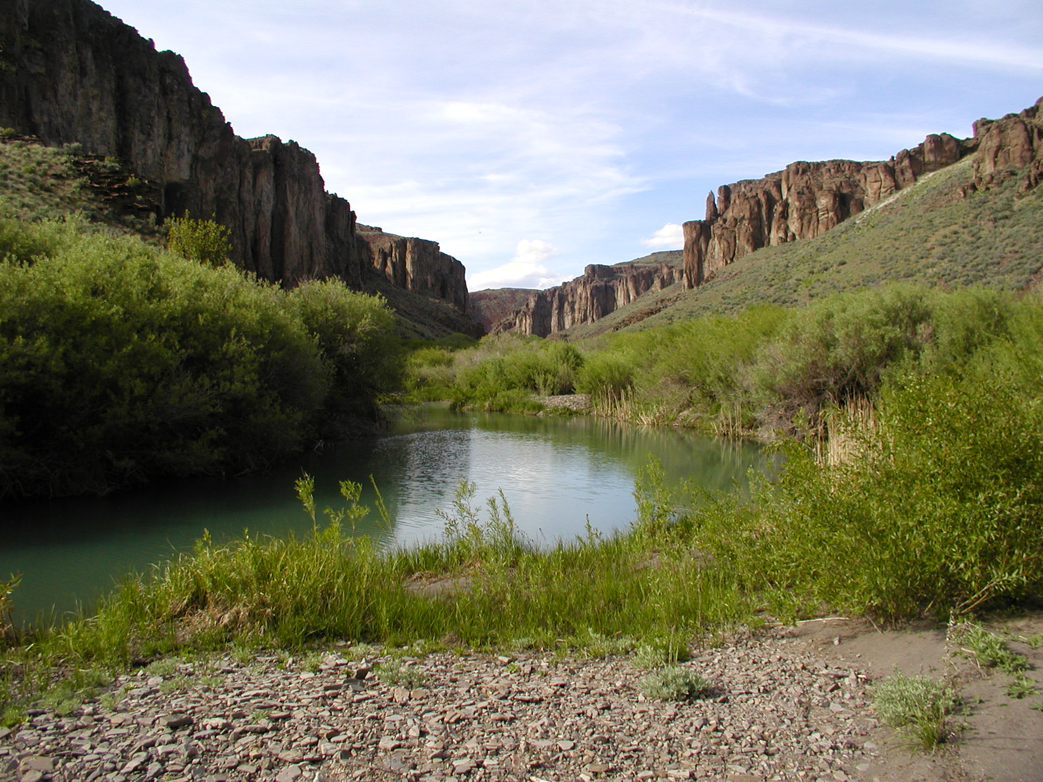
The Owyhee Canyonlands spread across approximately 2.5 million acres of high desert canyon country straddling the Oregon and Idaho border, managed primarily by the Bureau of Land Management, with dispersed camping permitted across virtually the entire area without fees or reservation systems. The Owyhee River has carved canyon walls reaching 1,000 feet in sections that rival anything in the Colorado Plateau while receiving perhaps 1 percent of the visitor traffic. Summer temperatures regularly exceed 100 degrees Fahrenheit, which is the primary reason most of the region remains uncrowded, but spring conditions from late March through early June deliver temperatures between 55 and 75 degrees Fahrenheit with wildflower displays across the sagebrush uplands that rival botanical gardens without the admission price. Archaeological sites, including petroglyphs estimated at 8,000 to 10,000 years of age, appear throughout the canyon system with no interpretive signage or protective infrastructure, accessible to anyone willing to navigate the unmarked terrain to reach them. The nearest services from the central Owyhee region are approximately 45 to 60 miles on roads that require high-clearance vehicles for reliable access. Cell service is absent across the majority of the area, which functions as a natural filter separating serious campers from recreational day visitors more effectively than any permit system could manage.
2. Boundary Waters Canoe Area Wilderness, Minnesota
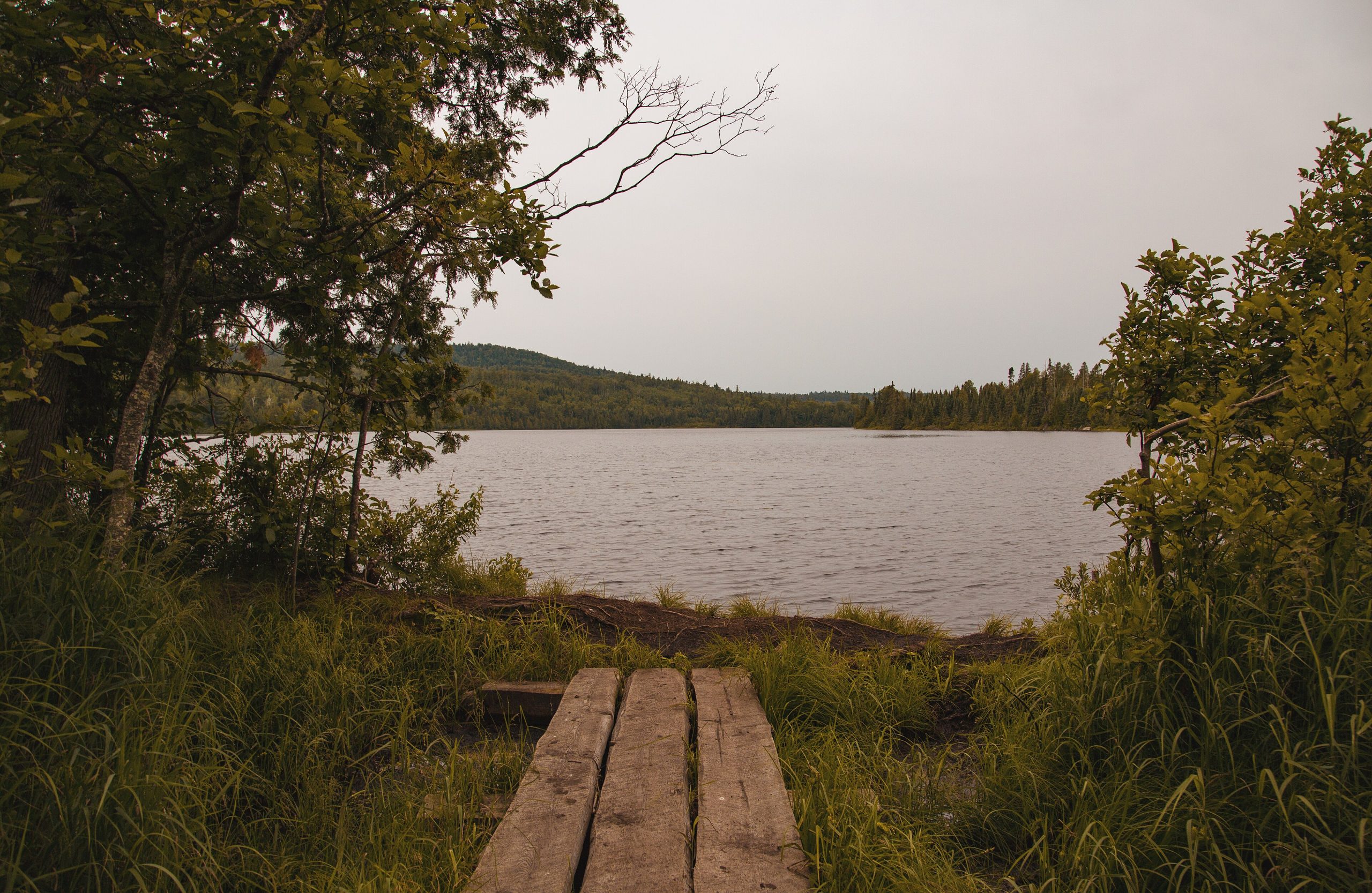
The Boundary Waters Canoe Area Wilderness covers 1.09 million acres of interconnected lakes, rivers, and portage trails along the Minnesota-Canada border, offering a paddling and camping experience with no motorized vehicles permitted across the majority of its designated wilderness zones. The BWCAW contains over 1,200 miles of canoe routes connecting more than 1,000 lakes through portage trails ranging from 10 rods to over 300 rods in length, with designated campsites averaging 3 to 5 miles apart that provide fire grates and wilderness latrines as the only infrastructure concessions to visitor management. Daily entry permits are required and cost $16 per person, which keeps visitor numbers manageable enough that paddlers frequently travel entire days without encountering another group during shoulder season from late August through early October. Fishing for walleye, northern pike, and lake trout in waters that receive minimal pressure by Midwestern standards produces catch rates that serious anglers travel from across the country to experience. The wolf population across the BWCAW and adjacent Quetico Provincial Park in Canada numbers approximately 100 animals, making this one of the most reliable locations in the lower 48 states for encountering wolves in genuine wilderness conditions rather than managed viewing areas. Water temperatures in August average 68 to 72 degrees Fahrenheit across most accessible lakes.
3. Weminuche Wilderness, Colorado
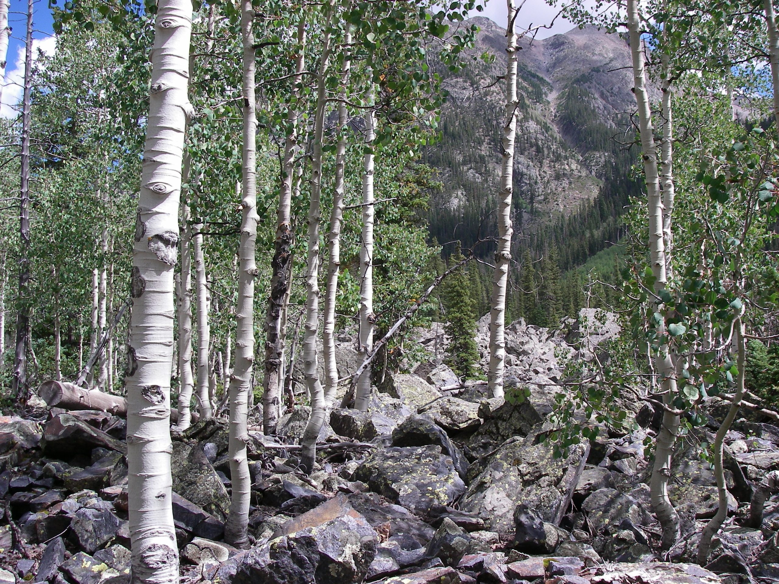
The Weminuche Wilderness covers 499,771 acres in the San Juan Mountains of southwestern Colorado, making it the largest wilderness area in the state, yet it receives a fraction of the attention that Rocky Mountain National Park and the Maroon Bells corridor absorb from Colorado’s enormous annual outdoor recreation visitor count. Elevations across the Weminuche range from 8,000 feet at lower trailheads to 14,083 feet at the summit of Windom Peak, one of four 14,000-foot summits accessible within the wilderness boundary. The Continental Divide National Scenic Trail traverses the entire length of the Weminuche for approximately 80 miles, passing through high alpine terrain above 12,000 feet for extended sections where treeline camping under genuinely dark skies produces some of the finest stargazing accessible from the trail in the continental United States. The Needle Mountains section centered around the Chicago Basin requires either a 25-mile round-trip hike or a narrow-gauge railroad approach on the Durango and Silverton line, which naturally limits visitor numbers to those genuinely committed to the effort. Afternoon thunderstorms above treeline occur with 70 to 80 percent frequency during July and August, requiring early morning summit attempts and afternoon camp arrivals that experienced alpine travelers plan around without difficulty. Permitting free access across the entire wilderness area makes trip planning straightforward once the approach logistics are organized.
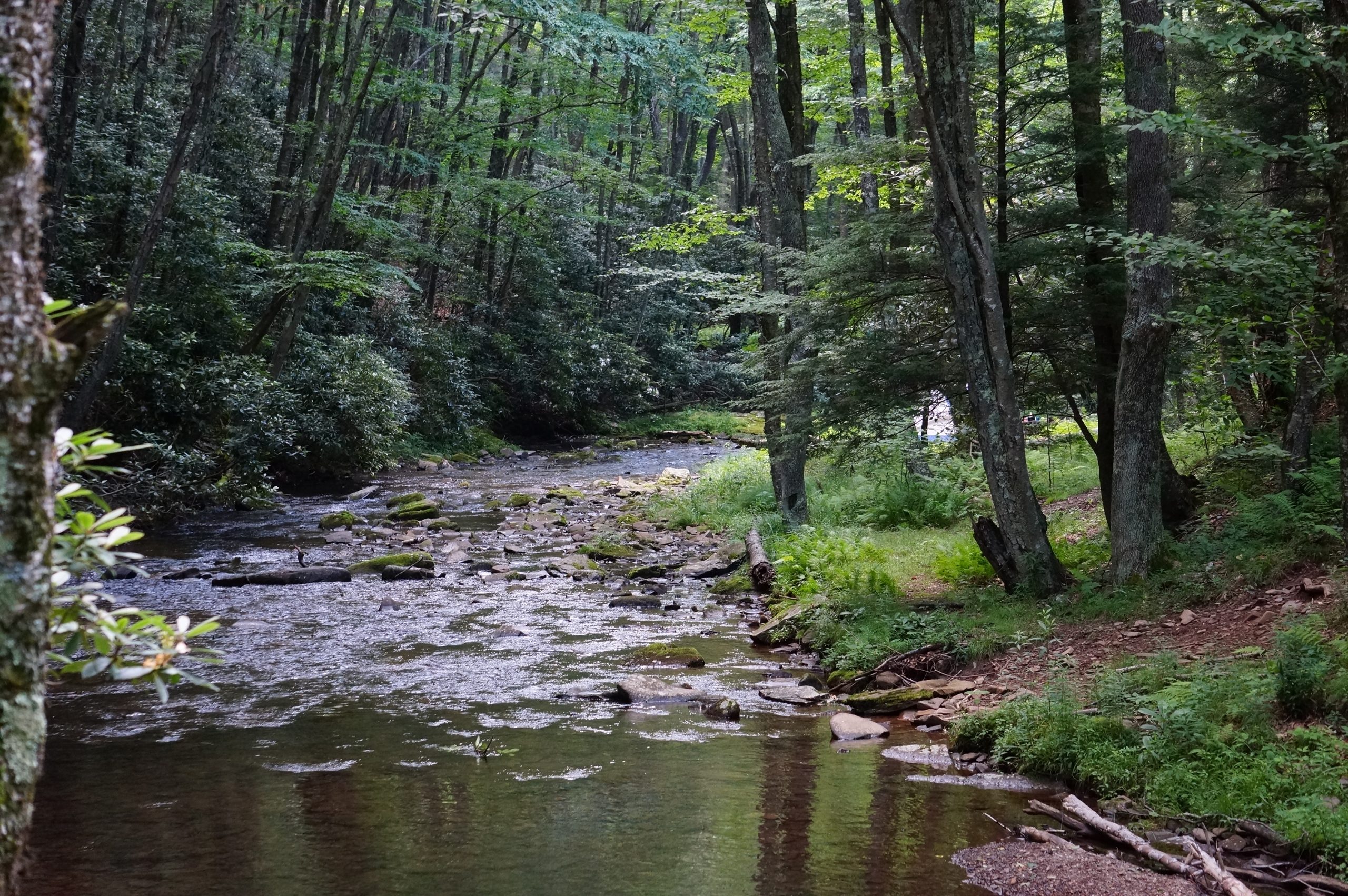
4. Congaree National Park, South Carolina
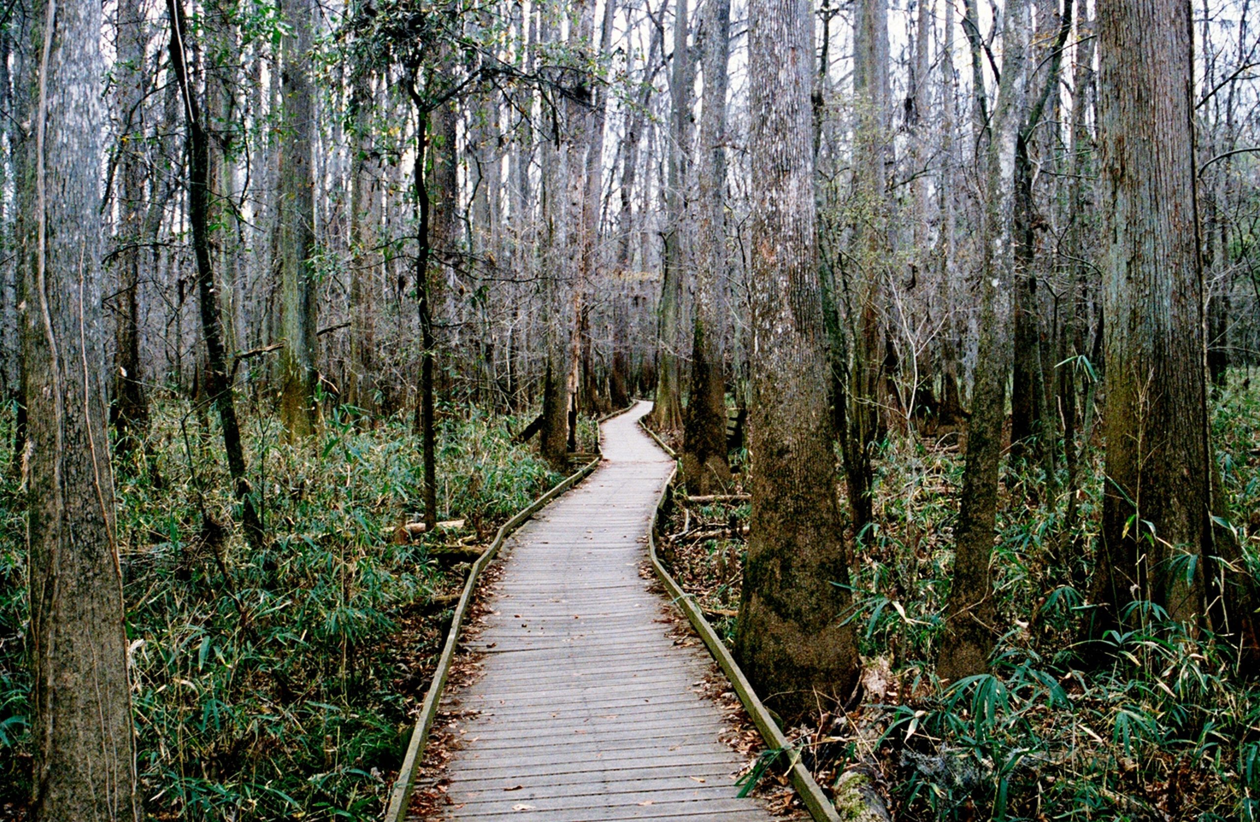
Congaree National Park protects 26,276 acres of old-growth bottomland hardwood forest in central South Carolina, containing the largest intact expanse of this forest type remaining in North America and producing individual trees of dimensions that most visitors who have never stood beneath a champion bald cypress or loblolly pine genuinely cannot anticipate from photographs. The tallest trees in the park exceed 167 feet, and the park contains more national and state champion trees than any other location in the country, with 25 species holding records within its boundaries. Backcountry camping is free and requires only a simple self-registration permit at the visitor center, with primitive campsites accessible by 2.4-mile and 4.4-mile trail systems that pass through flood plain terrain where seasonal flooding deposits nutrients that support the extraordinary tree growth defining the ecosystem. Bioluminescent firefly synchronization events in late May and early June, where thousands of Photinus carolinus fireflies flash in coordinated patterns across the dark forest floor, represent one of the most genuinely rare natural spectacles accessible from a designated campsite anywhere in the eastern United States. Flooding occurs with sufficient frequency that the park service provides current water level information that campers should check within 24 hours of arrival. Summer temperatures with humidity regularly reach heat index values above 105 degrees Fahrenheit, making the April through early June and October through November windows the most practically comfortable visiting periods.
5. Great Basin National Park, Nevada
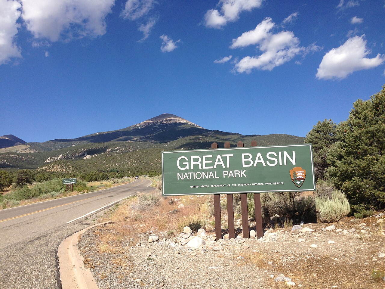
Great Basin National Park covers 77,180 acres in eastern Nevada near the Utah border, receiving approximately 130,000 annual visitors compared to the 4 to 5 million that similarly spectacular parks in the American West collect, a disparity explained entirely by its remote location, 290 miles from Las Vegas and 68 miles from the nearest interstate highway, rather than by any deficiency in the landscape itself. The park contains Wheeler Peak rising to 13,063 feet, an ancient bristlecone pine grove with individual trees exceeding 4,000 years of age, making them among the oldest living organisms on earth, and the Lehman Caves system featuring shield formations found in fewer than 5 percent of known caves worldwide. Dark sky conditions at the park rate among the best in the contiguous United States, with Bortle Scale readings of 2 commonly recorded at the Wheeler Peak campground,d sitting at 9,886 feet in elevation. The campground sits within 0.5 miles of the bristlecone pine trail, allowing pre-dawn access to a grove of trees that were already centuries old when the Roman Empire reached its peak. Summer temperatures at valley elevations of 6,825 feet average 85 degrees Fahrenheit, while Wheeler Peak campground averages 15 degrees cooler, creating a comfortable high-altitude camping environment that the 5,000-foot elevation difference between park boundaries makes genuinely diverse across a single day of vertical travel.
6. Aniakchak National Monument, Alaska
Aniakchak National Monument receives fewer than 200 visitors annually across its 601,294 acres on the Alaska Peninsula, making it the least visited unit in the entire National Park System and one of the most genuinely remote wilderness camping destinations accessible to non-expedition travelers within American borders. The centerpiece is Aniakchak Caldera, a 6-mile-diameter volcanic crater rising 2,200 feet above the surrounding landscape and containing Surprise Lake, a 2-mile-long crater lake that drains through a 1,500-foot breach in the caldera wall called The Gates, creating Class IV whitewater that flows directly into the Pacific Ocean over approximately 30 river miles of roadless wilderness. Access requires a charter floatplane from King Salmon, approximately 100 miles to the northeast, at costs ranging from $800 to $1,400 per person, depending on group size and operator. The NPS maintains no trails, no campsite infrastructure, and no visitor facilities within the monument boundaries, requiring complete self-sufficiency for all visiting parties. Weather on the Alaska Peninsula ranks among the most severe in North America, with sustained winds exceeding 60 mph recorded during summer months and precipitation averaging 35 inches annually,y concentrated in unpredictable multi-day storm systems. Brown bear density within the monument is among the highest in Alaska, making bear awareness and food storage discipline absolute requirements rather than precautionary suggestions for anyone camping within its boundaries.
7. Hercules Glades Wilderness, Missouri
The Hercules Glades Wilderness encompasses 12,315 acres within Mark Twain National Forest in the Missouri Ozarks, representing a landscape type so regionally specific that most American campers from outside the Midwest have never encountered it and cannot easily visualize it from standard wilderness photography that favors dramatic elevation and water features over the subtle, complex beauty of Ozark glade topography. The glades are open, rocky grassland openings within the surrounding oak-hickory forest, sitting atop chert and limestone outcroppings that support plant communities found nowhere else in the Midwest, including several species reaching the northernmost extent of their range within Hercules Glades specifically. The Long Creek drainage running through the wilderness provides reliable water across most of the year, ar with enough spring-fed flow to support wade fishing for smallmouth bass in pools averaging 3 to 6 feet deep during summer low water. Primitive camping is permitted throughout the wilderness without fees or permit requirements, with the 12-mile Hercules Glades Trail providing the primary access corridor through terrain that changes character dramatically between creek bottom hardwood forest and exposed glade ridgeline environments within elevation changes of only 200 to 400 feet. Rattlesnake awareness is genuinely warranted across the glade openings during warm months, but encounters are infrequent enough that experienced Ozark hikers treat it as standard terrain awareness rather than a deterrent to the experience.
8. Enchanted Rock State Natural Area, Texas
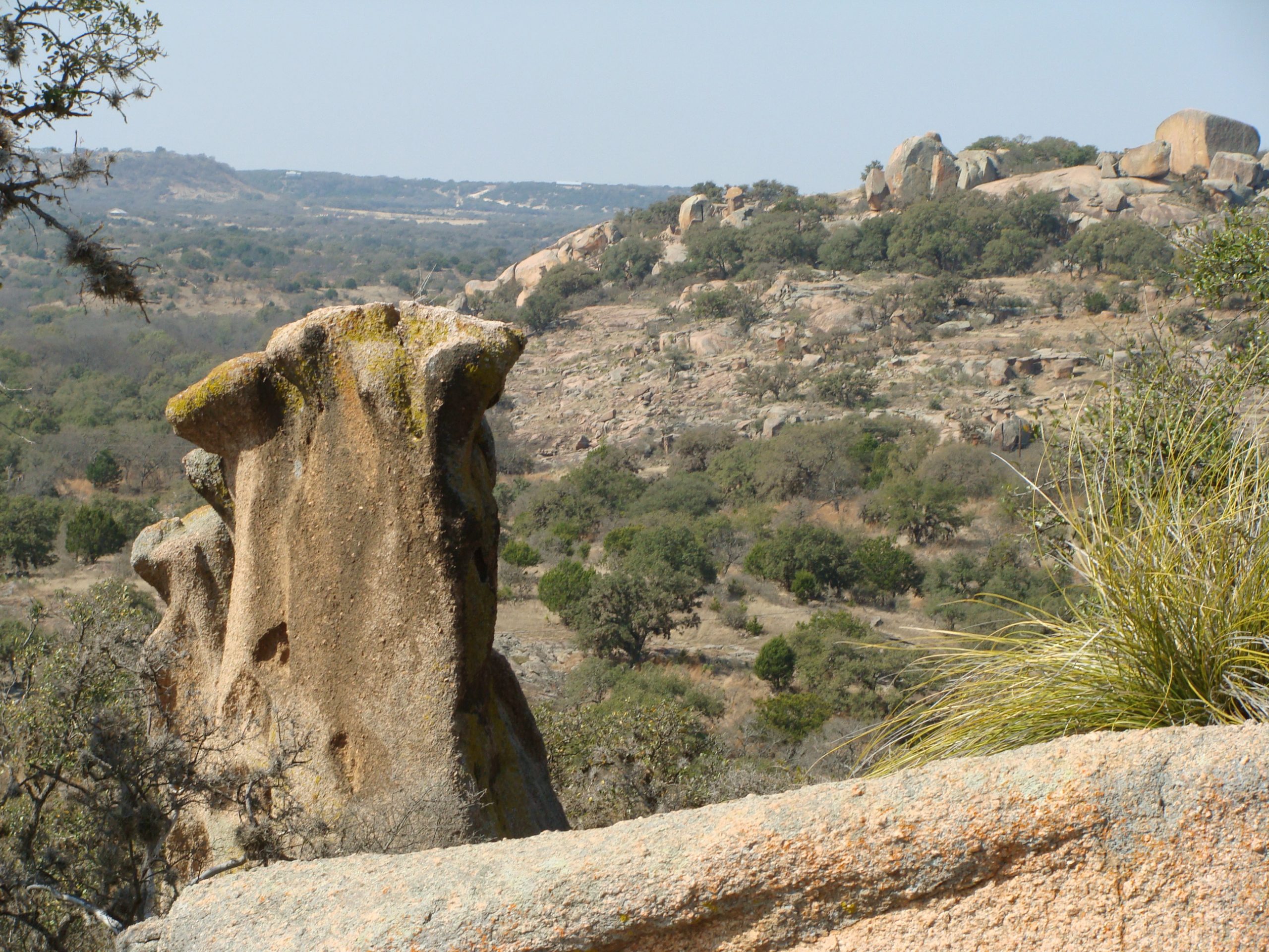
Enchanted Rock State Natural Area protects 1,643 acres in the Texas Hill Country, 18 miles north of Fredericksburg, centered on a 425-foot-tall exfoliated granite dome covering 640 acres that ranks as one of the largest batholiths in the United States. The geology is approximately 1 billion years old, predating most recognizable American landscapes by a margin that fundamentally reframes what ancient means in a North American context. The park permits primitive backpacking campsites along designated trails accessing the backcountry areas beyond the primary dome, placing overnight visitors in a landscape far removed from the day-use crowds that park capacity limits of 400 vehicles attempt to manage during peak spring wildflower season. The granite surfaces reach temperatures of 140 to 150 degrees Fahrenheit under direct summer sun, making the October through April window the physically comfortable visiting period when daytime temperatures average 60 to 75 degrees Fahrenheit on the exposed rock. Vernal pools forming in rock depressions after rainfall support fairy shrimp communities that complete their entire life cycle within days before the pools evaporate, a biological phenomenon visible from the trail surface that most visitors walk past without recognizing what they are seeing. Night sky quality from backcountry campsites away from Fredericksburg’s light dome rates considerably better than the park’s proximity to civilization suggests, with Milky Way visibility on moonless nights that surprise first-time overnight visitors consistently.
9. Dolly Sods Wilderness, West Virginia
Dolly Sods Wilderness covers 17,371 acres in the Monongahela National Forest of eastern West Virginia at elevations between 3,500 and 4,720 feet, creating a high-altitude plateau ecosystem with wind-sculpted red spruce forests, open heath barrens, and sphagnum bogs that botanically and climatically resemble Hudson Bay more than anything a casual observer would expect to find in Appalachia. The unusual ecosystem results from prevailing southwest winds that strip tree cover from exposed ridgelines, creating open heath barrens where bearberry, blueberry, and Catawba rhododendron grow at knee height across terrain that feels genuinely subalpine despite sitting in the mid-Atlantic region. Trail mileage within the wilderness totals approximately 47 miles, with primitive dispersed camping permitted throughout, requiring a 200-foot buffer from water sources and trail edges that experienced Leave No Trace practitioners treat as standard practice. Wind speeds on the exposed barrens regularly exceed 40 to 50 mph during any season, and snowfall can occur in any month at the highest elevations, making weather preparation requirements genuinely more demanding than West Virginia’s geographic location implies. The wilderness sits on land that served as an artillery range during World War II, and unexploded ordnance warnings remain active for specific areas clearly marked on official wilderness maps that the Forest Service provides,s and visitors should carry and study before selecting campsites in the northern sections of the wilderness.
10. Pictured Rocks National Lakeshore, Michigan
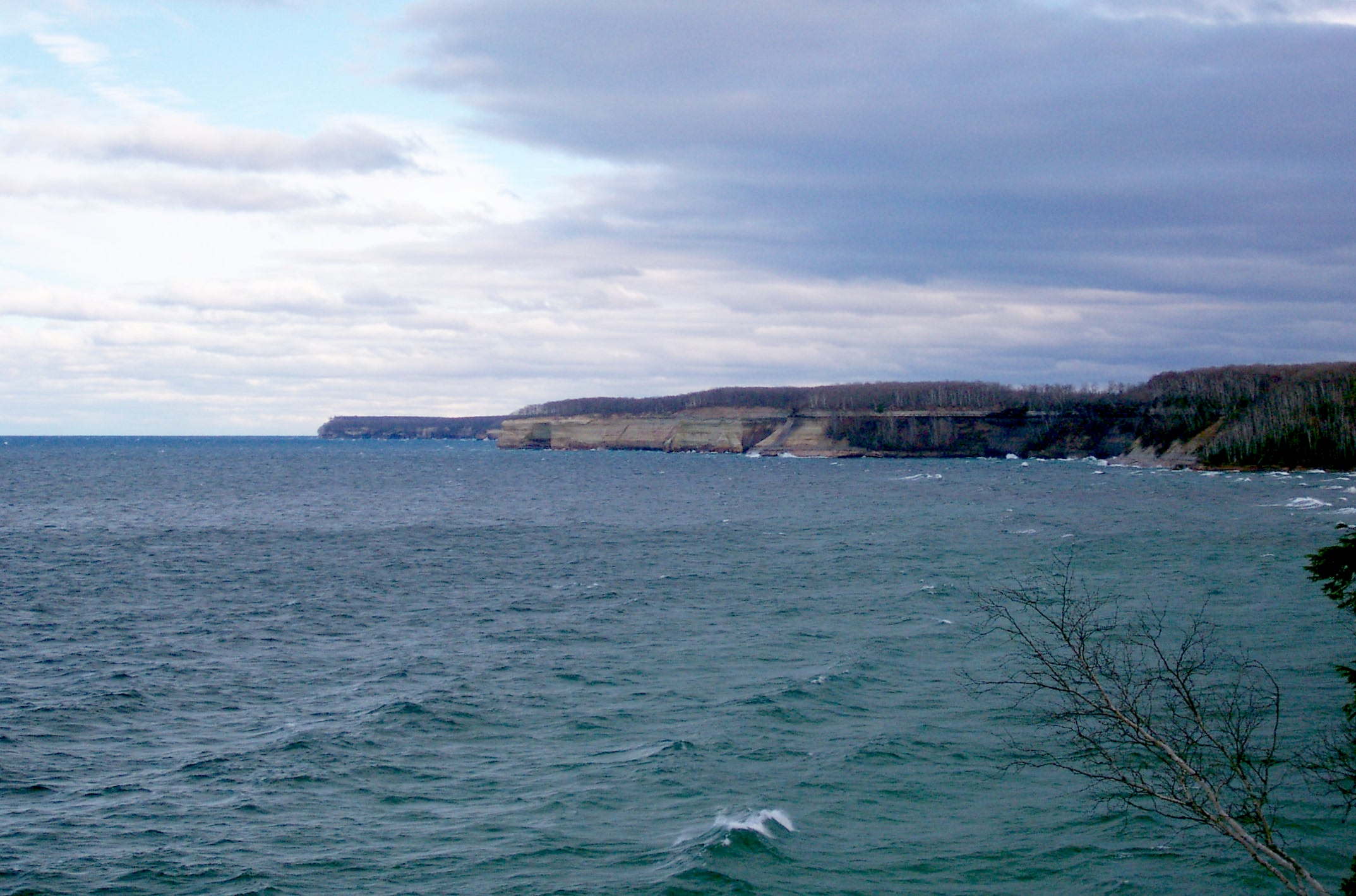
Pictured Rocks National Lakeshore stretches 42 miles along the Lake Superior shoreline of Michigan’s Upper Peninsula, protecting 73,236 acres of sandstone cliffs rising 50 to 200 feet directly from Lake Superior’s surface, carved and colored by mineral seepage into formations of ochre, white, pink, and green that no photograph fully represents and that most campers from outside the Great Lakes region have never encountered or considered as a serious wilderness destination. The North Country National Scenic Trail traverses the entire lakeshore, providing access to 13 designated backcountry campgrounds spaced 3 to 7 miles apart, each requiring a reservation through recreation.gov at $15 per night during the May through October season. Lake Superior water temperatures average 38 to 45 degreesFahrenheiti,t even during peak summer, creating a cold fog microclimate along the cliff base that keeps shoreline campsites 10 to 15 degrees Fahrenheit cooler than inland temperatures during July and August heat. The combination of sandstone cliff camping above a sea-scale freshwater lake, old-growth hemlock and yellow birch forest in the interior sections, and waterfalls, ls including Miners Falls at 40 feet and Munising Falls at 50 feet dropping directly to Lake Superior,ior creates an experiential variety across 42 miles of trail that most single wilderness areas cannot match. Winter camping on the frozen lakeshore when ice formations transform the cliff faces into cathedral-scale ice sculptures is documented by a small community of experienced winter campers as among the most spectacular cold-weather camping experiences available within the continental United States.


